MyTopo
Willows Mississippi US Topo Map
Couldn't load pickup availability
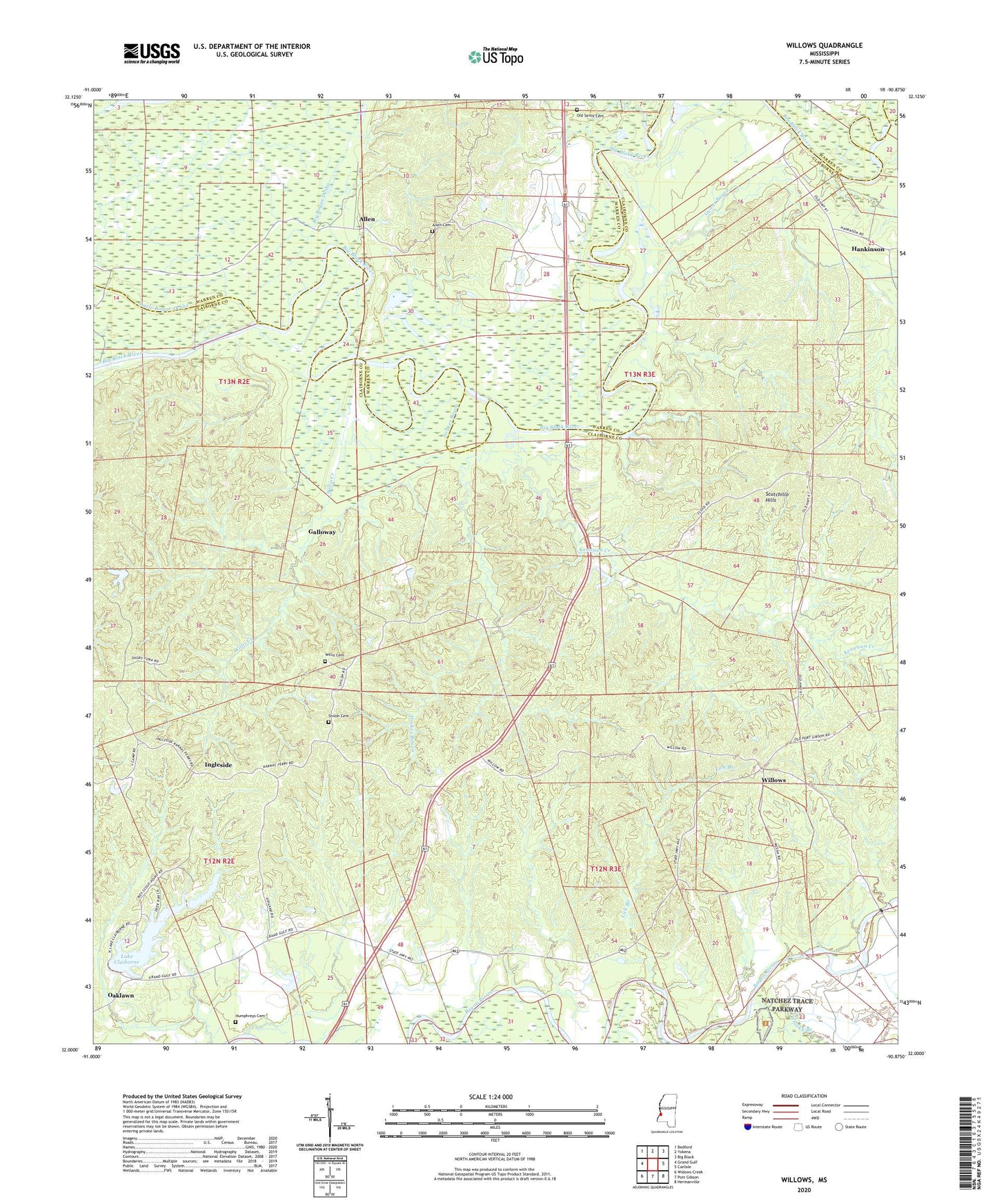
2020 topographic map quadrangle Willows in the state of Mississippi. Scale: 1:24000. Based on the newly updated USGS 7.5' US Topo map series, this map is in the following counties: Claiborne, Warren. The map contains contour data, water features, and other items you are used to seeing on USGS maps, but also has updated roads and other features. This is the next generation of topographic maps. Printed on high-quality waterproof paper with UV fade-resistant inks.
Quads adjacent to this one:
West: Grand Gulf
Northwest: Bedford
North: Yokena
Northeast: Big Black
East: Carlisle
Southeast: Hermanville
South: Port Gibson
Southwest: Widows Creek
Contains the following named places: Allen, Allen Cemetery, Ashland Baptist Church, Ashland Plantation, Ashland School, Big Bogue Desha, Blackman Bayou, Burnstand Church, Campbell Chapel, Drakes Bayou, Fairview Branch, Fairview Plantation, Galloway, Grindstone Ford, Gunns Bayou, Hankinson, Hankinson Bridge, Hankinsons Ferry, Hard Scrabble School, Humphreys Cemetery, Ingleside, Ingleside School, Kennison Creek, Kings Landing, Lake Claiborne, Lake Claiborne Dam, Lick Branch, Little Bogue Desha, Little Come and See Church, Little Come and See Church Number 2, Mount Zion Church, Oaklawn, Old Savoy Cemetery, Shiloh Baptist Church, Shiloh Cemetery, Thompsons Ferry, Warner YMCA Camp, Whisky Branch, Willis Cemetery, Willis Creek, Willow Springs Methodist Church, Willows, Willows School, Woodlawn Plantation, Woodlawn School, Wrights Creek, ZIP Code: 39150