MyTopo
Yokena Mississippi US Topo Map
Couldn't load pickup availability
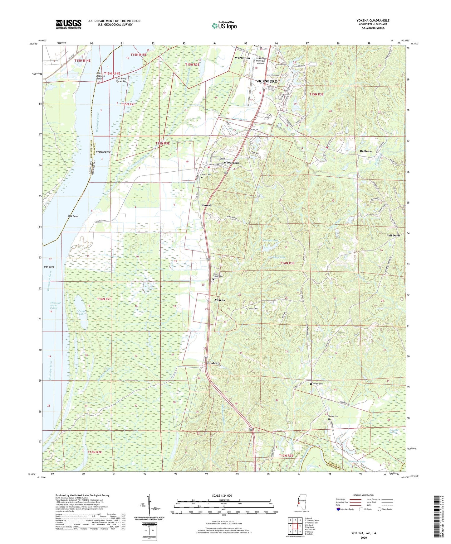
2024 topographic map quadrangle Yokena in the states of Mississippi, Louisiana. Scale: 1:24000. Based on the newly updated USGS 7.5' US Topo map series, this map is in the following counties: Warren, Madison, Claiborne. The map contains contour data, water features, and other items you are used to seeing on USGS maps, but also has updated roads and other features. This is the next generation of topographic maps. Printed on high-quality waterproof paper with UV fade-resistant inks.
Quads adjacent to this one:
West: Bedford
Northwest: Mound
North: Vicksburg West
Northeast: Vicksburg East
East: Big Black
Southeast: Carlisle
South: Willows
Southwest: Grand Gulf
This map covers the same area as the classic USGS quad with code o32090b8.
Contains the following named places: Beach Grove Church, Beard Cemetery, Bedford Bend, Cedars Cemetery, Cedars School, Diamond Island Cutoff, Glass Cemetery, Grace Church, Hennesseys Bayou, Hopewell Church, Horseshoe Lake, Immanuel Church, Jeff Davis, Jeff Davis Lookout Tower, Jeff Davis School, Kellogg Lake Dam, Kimberly, King Davis Church, Le Tourneau, Letourneau Lake Dam, Letourneau Volunteer Fire Department, Letourneau Volunteer Fire Department Station 1, Morning Star Church, Mount Giving Cemetery, Mount Vernon Post Office, Oak Bend, Oak Bend Landing, Oak Bend Upper Bar, Paces Bayou, Paine Lake, Purks Lake Dam, Redbone, Redbone Church, Redbone Creek, Reid-Bedford Bend, Reid-Bedford Revetment, Rings Lake, Sadler Cemetery, Saint John Church, Simmons Lake, Simrall, Southall Lake, Southall Lake Dam, Supervisor District 4, Taylor Landing, Vicksburg Fire Department Station 5, Vicksburg Municipal Airport, W R Farris Lake Dam, Warrenton, Warrenton Elementary School, Warrenton Heights, Warrenton Heights Recreation Lake Dam, Wright Cemetery, Yokena