MyTopo
Brookline Missouri US Topo Map
Couldn't load pickup availability
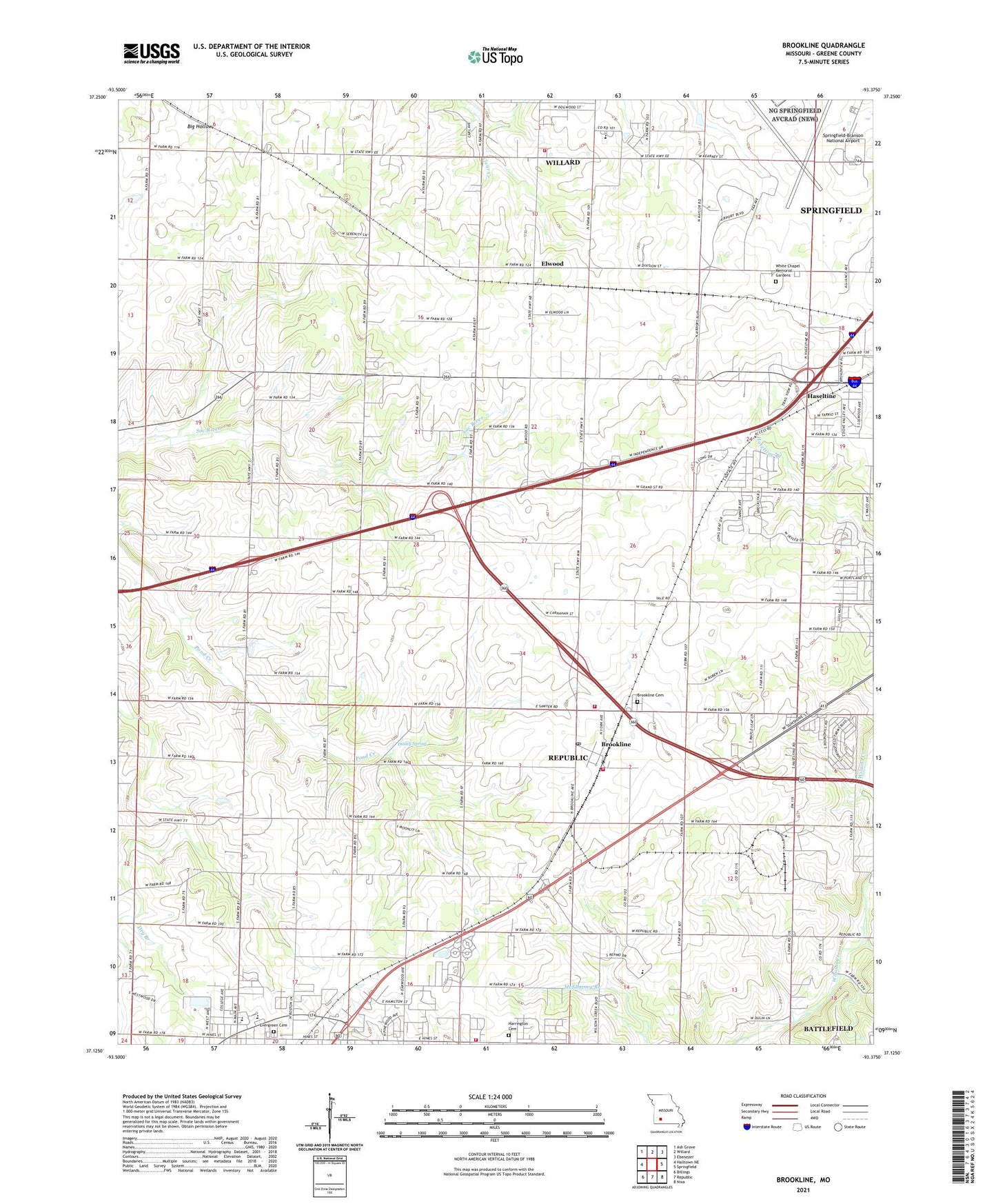
2021 topographic map quadrangle Brookline in the state of Missouri. Scale: 1:24000. Based on the newly updated USGS 7.5' US Topo map series, this map is in the following counties: Greene. The map contains contour data, water features, and other items you are used to seeing on USGS maps, but also has updated roads and other features. This is the next generation of topographic maps. Printed on high-quality waterproof paper with UV fade-resistant inks.
Quads adjacent to this one:
West: Halltown NE
Northwest: Ash Grove
North: Willard
Northeast: Ebenezer
East: Springfield
Southeast: Nixa
South: Republic
Southwest: Billings
Contains the following named places: Bennett School, Beulah School, Brewster Park, Brick School, Brookline, Brookline Cemetery, Brookline Fire Protection District Station 1, Brookline Fire Protection District Station 2, Brookline Post Office, Brookline School, Center School, Dailey Spring, Elwood, Evergreen Cemetery, Harrington Cemetery, Haseltine, Jones School, KSWM-AM (Republic), Mount Aetna School, Pleasant View Church, Republic Fire Department Station 2 Brookline, Rountree Branch, Sanford Park, Springfield-Branson National Airport, Township of Brookline, Township of Center Number 1, Township of Republic North, Township of West Republic, White Chapel Memorial Gardens, Willard Fire Protection District Station 3, Wyandotte School, Yeakley