MyTopo
Browning Missouri US Topo Map
Couldn't load pickup availability
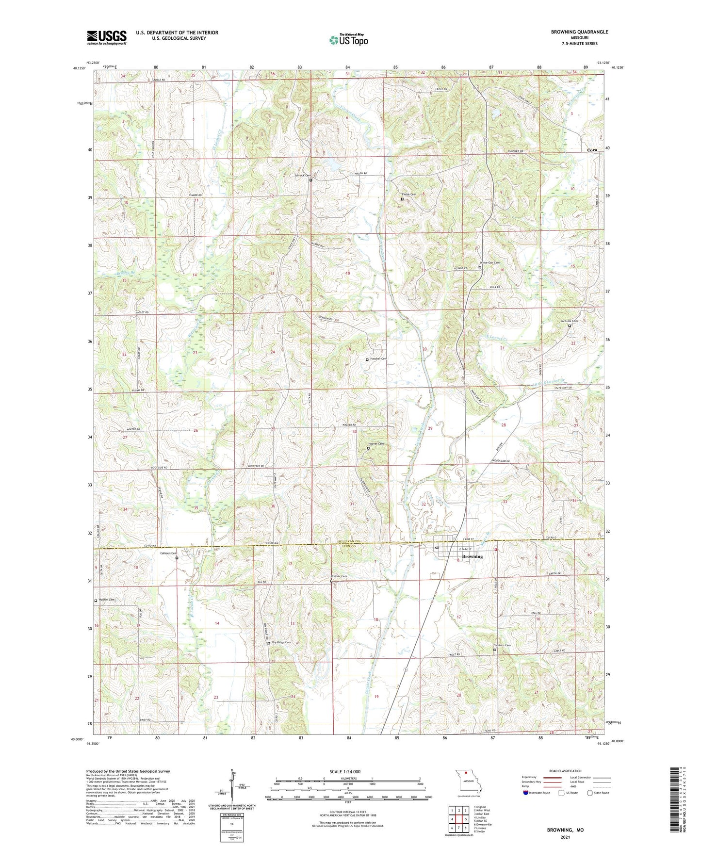
2021 topographic map quadrangle Browning in the state of Missouri. Scale: 1:24000. Based on the newly updated USGS 7.5' US Topo map series, this map is in the following counties: Sullivan, Linn. The map contains contour data, water features, and other items you are used to seeing on USGS maps, but also has updated roads and other features. This is the next generation of topographic maps. Printed on high-quality waterproof paper with UV fade-resistant inks.
Quads adjacent to this one:
West: Lindley
Northwest: Osgood
North: Milan West
Northeast: Milan East
East: Milan SE
Southeast: Shelby
South: Linneus
Southwest: Eversonville
Contains the following named places: Browning, Browning Fire Department, Browning Post Office, Browning Rural Fire Department, Brushy Branch, Calhoun Cemetery, City of Browning, Clem Springs School, Cora, Dry Ridge Cemetery, East Locust Creek, Fields Cemetery, Fields Lake Dam, Gray Lake Dam, Hatcher Cemetery, Hooker Cemetery, Hooker School, Hoover Cemetery, Jenkins Cemetery, Jenkins School, Jones Dam, Jones Lake, Little East Locust Creek, Locust Valley Church, Mairs Branch, McCulla Cemetery, Mundell School, North Hooker School, Prather Cemetery, Schrock Cemetery, Scottsville School, Smith School, Township of Duncan, Warren School, White Oak Cemetery, White Oak Church, White Oak Grove School, ZIP Code: 64630