MyTopo
Linneus Missouri US Topo Map
Couldn't load pickup availability
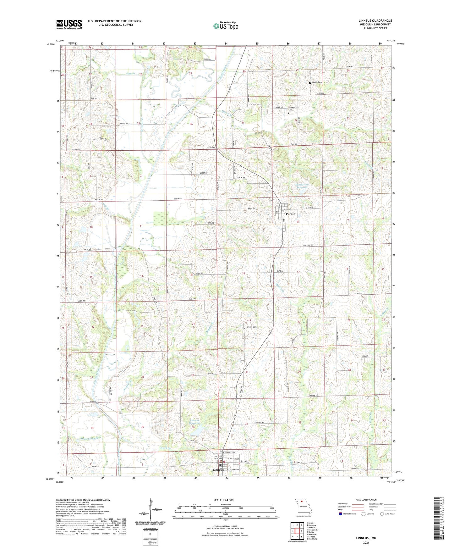
2021 topographic map quadrangle Linneus in the state of Missouri. Scale: 1:24000. Based on the newly updated USGS 7.5' US Topo map series, this map is in the following counties: Linn. The map contains contour data, water features, and other items you are used to seeing on USGS maps, but also has updated roads and other features. This is the next generation of topographic maps. Printed on high-quality waterproof paper with UV fade-resistant inks.
Quads adjacent to this one:
West: Eversonville
Northwest: Lindley
North: Browning
Northeast: Milan SE
East: Shelby
Southeast: Brookfield
South: Laclede
Southwest: Meadville
This map covers the same area as the classic USGS quad with code o39093h2.
Contains the following named places: Brown School, City of Linneus, City of Purdin, Couch Branch, Dryden Cemetery, Gooch Cemetery, Gooch School, Greenview School, Hale Lake Dam, Henning Lake Dam, Lee School, Liberty School, Lick Branch, Light School, Linn Branch, Linn County Sheriff's Office, Linneus, Linneus Fire Protection District, Linneus Lake Dam, Linneus Post Office, Linneus Reservoir, Lowes Branch, Magnolia Church, Number 217 Reservoir, Oak Grove School, Pierce School, Pleasant Point School, Pleasant Shade School, Purdin, Purdin Post Office, Southerland Cemetery, Township of Benton, Township of Locust Creek, West Locust Creek, Woodview School, ZIP Codes: 64653, 64674