MyTopo
Bucklin Missouri US Topo Map
Couldn't load pickup availability
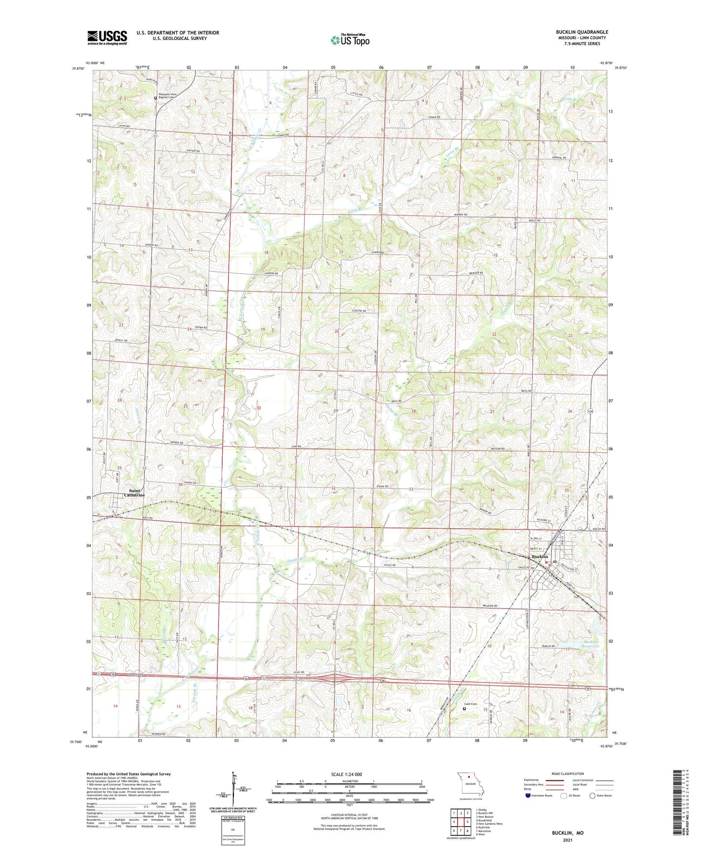
2021 topographic map quadrangle Bucklin in the state of Missouri. Scale: 1:24000. Based on the newly updated USGS 7.5' US Topo map series, this map is in the following counties: Linn. The map contains contour data, water features, and other items you are used to seeing on USGS maps, but also has updated roads and other features. This is the next generation of topographic maps. Printed on high-quality waterproof paper with UV fade-resistant inks.
Quads adjacent to this one:
West: Brookfield
Northwest: Shelby
North: Bucklin NW
Northeast: New Boston
East: New Cambria West
Southeast: Wien
South: Marceline
Southwest: Rothville
Contains the following named places: Black Horse Dam, Boone School, Brownlee School, Bucklin, Bucklin City Lake Dam, Bucklin Police Department, Bucklin Post Office, Bucklin Reservoir, Bucklin Volunteer Fire Department, Carpenter School, Carter School, Cash Cemetery, Cash School, City of Bucklin, Hahn Lake Dam, Larrys Lake, Long Branch, Oakdale School, Onion Branch, Osage School, Pin Oak Branch, Pleasant View Baptist Cemetery, Pleasant View Church, Pleasant View School, Saint Catharine, Saint Catharine Census Designated Place, Saint Catherine School, Sights Branch, Sights School, Switzer Chapel, Township of Bucklin, Township of Yellow Creek, Wyandotte Church