MyTopo
Bucklin NW Missouri US Topo Map
Couldn't load pickup availability
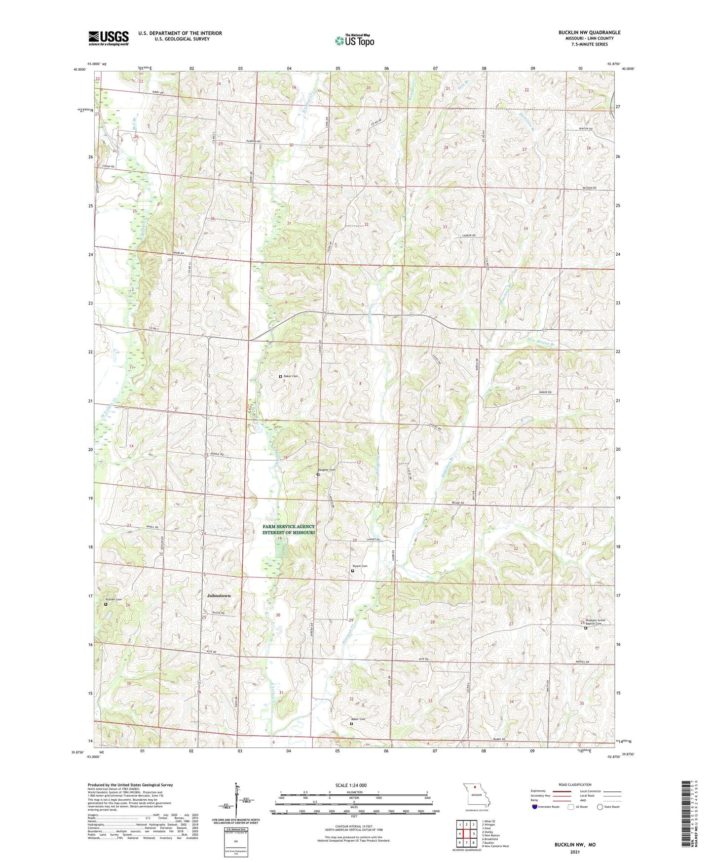
2021 topographic map quadrangle Bucklin NW in the state of Missouri. Scale: 1:24000. Based on the newly updated USGS 7.5' US Topo map series, this map is in the following counties: Linn. The map contains contour data, water features, and other items you are used to seeing on USGS maps, but also has updated roads and other features. This is the next generation of topographic maps. Printed on high-quality waterproof paper with UV fade-resistant inks.
Quads adjacent to this one:
West: Shelby
Northwest: Milan SE
North: Winigan
Northeast: Nind
East: New Boston
Southeast: New Cambria West
South: Bucklin
Southwest: Brookfield
This map covers the same area as the classic USGS quad with code o39092h8.
Contains the following named places: Baker Cemetery, Baugher Cemetery, Bull Branch, Clapp School, Davis School, Garner, Garner Church, Hackler School, Hamilton Branch, Harper School, Hill School, Hybrid, Johnstown, Mount Hope Church, Nester Chapel, Nester School, New Boston Branch, Phillips School, Pleasant Grove Baptist Cemetery, Pleasant Grove Church, Pulliam Cemetery, Sam Branch, Snowdon, Snowdon Post Office, Thudium School, Township of Baker, Warner School, White School, Winigan Creek, Wyant Cemetery, ZIP Code: 63557