MyTopo
Carl Junction Missouri US Topo Map
Couldn't load pickup availability
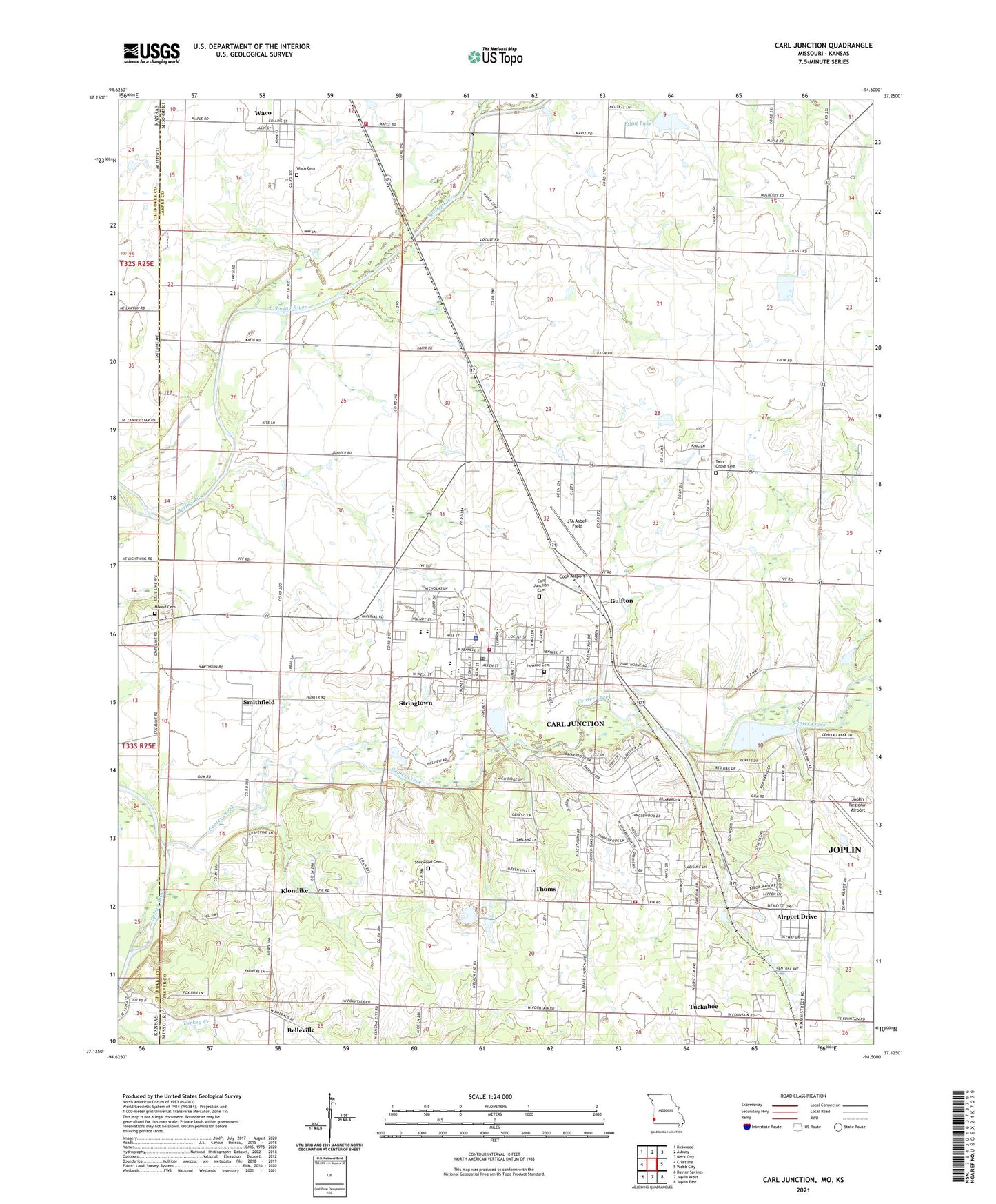
2021 topographic map quadrangle Carl Junction in the states of Missouri, Kansas. Scale: 1:24000. Based on the newly updated USGS 7.5' US Topo map series, this map is in the following counties: Jasper, Cherokee. The map contains contour data, water features, and other items you are used to seeing on USGS maps, but also has updated roads and other features. This is the next generation of topographic maps. Printed on high-quality waterproof paper with UV fade-resistant inks.
Quads adjacent to this one:
West: Crestline
Northwest: Kirkwood
North: Asbury
Northeast: Neck City
East: Webb City
Southeast: Joplin East
South: Joplin West
Southwest: Baxter Springs
Contains the following named places: Airport Drive, Brick School, Burton School, Carl Junction, Carl Junction Cemetery, Carl Junction Fire Protection District Station 1, Carl Junction Fire Protection District Station 3, Carl Junction Fire Protection District Station 4, Carl Junction High School, Carl Junction Intermediate School, Carl Junction Junior High School, Carl Junction Police Department, Carl Junction Post Office, Carl Junction Primary 2 - 3 School, Carl Junction Primary K - 1 School, Center Creek, Center School, City of Carl Junction, City of Waco, Cook Airport, Elliot Lake, Elliot Lake Dam, Gulfton, Howard Cemetery, Joplin Regional Airport, JTA Asbell Field, KIXQ-FM (Webb City), Klondike, Mound Cemetery, New Hope Church, Oscie Ora Acres Lake, Oscie Ora Acres Lake Dam, Pleasant Hill Church, Prairie Hill School, Sherwood Cemetery, Smithfield, Smithfield School, Stringtown, Thoms, Township of Twin Groves, Tuckahoe, Twin Grove Cemetery, Twin Groves School, Village of Airport Drive, Waco, Waco Cemetery, Waco School, Zincite School, ZIP Code: 64834