MyTopo
Asbury Missouri US Topo Map
Couldn't load pickup availability
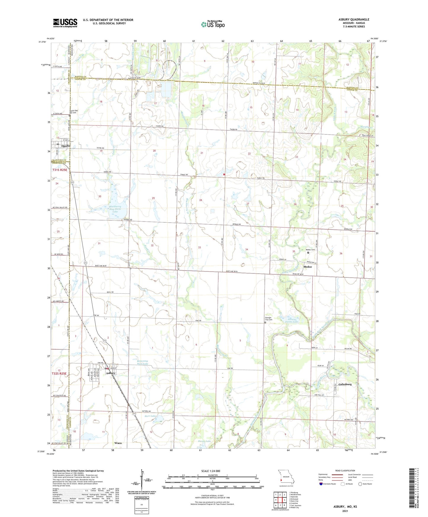
2021 topographic map quadrangle Asbury in the states of Missouri, Kansas. Scale: 1:24000. Based on the newly updated USGS 7.5' US Topo map series, this map is in the following counties: Jasper, Barton, Cherokee, Crawford. The map contains contour data, water features, and other items you are used to seeing on USGS maps, but also has updated roads and other features. This is the next generation of topographic maps. Printed on high-quality waterproof paper with UV fade-resistant inks.
Quads adjacent to this one:
West: Kirkwood
Northwest: Pittsburg
North: Mindenmines
Northeast: Nashville
East: Neck City
Southeast: Webb City
South: Carl Junction
Southwest: Crestline
This map covers the same area as the classic USGS quad with code o37094c5.
Contains the following named places: Asbury, Asbury Farms Dam, Asbury Farms Lake, Asbury Fire Protection District Station 1, Asbury Fire Protection District Station 2, Asbury Post Office, Asbury School, Blackberry Creek, Blackberry Hay Farm Dam, Blackberry Hay Farm Lake, Blackberry School, Browning West Lake, Cherokee Plains, City of Asbury, Doran Lake, Doran Lake Dam, East Opolis School, Galesburg, Galesburg School, Georgia City, Georgia City Cemetery, Herr Lake, Herr Lake Dam, Little North Fork, Medoc, Medoc School, Murphy Creek, North Fork Spring River, Number 654 Dam, Opolis, Opolis Census Designated Place, Opolis Oak Hill Cemetery, Opolis Post Office, Pond Creek, Raymond Smith Dam, Raymond Smith Lake, Silver Creek School, Township of Jasper, Wah-Sha-She Prairie State Wildlife Area, ZIP Codes: 64832, 66760