MyTopo
Hatfield Missouri US Topo Map
Couldn't load pickup availability
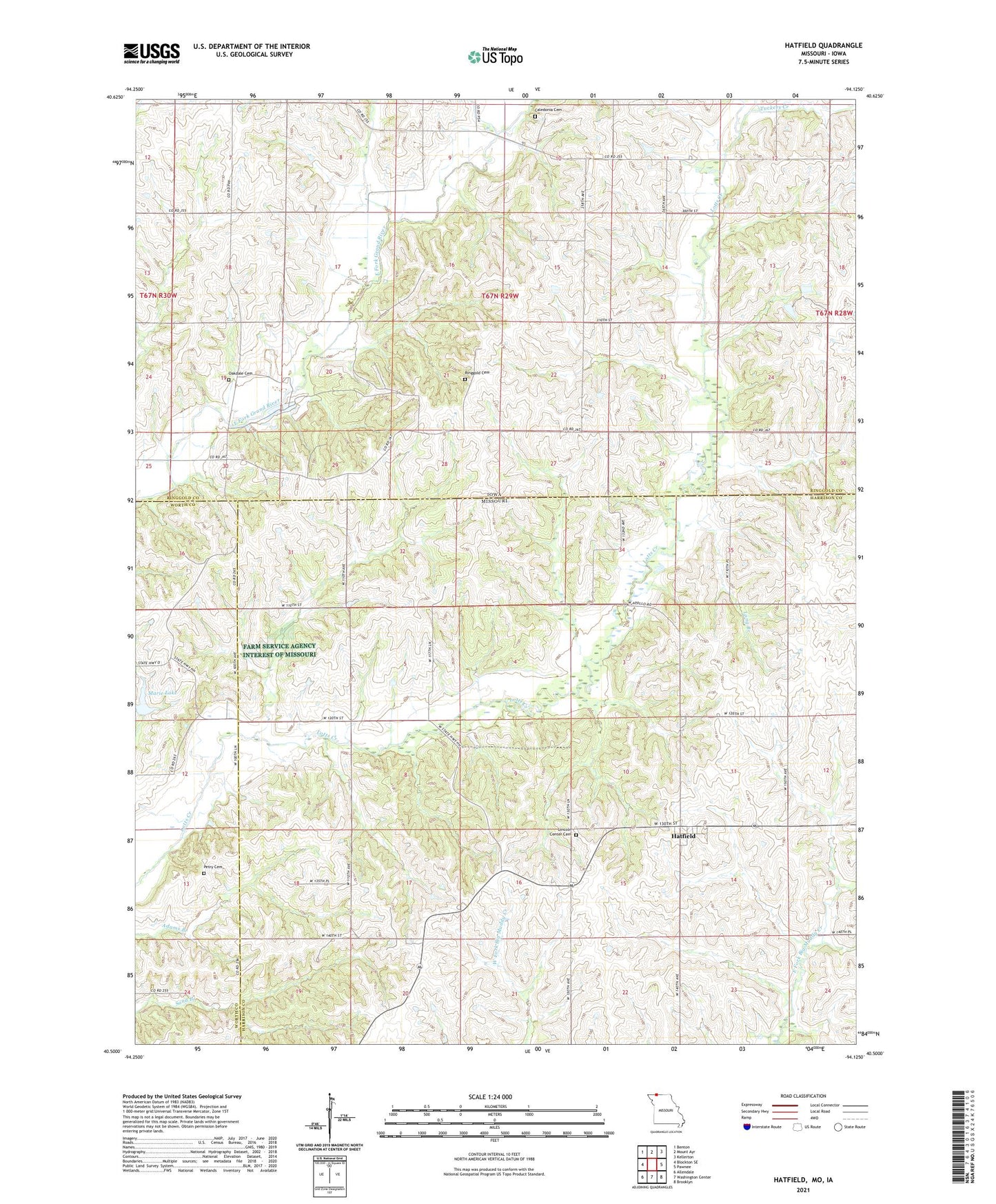
2021 topographic map quadrangle Hatfield in the states of Missouri, Iowa. Scale: 1:24000. Based on the newly updated USGS 7.5' US Topo map series, this map is in the following counties: Harrison, Ringgold, Worth. The map contains contour data, water features, and other items you are used to seeing on USGS maps, but also has updated roads and other features. This is the next generation of topographic maps. Printed on high-quality waterproof paper with UV fade-resistant inks.
Quads adjacent to this one:
West: Blockton SE
Northwest: Benton
North: Mount Ayr
Northeast: Kellerton
East: Pawnee
Southeast: Brooklyn
South: Washington Center
Southwest: Allendale
Contains the following named places: Baptist Church, Caledonia, Caledonia Cemetery, Caledonia Post Office, Cottrel Lake Dam, East Fork Grand River, Green Hills Planning Region, Hatfield, Lincoln Center Cemetery, Long Branch, Lotts Grove Church, Marie Lake, Methodist Episcopal Church, Oakdale Cemetery, Petry Cemetery, Poyneer Post Office, Ringgold, Ringgold Cemetery, Ringgold Post Office, Ringgold State Wildlife Area, Thomas, Thomas Post Office, Township of Lincoln, Township of Lotts Creek, Tuckers Creek, Turkey Grove School, Watterson, Watterson Post Office, Watterson Quarry, ZIP Code: 64458