MyTopo
Washington Center Missouri US Topo Map
Couldn't load pickup availability
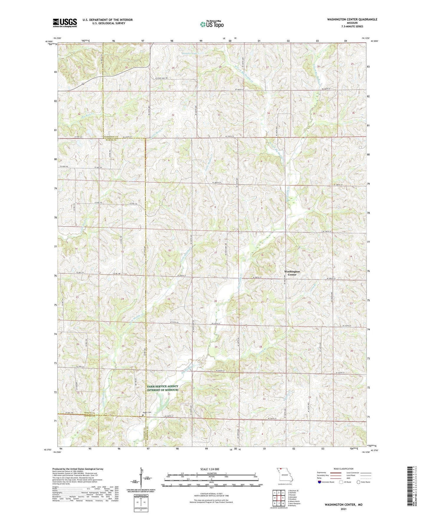
2021 topographic map quadrangle Washington Center in the state of Missouri. Scale: 1:24000. Based on the newly updated USGS 7.5' US Topo map series, this map is in the following counties: Harrison, Worth, Gentry. The map contains contour data, water features, and other items you are used to seeing on USGS maps, but also has updated roads and other features. This is the next generation of topographic maps. Printed on high-quality waterproof paper with UV fade-resistant inks.
Quads adjacent to this one:
West: Allendale
Northwest: Blockton SE
North: Hatfield
Northeast: Pawnee
East: Brooklyn
Southeast: Bethany
South: New Hampton
Southwest: Albany North
This map covers the same area as the classic USGS quad with code o40094d2.
Contains the following named places: Baugher Dam, Baugher Lake, Chambers Lake Dam, Dry School, East Fork Big Muddy Creek, Emmett and Leah Seat Memorial Wildlife Area, Gem, Glenn Lake Dam North, Glenn Lake Dam South, Isabell Church, Koger Cemetery, Long Branch, Long Branch School, Moore School, Muddy Valley School, New Harmony Church, Pebble Ridge School, Township of Washington, Washington Center, Washington Center School, Weaver Church, Wesley Church, West Fork Big Muddy Creek, Williams School, Zimmerman School, ZIP Code: 64467