MyTopo
Jasper Missouri US Topo Map
Couldn't load pickup availability
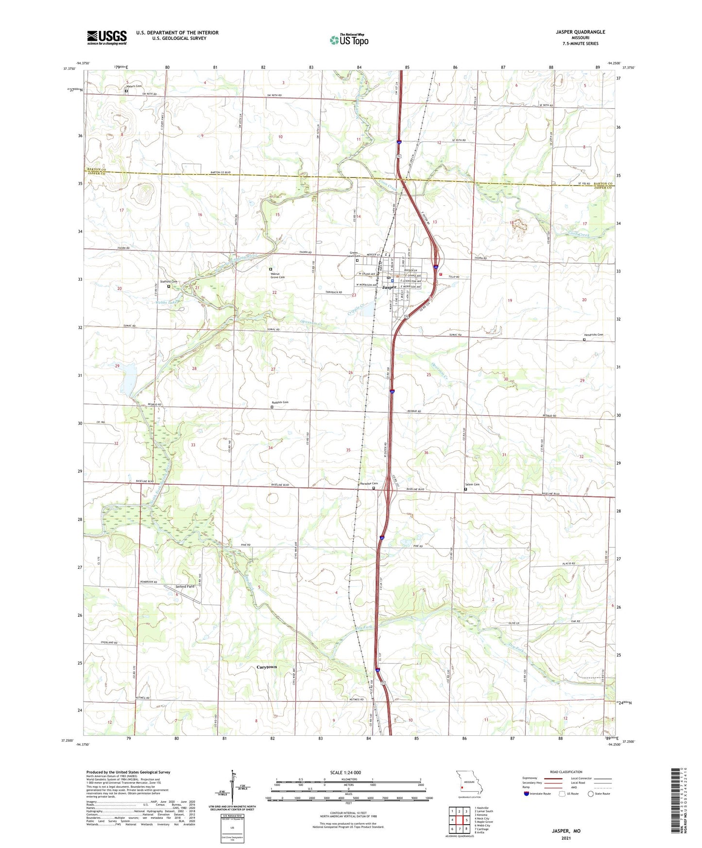
2021 topographic map quadrangle Jasper in the state of Missouri. Scale: 1:24000. Based on the newly updated USGS 7.5' US Topo map series, this map is in the following counties: Jasper, Barton. The map contains contour data, water features, and other items you are used to seeing on USGS maps, but also has updated roads and other features. This is the next generation of topographic maps. Printed on high-quality waterproof paper with UV fade-resistant inks.
Quads adjacent to this one:
West: Neck City
Northwest: Nashville
North: Lamar South
Northeast: Kenoma
East: Maple Grove
Southeast: Avilla
South: Carthage
Southwest: Webb City
Contains the following named places: Blue Community Hall, Carytown, Carytown School, City of Carytown, City of Jasper, Coon Creek, Cripple Creek, Dewey School, Dry Fork, Farmers Union School, Hendricks Cemetery, Jasper, Jasper County Elementary School, Jasper Farmers Fire Protection Association, Jasper High School, Jasper Police Department, Jasper Post Office, Jasper Volunteer Fire Department, King School, Mount Moriah Church, Opossum Creek, Paradise Cemetery, Pleasant Hill School, Rising Sun School, Ruddick Cemetery, Salem Church, Scroggs Lake, Scroggs Lake Dam, Seiferd Field, Sheridan School, Stafford Cemetery, Township of Preston, Union Valley School, Walnut Grove Cemetery, Waters Cemetery, Webbs Lake, ZIP Code: 64755