MyTopo
Knob Noster NW Missouri US Topo Map
Couldn't load pickup availability
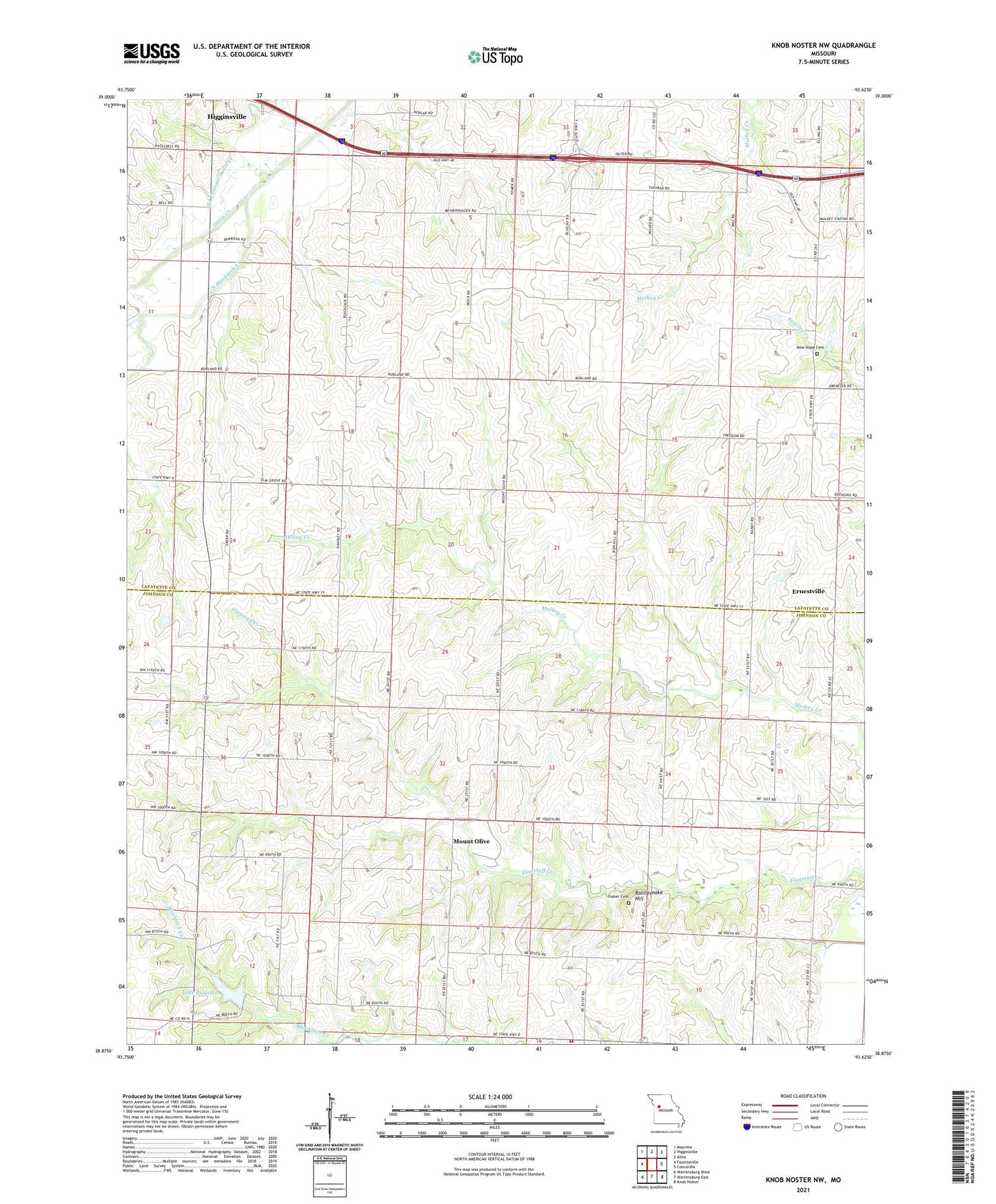
2021 topographic map quadrangle Knob Noster NW in the state of Missouri. Scale: 1:24000. Based on the newly updated USGS 7.5' US Topo map series, this map is in the following counties: Lafayette, Johnson. The map contains contour data, water features, and other items you are used to seeing on USGS maps, but also has updated roads and other features. This is the next generation of topographic maps. Printed on high-quality waterproof paper with UV fade-resistant inks.
Quads adjacent to this one:
West: Fayetteville
Northwest: Mayview
North: Higginsville
Northeast: Alma
East: Concordia
Southeast: Knob Noster
South: Warrensburg East
Southwest: Warrensburg West
Contains the following named places: Borland, Bowman School, Dyer Lake Dam, East Lynn School, Ebenezer School, Elm Grove School, Ernestville, Eureka School, Foster Cemetery, Foster School, Handly School, Hazel Dell School, Houston Lake Dam, Johnson County Fire Protection District Station 6 Valley City, Lake Pajastka, Lake Pajastka Dam, Mock School, Mount Olive, Mulkey, New Hope Cemetery, North Blackjack Creek, Oak Grove Church, Priest Post Office, Rattlesnake Hill, Saint Matthews Church, Township of Simpson, Zion Hill Church