MyTopo
Fayetteville Missouri US Topo Map
Couldn't load pickup availability
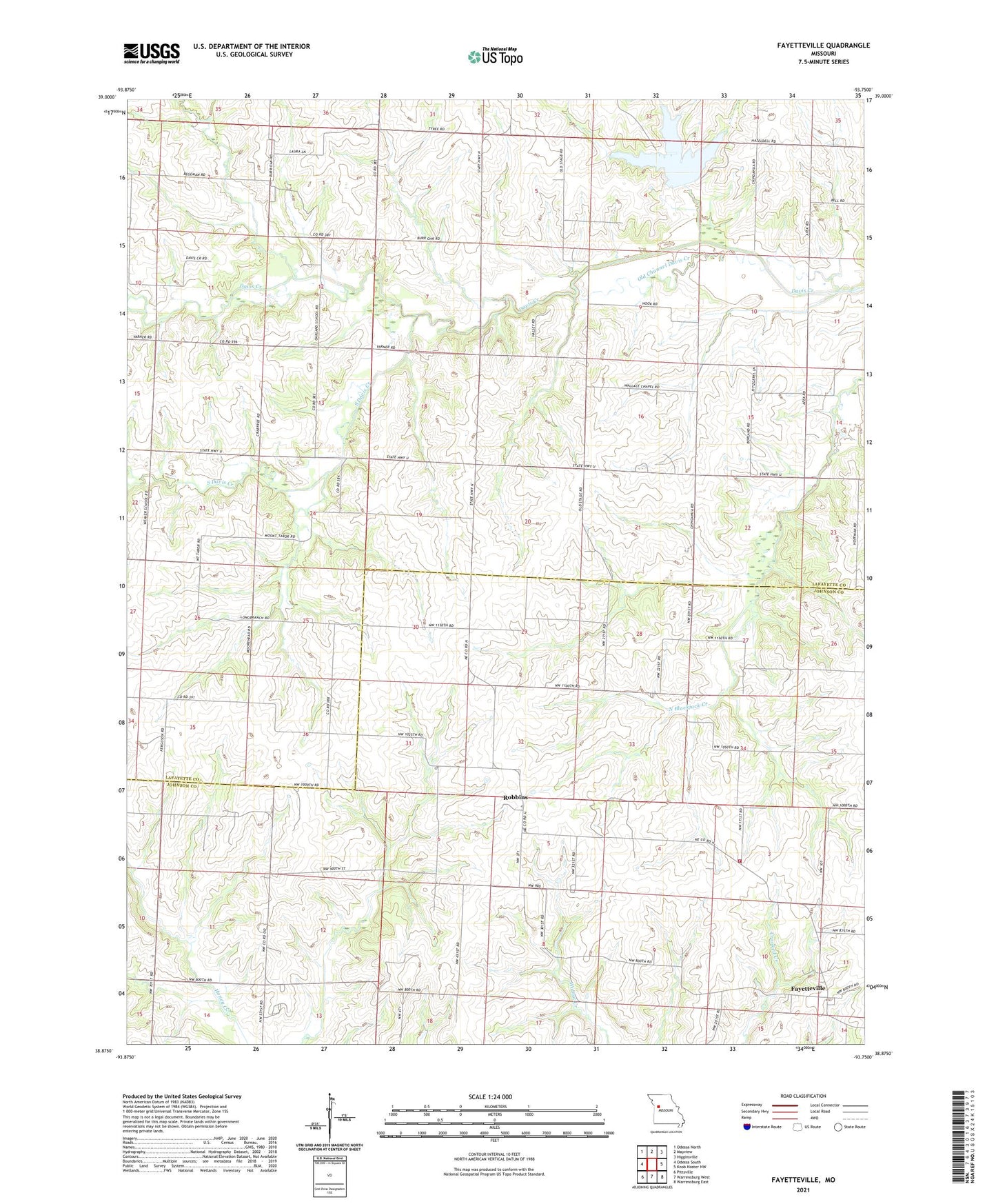
2021 topographic map quadrangle Fayetteville in the state of Missouri. Scale: 1:24000. Based on the newly updated USGS 7.5' US Topo map series, this map is in the following counties: Lafayette, Johnson. The map contains contour data, water features, and other items you are used to seeing on USGS maps, but also has updated roads and other features. This is the next generation of topographic maps. Printed on high-quality waterproof paper with UV fade-resistant inks.
Quads adjacent to this one:
West: Odessa South
Northwest: Odessa North
North: Mayview
Northeast: Higginsville
East: Knob Noster NW
Southeast: Warrensburg East
South: Warrensburg West
Southwest: Pittsville
This map covers the same area as the classic USGS quad with code o38093h7.
Contains the following named places: Cedar Grove Church, Chihauhua School, Coleman School, Day Lake Dam, Downing Lake Dam, Farmers School, Fayetteville, Hoffman, Hoffman Post Office, I-70 and 13 Channel Catfish Farm Lake, Johnson County Fire Protection District Station 8 Fayetteville, KCMW-FM (Warrensburg), Long Branch Church, Long Branch School, McCoy School, Newland East Lake Dam, Newland Lake, Newland Lake Section 20 Dam, Newland West Lake Dam, Oakland, Oakland Church, Oakland School, Rauch Dam, Reich Lake Dam, Robbins, Salem School, South Davis Creek, Tabo, Tabo Post Office, Township of Hazel Hill, Tyree School, Wallace Chapel, Weaver School, William Riech Lake, Wolfenbarger School, Wooden Lake Section 16 Dam, Zander Lake Dam