MyTopo
Luckett Ridge Missouri US Topo Map
Couldn't load pickup availability
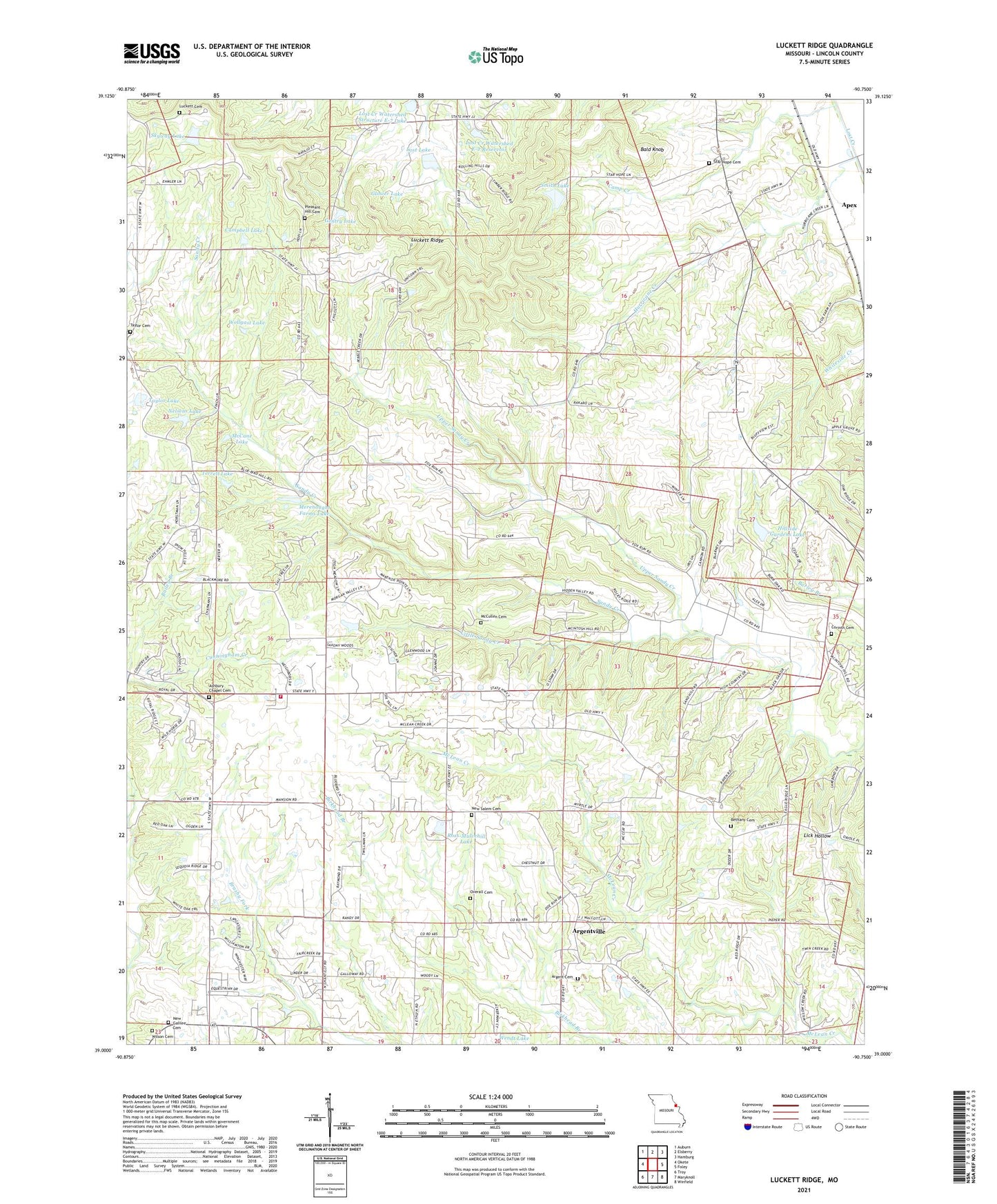
2021 topographic map quadrangle Luckett Ridge in the state of Missouri. Scale: 1:24000. Based on the newly updated USGS 7.5' US Topo map series, this map is in the following counties: Lincoln. The map contains contour data, water features, and other items you are used to seeing on USGS maps, but also has updated roads and other features. This is the next generation of topographic maps. Printed on high-quality waterproof paper with UV fade-resistant inks.
Quads adjacent to this one:
West: Okete
Northwest: Auburn
North: Elsberry
Northeast: Hamburg
East: Foley
Southeast: Winfield
South: Maryknoll
Southwest: Troy
Contains the following named places: Apex, Argent Cemetery, Argentville, Ashbury Chapel, Ashbury Chapel Cemetery, Bald Knob, Bethany Cemetery, Bethany Methodist Church, Birkhead Lake, Birkhead Lake Dam, Boehm Lake, Boehm Lake Dam, Britt School, Brussells School, Burr Oak, Burr Oak School, Camp Creek, Campbell Lake, Campbell Lake Dam, Corinth Cemetery, Corinth Church, Cornick School, Cunningham Creek, Ellis School, Gentry Lake, Gentry Lake Dam, Glosier Lake, Glosier Lake Dam, Hickory Ridge School, Hillside Gardens Lake, Hillside Gardens Lake Dam, Hurricane Creek, Little Sandy Creek, Lost Creek Watershed E-2 Dam, Lost Creek Watershed E-2 Reservoir, Lost Creek Watershed Structure E-7 Lake, Lost Lake, Lost Lake Dam, Luckett Cemetery, Luckett Ridge, McCane Lake, McCane Lake Dam, McCullen Cemetery, Merenaught Farms Lake, Merenaught Farms Lake Dam, Myers School, Nelsens Lake, Nelsens Lake Dam, New Galilee Cemetery, New Galilee Church, New Salem, New Salem Cemetery, New Salem Church, New Salem School, Overall Cemetery, Peek Lake Section 13, Peek Lake Section 13 Dam, Peek Lake Section 18, Peek Lake Section 18 Dam, Pleasant Hill Cemetery, Ross-Mulvehill Lake, Ross-Mulvehill Lake Dam, Skyway Lake, Skyway Lake Dam, Smith Lake, Smith Lake Dam, Star Hope Cemetery, Star Hope Church, Star Hope School, Taylor Cemetery, Taylor Lake, Taylor Lake Dam, Taylor School, Terrell Lake, Terrell Lake Dam, Township of Burr Oak, Upper Sandy Creek, Wilson Cemetery, Winfield - Foley Fire Protection District Station 4, Winfield Manor Heliport, Wollgast Lake, Wollgast Lake Dam, ZIP Codes: 63347, 63389