MyTopo
Hamburg Illinois US Topo Map
Couldn't load pickup availability
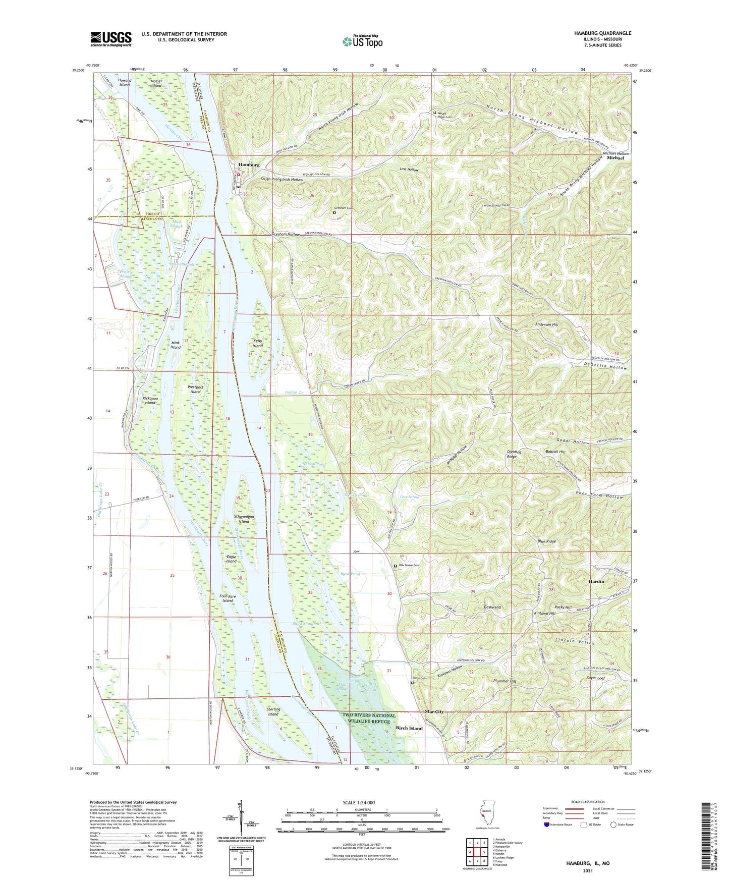
2024 topographic map quadrangle Hamburg in the states of Illinois, Missouri. Scale: 1:24000. Based on the newly updated USGS 7.5' US Topo map series, this map is in the following counties: Calhoun, Lincoln, Pike. The map contains contour data, water features, and other items you are used to seeing on USGS maps, but also has updated roads and other features. This is the next generation of topographic maps. Printed on high-quality waterproof paper with UV fade-resistant inks.
Quads adjacent to this one:
West: Elsberry
Northwest: Annada
North: Pleasant Dale Valley
Northeast: Kampsville
East: Hardin
Southeast: Nutwood
South: Foley
Southwest: Luckett Ridge
Contains the following named places: Anderson Hill, Birch Island, Blue Ridge, Bobtail Hill, Burr Oak Landing, Byrd Pond, Calhoun County, Cave Spring, Deer Slough, Dividing Ridge, Dixon Cemetery, Dixon Slough, Eagle Island, Four Acre Island, Gaske Hill, Gilead Election Precinct, Gilead Gun Club, Gilead Slough, Gilford Post Light, Gresham Cemetery, Gresham Hollow, Hamburg, Hamburg Ferry, Hamburg Post Office, Indian Creek, Indian Creek Church, Indian Creek School, Kelly Island, Kickapoo Chute, Kickapoo Island, Kintown Hill, Kintown Hollow, Lamey Pond, Lost Hollow, Mark Twain National Wildlife Refuge, McNabb Hollow, Middle Slough, Mink Island, Mount Hope Cemetery, Mount Hope School, Mozier Island, Mud Slough, Nelson Pond, North Calhoun Fire Protection District Station 2, North Prong Irish Hollow, North Prong Michael Hollow, Norton Woods Public Access, Oak Grove Cemetery, Oak Grove School, Old Westport Landing, Plummer Hill, Prairie Slough, Red Landing Post Light, Reds Landing State Fish and Waterfowl Manage, Rocky Hill, Sand Slough, Schwanigan Island, Sloan's Airport, South Prong Irish Hollow, South Prong Michael Hollow, Star City, Sterling Island, Strator Pond, Sugar Loaf, Thomas Chute, Tremell Slough, Upper Mississippi Conservation Area, Village of Hamburg, Westport Chute, Westport Island, ZIP Code: 62065