MyTopo
Maryknoll Missouri US Topo Map
Couldn't load pickup availability
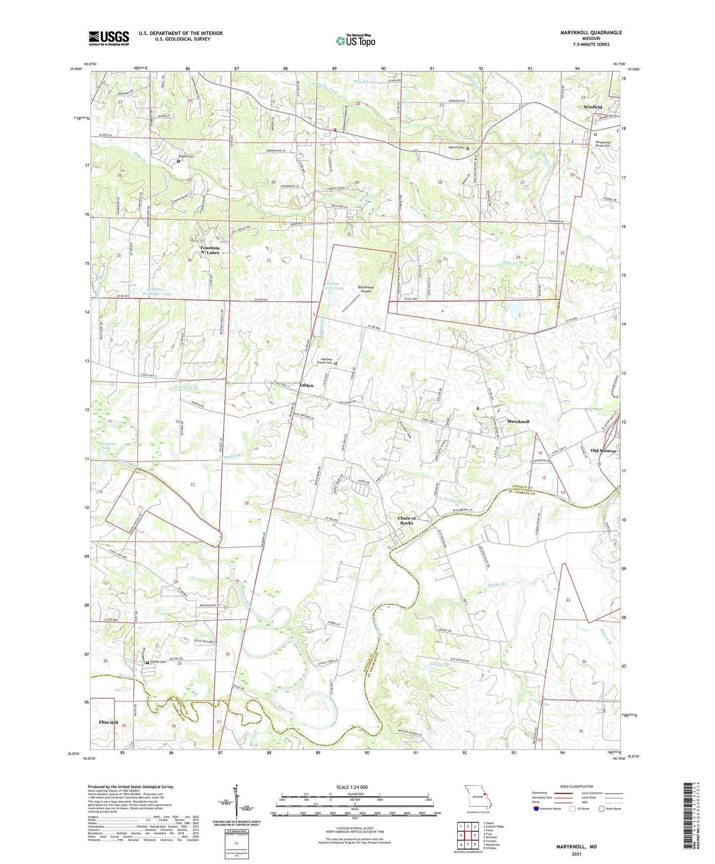
2021 topographic map quadrangle Maryknoll in the state of Missouri. Scale: 1:24000. Based on the newly updated USGS 7.5' US Topo map series, this map is in the following counties: Lincoln, St. Charles. The map contains contour data, water features, and other items you are used to seeing on USGS maps, but also has updated roads and other features. This is the next generation of topographic maps. Printed on high-quality waterproof paper with UV fade-resistant inks.
Quads adjacent to this one:
West: Troy
Northwest: Okete
North: Luckett Ridge
Northeast: Foley
East: Winfield
Southeast: O'Fallon
South: Wentzville
Southwest: Foristell
Contains the following named places: Admire Cemetery, Amity School, Bals School, Big Creek, Birkhead Branch, Blackhawk Airport, Brushy Fork, Campbell Branch, Chain of Rocks, Chantilla Post Office, Chantilly, Chantilly School, Creech School, Ethlyn, Fountain N' Lakes, Groshong Branch, Highland Prairie Cemetery, Highland Prairie Church, Highview, Highview Post Office, Immaculate Conception Parish, Immaculate Conception School, Jordan Branch, Keelstone Branch, Keelstone School, Lindsey School, Maryknoll, McCoy Creek, Muich Lake, Muich Lake Dam, Nelson School, Old Monroe Fire Protection District Station 2, Old Monroe School, Owen, Owen Station School, Palmer Farms Lake, Palmer Farms Lake Dam, Riddle Cemetery, Rybolt Cemetery, Saint Pauls Church, Schlueter - Heddinger Lake, Schlueter - Heddinger Lake Dam, Star Prairie School, Touchette Lake, Touchette Lake Dam, Township of Monroe, True Gospel Church, Village of Chain of Rocks, Village of Fountain N' Lakes, Wendt Lake, Wendt Lake Dam, West Liberty School, Whites Bar, Whites Branch, Wilson School, Winfield - Foley Fire Protection District Station 3, Winfield High School, ZIP Codes: 63362, 63369