MyTopo
Foristell Missouri US Topo Map
Couldn't load pickup availability
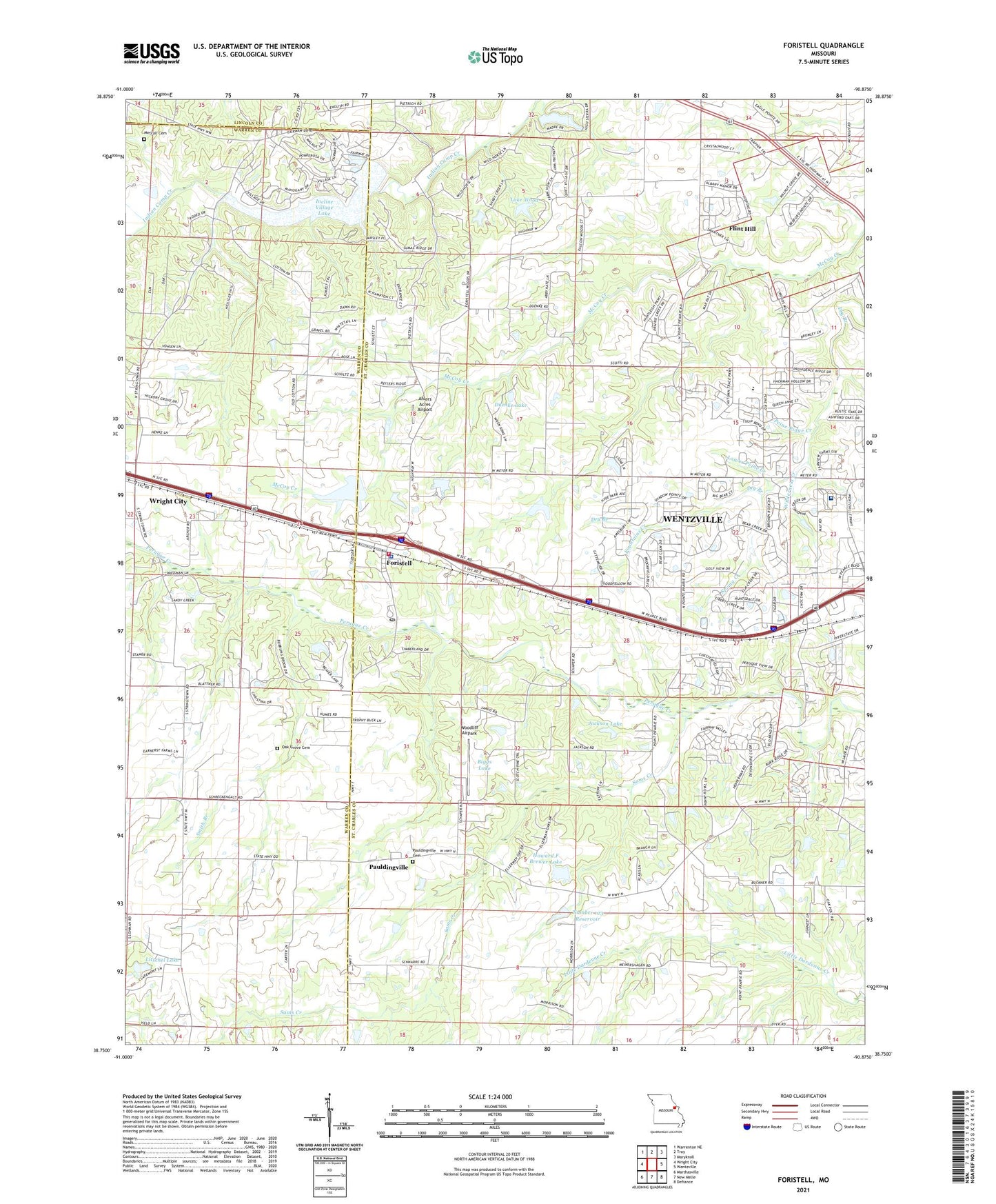
2021 topographic map quadrangle Foristell in the state of Missouri. Scale: 1:24000. Based on the newly updated USGS 7.5' US Topo map series, this map is in the following counties: St. Charles, Warren, Lincoln. The map contains contour data, water features, and other items you are used to seeing on USGS maps, but also has updated roads and other features. This is the next generation of topographic maps. Printed on high-quality waterproof paper with UV fade-resistant inks.
Quads adjacent to this one:
West: Wright City
Northwest: Warrenton NE
North: Troy
Northeast: Maryknoll
East: Wentzville
Southeast: Defiance
South: New Melle
Southwest: Marthasville
This map covers the same area as the classic USGS quad with code o38090g8.
Contains the following named places: African School, Ahlers Acres Airport, Bear Creek Golf Course, Berry Park Dam, Biggs Lake, Biggs Lake Dam, Birnbaum Lake Dam, Blattner School, Boy Scout Camp, Carlie Lake Dam, City of Foristell, Cloverleaf Farm Lake, Cloverleaf Farm Lake Dam, Doctor Courtney Dam, Doctor Courtney Lake, Douglas School, Duenke Lake, Forest Hills Lake Dam, Foristell, Foristell City Police Department, Foristell Post Office, Fountains at Bear Creek, Fountains Creek, Garrett Lake Dam, Gibson School, Great Oaks, Great Oaks Creek, Hickory Hollow, Hitz Lake Dam, Howard F Brewer Lake, Hughes School, Huntsdale, Incline Village Lake, Incline Village Lake Dam, Jackson Dam, Jackson Lake, Johnson Lake Dam, Lake Dan-Bea Dam, Lake Wood, Lake Wood Dam, Litschel Lake, Litschell Lake Dam, Lower Peine Creek, Meridian School, Metcall Cemetery, Mid America Raceway, Niedner Lake Dam, Number 123 Reservoir, Number 507 Dam, Oak Dale School, Oak Grove Cemetery, Oakland School, Pauldingville, Pauldingville Cemetery, Peine Ridge Creek, Peine Ridge Elementary School, Peine Woods, Point Prairie School, Riddle's Roost Airport, Sams Creek, Shiloh Church, Smith Branch, Smith Chapel, Spring Creek, SSM Health Saint Joseph Hospital - Wentzville, Stonemoor, Thompson Lake Dam, Weir Lake Dam, Wentzville Fire Protection District Station 3, Wilderness Creek, Woodlands at Bear Creek, Woodliff Airpark, Wright City East Elementary School, ZIP Code: 63348