MyTopo
Mystic Missouri US Topo Map
Couldn't load pickup availability
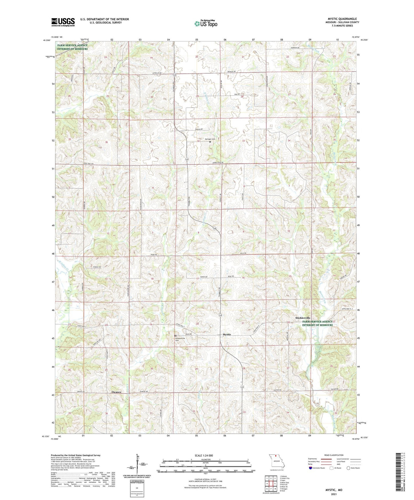
2021 topographic map quadrangle Mystic in the state of Missouri. Scale: 1:24000. Based on the newly updated USGS 7.5' US Topo map series, this map is in the following counties: Sullivan. The map contains contour data, water features, and other items you are used to seeing on USGS maps, but also has updated roads and other features. This is the next generation of topographic maps. Printed on high-quality waterproof paper with UV fade-resistant inks.
Quads adjacent to this one:
West: Milan East
Northwest: Pollock
North: Green City
Northeast: Stahl
East: Pure Air
Southeast: Nind
South: Winigan
Southwest: Milan SE
Contains the following named places: Carter Lake Dam, Comstock School, Cook School, Hickory Grove School, Independent School, Johnson School, Mystic, Owasco, Owasco School, Pleasantville Cemetery, Pleasantville School, Prairie Chapel, Red Brush School, Springer Cemetery, Springer School, Sticklerville, Township of Union, Yellow Creek Church