MyTopo
Pollock Missouri US Topo Map
Couldn't load pickup availability
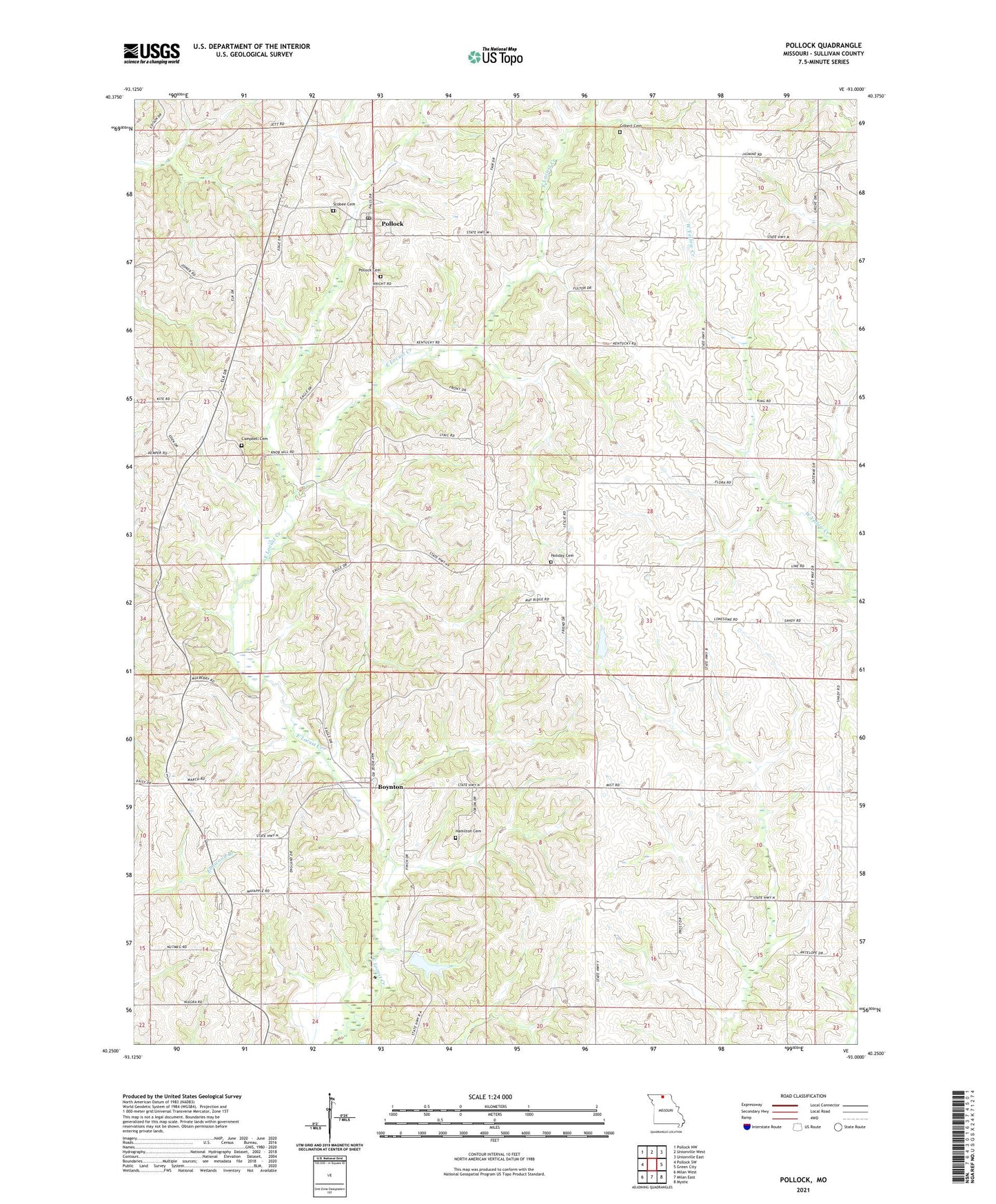
2021 topographic map quadrangle Pollock in the state of Missouri. Scale: 1:24000. Based on the newly updated USGS 7.5' US Topo map series, this map is in the following counties: Sullivan. The map contains contour data, water features, and other items you are used to seeing on USGS maps, but also has updated roads and other features. This is the next generation of topographic maps. Printed on high-quality waterproof paper with UV fade-resistant inks.
Quads adjacent to this one:
West: Pollock SW
Northwest: Pollock NW
North: Unionville West
Northeast: Unionville East
East: Green City
Southeast: Mystic
South: Milan East
Southwest: Milan West
This map covers the same area as the classic USGS quad with code o40093c1.
Contains the following named places: Anspach School, Boynton, Boynton School, Campbell Cemetery, Chappell School, Dudley School, Elmwood Church, Elmwoods School, Fairview Church, Fairview School, Gilbert Cemetery, Gilbert School, Hamilton Cemetery, Hawkeye School, Holiday Cemetery, Holliday School, Jackson Corner School, Jacksonville, Mount Zion Church, Pollock, Pollock Cemetery, Pollock Post Office, Red School, Scobee Cemetery, Sears Community Lake, Sears Community Lake Dam, Stevens Lake, Township of Jackson, Village of Pollock, ZIP Code: 63560