MyTopo
Pawnee Missouri US Topo Map
Couldn't load pickup availability
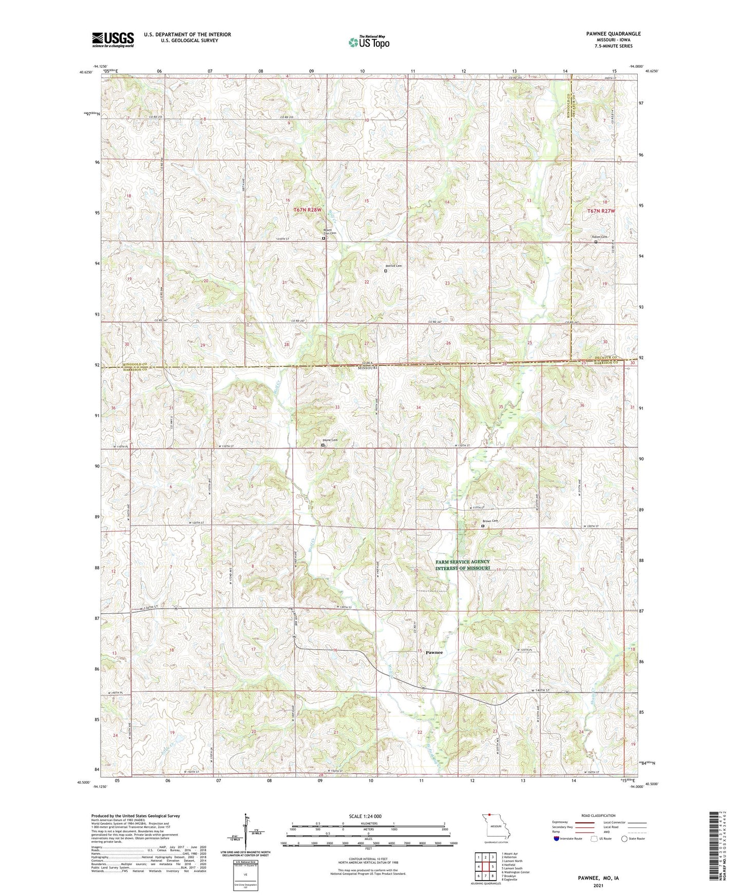
2021 topographic map quadrangle Pawnee in the states of Missouri, Iowa. Scale: 1:24000. Based on the newly updated USGS 7.5' US Topo map series, this map is in the following counties: Harrison, Ringgold, Decatur. The map contains contour data, water features, and other items you are used to seeing on USGS maps, but also has updated roads and other features. This is the next generation of topographic maps. Printed on high-quality waterproof paper with UV fade-resistant inks.
Quads adjacent to this one:
West: Hatfield
Northwest: Mount Ayr
North: Kellerton
Northeast: Lamoni North
East: Lamoni South
Southeast: Eagleville
South: Brooklyn
Southwest: Washington Center
Contains the following named places: Arrington School, Bloomington, Brown Cemetery, Franklin Church, Friendship Church, High Point School, Hollen Cemetery, Latter-Day Saints Church, Lee, Lee Post Office, Lone Rock Church, Lone Rock School, Mount Zion Cemetery, Patrick Cemetery, Pawnee, Payne Cemetery, Ramey School, Smith School, Township of Hamilton, Township of Riley, Wolf Creek