MyTopo
Pilot Grove North Missouri US Topo Map
Couldn't load pickup availability
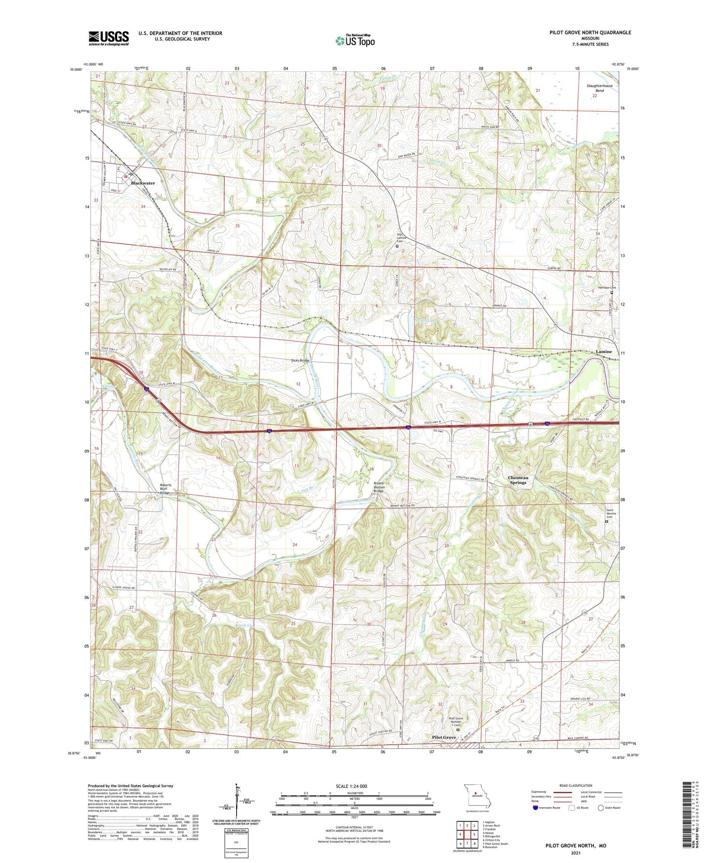
2021 topographic map quadrangle Pilot Grove North in the state of Missouri. Scale: 1:24000. Based on the newly updated USGS 7.5' US Topo map series, this map is in the following counties: Cooper, Howard. The map contains contour data, water features, and other items you are used to seeing on USGS maps, but also has updated roads and other features. This is the next generation of topographic maps. Printed on high-quality waterproof paper with UV fade-resistant inks.
Quads adjacent to this one:
West: Nelson
Northwest: Napton
North: Arrow Rock
Northeast: Franklin
East: Billingsville
Southeast: Bunceton
South: Pilot Grove South
Southwest: Clifton City
Contains the following named places: Becker School, Blackwater, Blackwater Elementary School, Blackwater Post Office, Blackwater River, Blackwater Rural Fire Department, Brush Creek, Bryant Bottom Bridge, Buffalo Prairie School, Chouteau Branch, Chouteau Creek, Chouteau School, Chouteau Springs, City of Blackwater, Corioli, Dicks Bridge, Fenical Lake Dam, Flat Creek, Herndon Cemetery, Lamine Church, Locust Grove School, Oakwood School Number One, Old Lamine Cemetery, Peninsula Church, Peninsula School, Pilot Grove High School, Pilot Grove Middle School, Pilot Grove Number 1 Cemetery, Pleasant Grove School, Roberts Bluff Bridge, Saint Martins Cemetery, Salt Branch, Simmons School, Slaughterhouse Bend, Township of Lamine, Township of Pilot Grove, Widel Lake, Wilson Lake, ZIP Code: 65322