MyTopo
Nelson Missouri US Topo Map
Couldn't load pickup availability
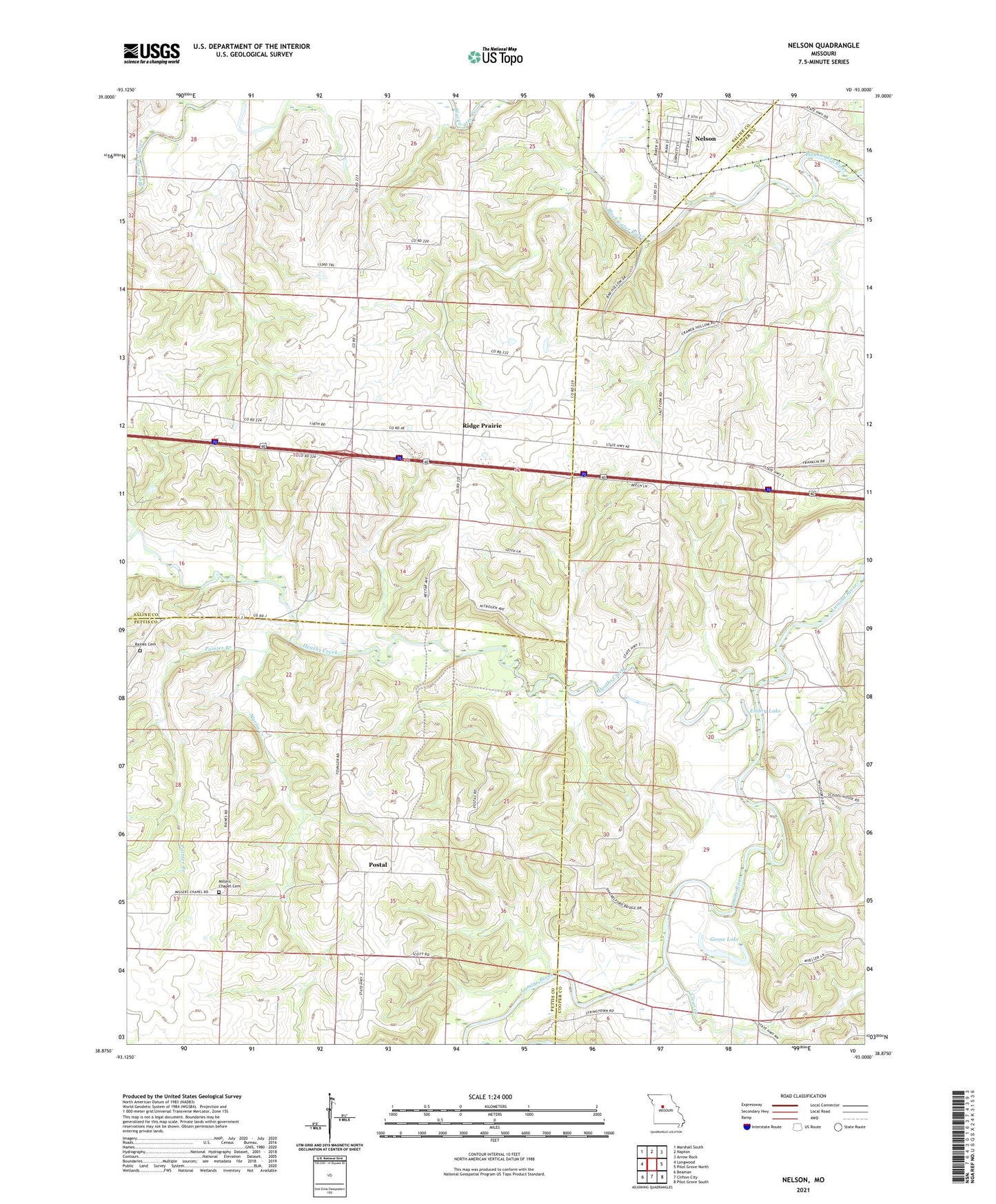
2021 topographic map quadrangle Nelson in the state of Missouri. Scale: 1:24000. Based on the newly updated USGS 7.5' US Topo map series, this map is in the following counties: Cooper, Saline, Pettis. The map contains contour data, water features, and other items you are used to seeing on USGS maps, but also has updated roads and other features. This is the next generation of topographic maps. Printed on high-quality waterproof paper with UV fade-resistant inks.
Quads adjacent to this one:
West: Longwood
Northwest: Marshall South
North: Napton
Northeast: Arrow Rock
East: Pilot Grove North
Southeast: Pilot Grove South
South: Clifton City
Southwest: Beaman
This map covers the same area as the classic USGS quad with code o38093h1.
Contains the following named places: Berea Church, City of Nelson, Clear Creek, Cotton Patch School, Embry Lake, Franklin School, Goose Lake, Heaths Creek, Heaths Creek Church, Horseshoe Lake, Marlin Creek, Milers Chapel, Nelson, Oak Hill School, Painter Branch, Postal, Postal School, Raines Cemetery, Ridge Prairie, Ridge Prairie School, Shackleford Crossing, Shackleford School, Township of Blackwater, ZIP Code: 65347