MyTopo
Salisbury Missouri US Topo Map
Couldn't load pickup availability
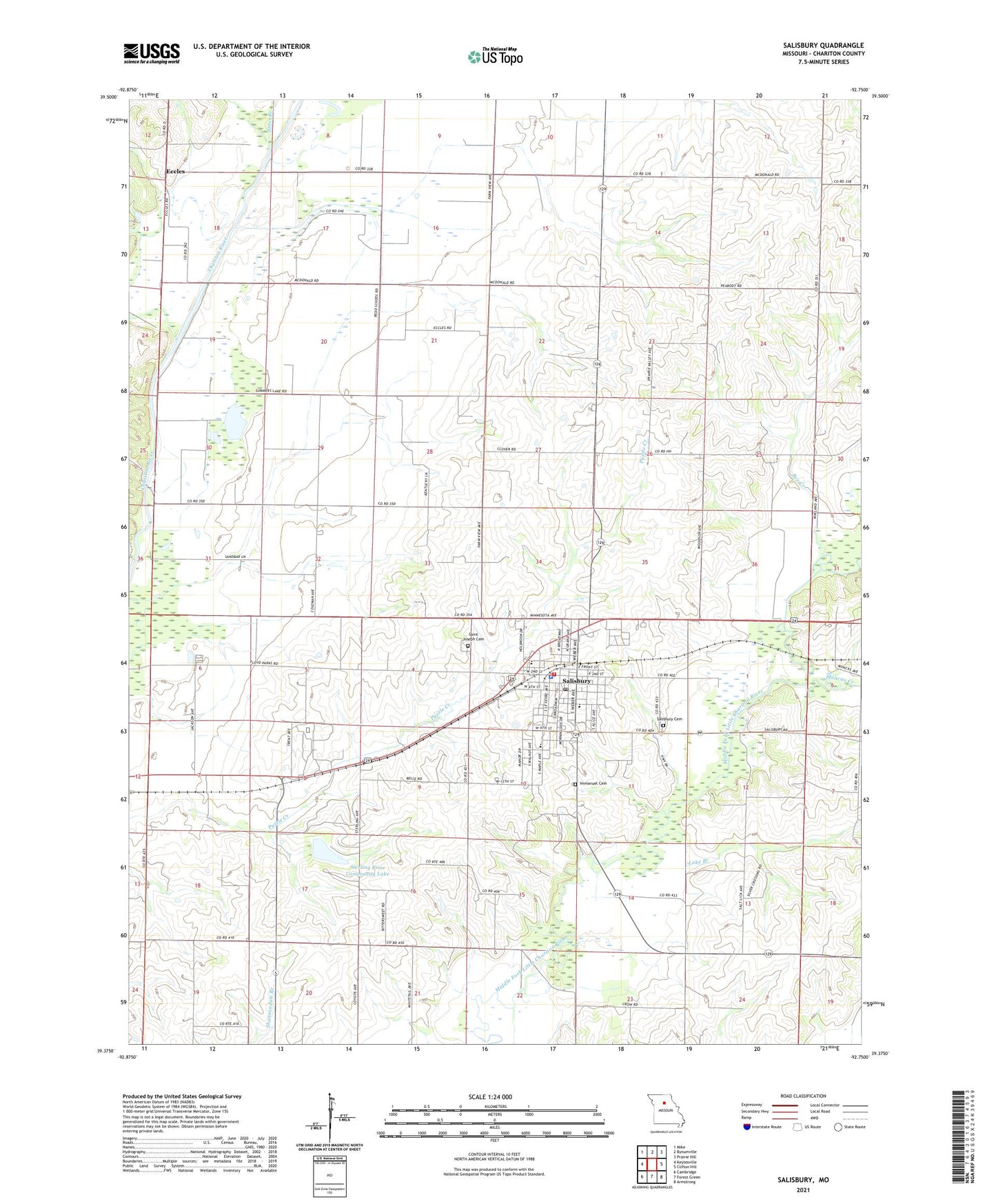
2021 topographic map quadrangle Salisbury in the state of Missouri. Scale: 1:24000. Based on the newly updated USGS 7.5' US Topo map series, this map is in the following counties: Chariton. The map contains contour data, water features, and other items you are used to seeing on USGS maps, but also has updated roads and other features. This is the next generation of topographic maps. Printed on high-quality waterproof paper with UV fade-resistant inks.
Quads adjacent to this one:
West: Keytesville
Northwest: Mike
North: Bynumville
Northeast: Prairie Hill
East: Clifton Hill
Southeast: Armstrong
South: Forest Green
Southwest: Cambridge
Contains the following named places: Bee Creek, Bentley School, Brumall School, City of Salisbury, Coliman School, Eccles, Hopewell School, Immanuel Cemetery, Jones Branch, Lake Branch, McDonald School, Muncas Creek, Prairie Valley Church, Prairie Valley School, Redd School, Saint Joseph Cemetery, Salisbury, Salisbury Cemetery, Salisbury Fire Department, Salisbury Municipal Airport, Salisbury Police Department, Salisbury Post Office, Sterling Price Community Lake, Sterling Price Lake Dam, Township of Salisbury, Trent School, ZIP Code: 65281