MyTopo
Cambridge Missouri US Topo Map
Couldn't load pickup availability
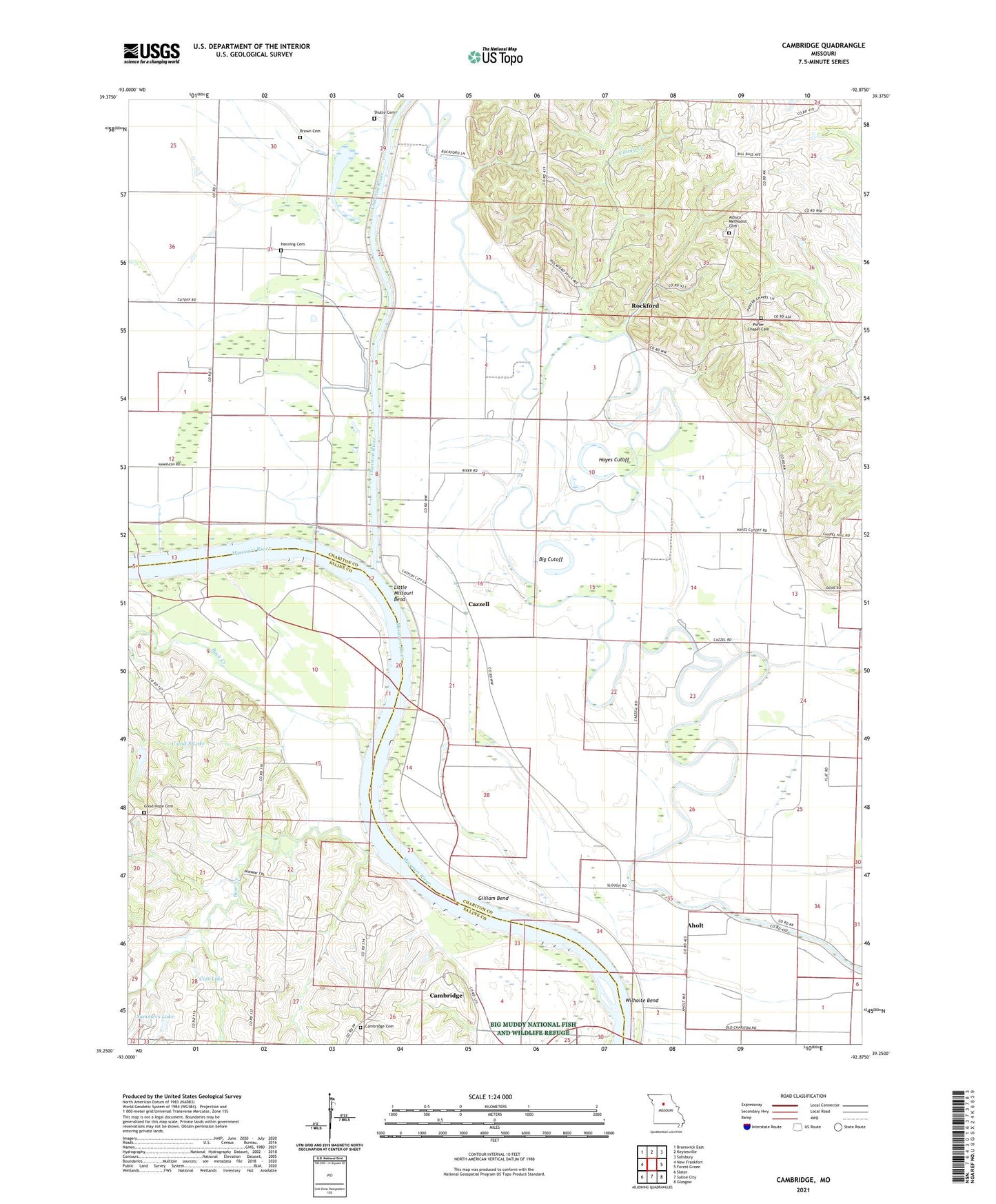
2021 topographic map quadrangle Cambridge in the state of Missouri. Scale: 1:24000. Based on the newly updated USGS 7.5' US Topo map series, this map is in the following counties: Chariton, Saline. The map contains contour data, water features, and other items you are used to seeing on USGS maps, but also has updated roads and other features. This is the next generation of topographic maps. Printed on high-quality waterproof paper with UV fade-resistant inks.
Quads adjacent to this one:
West: New Frankfort
Northwest: Brunswick East
North: Keytesville
Northeast: Salisbury
East: Forest Green
Southeast: Glasgow
South: Saline City
Southwest: Slater
This map covers the same area as the classic USGS quad with code o39092c8.
Contains the following named places: Aholt, Asbury Church, Asbury Methodist Cemetery, Bear Creek, Big Cutoff, Brown Cemetery, Buck Creek, C and S Lake, C and S Lake Dam, Cambridge, Cambridge Cemetery, Cazzell, Chariton River, Chariton River Main Stem Levee, Cott Lake, Cott Lake Dam, Elm Ridge Church, Gilliam Bend, Gillis Chapel School, Good Hope Cemetery, Hayes Cutoff, Henning Cemetery, Hill School, Hurt School, Immanuel Church, Kottman Lake, Kottman Lake Dam, Little Missouri Bend, Namrash, Palmer Creek, Porter Chapel Cemetery, Richardson School, Riverside School, Rockford, Salem School, Shulte Cemetery, Smith Lake, Summers Lake, Summers Lake Dam, Township of Chariton, Township of Missouri, Vance School, Whiteside Lake, Wilhoite Bend, Young Creek