MyTopo
Smallett Missouri US Topo Map
Couldn't load pickup availability
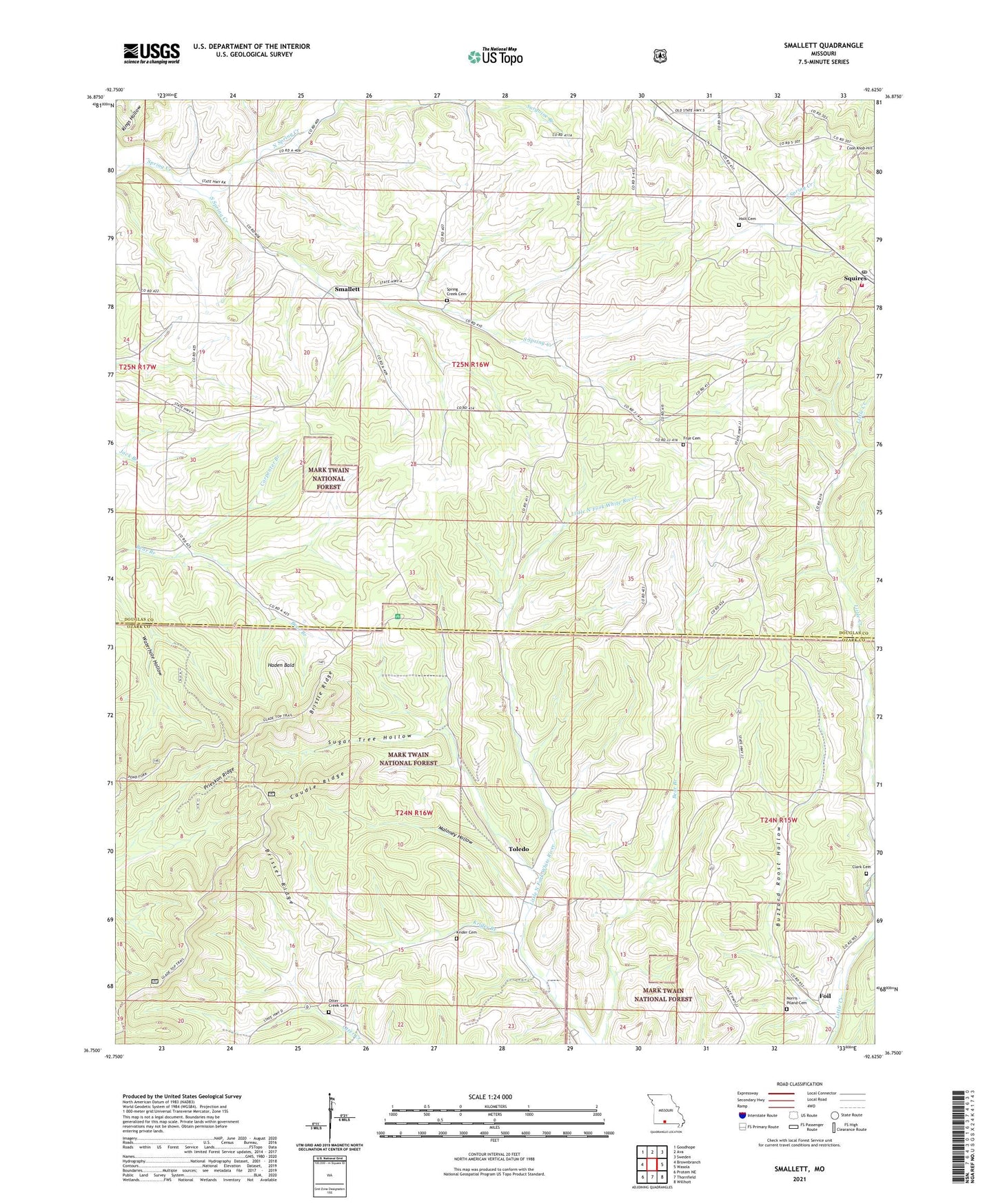
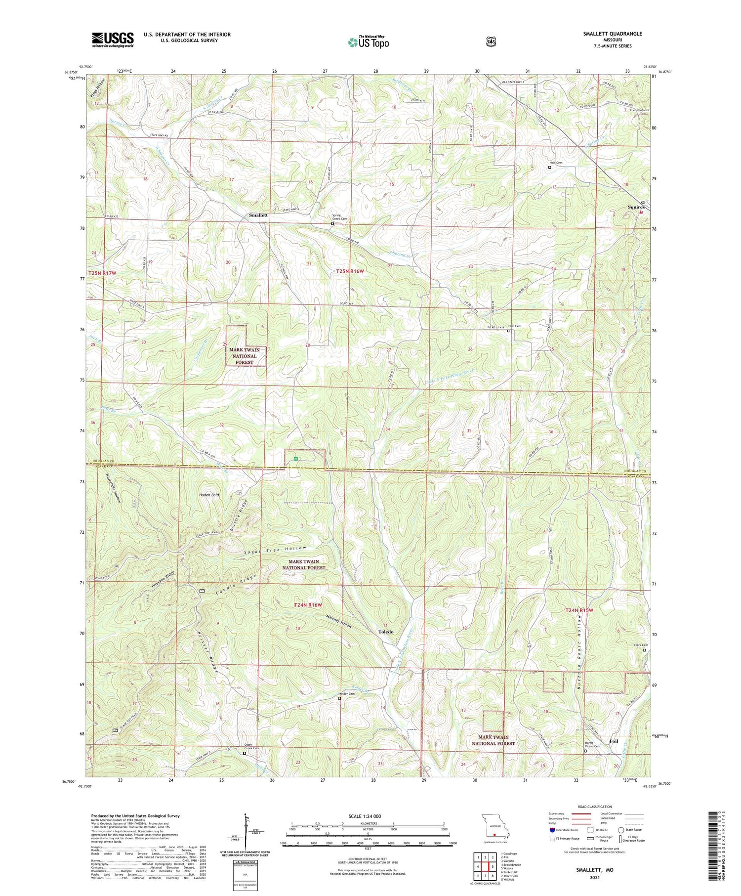
2021 topographic map quadrangle Smallett in the state of Missouri. Scale: 1:24000. Based on the newly updated USGS 7.5' US Topo map series, this map is in the following counties: Douglas, Ozark. The map contains contour data, water features, and other items you are used to seeing on USGS maps, but also has updated roads and other features. This is the next generation of topographic maps. Printed on high-quality waterproof paper with UV fade-resistant inks.
Quads adjacent to this one:
West: Brownbranch
Northwest: Goodhope
North: Ava
Northeast: Sweden
East: Wasola
Southeast: Willhoit
South: Thornfield
Southwest: Protem NE
Contains the following named places: Bethlehem Church, Brissel Ridge, Bristle Ridge, Buzzard Roost Hollow, Carpenter Branch, Caudle Ridge, Clark Cemetery, Clark School, Coon Knob Hill, East Prong Little Creek, Foil, Frye Cemetery, Frye Church, Haden Bald, Holt Cemetery, Krider Branch, Krider Cemetery, Little Creek School, Maloney Hollow, Middle Prong Little Creek, New Harmony Church, Norris - Piland Cemetery, North Spring Creek, Otter Creek Cemetery, Otter Creek School, Prieskon Ridge, Robinson School, Salt Road Post Office, Silver Shade Church, Silver Shade School, Smallett, South Spring Creek, Spring Creek, Spring Creek Cemetery, Spring Creek Church, Squires Post Office, Squires Volunteer Fire Department, Sugar Tree Hollow, Surgoine Branch, Toledo, Township of Spring Creek, Tranquility School, Walnut Grove Church, Walnut Grove School