MyTopo
Ava Missouri US Topo Map
Couldn't load pickup availability
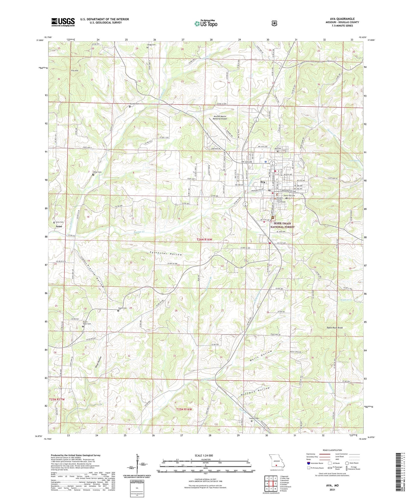
2021 topographic map quadrangle Ava in the state of Missouri. Scale: 1:24000. Based on the newly updated USGS 7.5' US Topo map series, this map is in the following counties: Douglas. The map contains contour data, water features, and other items you are used to seeing on USGS maps, but also has updated roads and other features. This is the next generation of topographic maps. Printed on high-quality waterproof paper with UV fade-resistant inks.
Quads adjacent to this one:
West: Goodhope
Northwest: Dogwood
North: Cedar Gap
Northeast: Mansfield
East: Sweden
Southeast: Wasola
South: Smallett
Southwest: Brownbranch
This map covers the same area as the classic USGS quad with code o36092h6.
Contains the following named places: Arno, Arno Cemetery, Arno School, Ava, Ava Bill Martin Memorial Airport, Ava Cemetery, Ava Fire Department, Ava Police Department, Ava Post Office, Ava Rural Fire Department Station 1, Blackoak School, Bragg Cemetery, Burdett Cemetery, Casto Creek, City of Ava, Coon Spring, Cowskin Creek, Crossroads School, Douglas County Sheriff's Office, Fannon Cemetery, Fox Meadow Lake, Hailey Dam, Happy Home Church, Harris Cemetery, Hart Branch, Hest, Huffmon Hollow, KKOZ-AM (Ava), KSOA-AM (Ava), Lakley School, Mark Twain National Forest Ava - Cassville - Willow Springs Ranger District Ava Office, Missouri Department of Conservation Forestry Ozark Regional Field Fire Facility Office Ava, Mount Calvary Church, Mount Tabor Church, Mount Tabor School, Nubbin Ridge School, Pilot Knob, Prairie Creek, Prairie Hollow, Ritter Cemetery, Robertson Branch, Saint Leo Church, Sylvester Hollow, Table Rock Knob, Tower Hill Cemetery, Township of Benton, Trinity Church, Wells Hollow, ZIP Code: 65608