MyTopo
Stanton Missouri US Topo Map
Couldn't load pickup availability
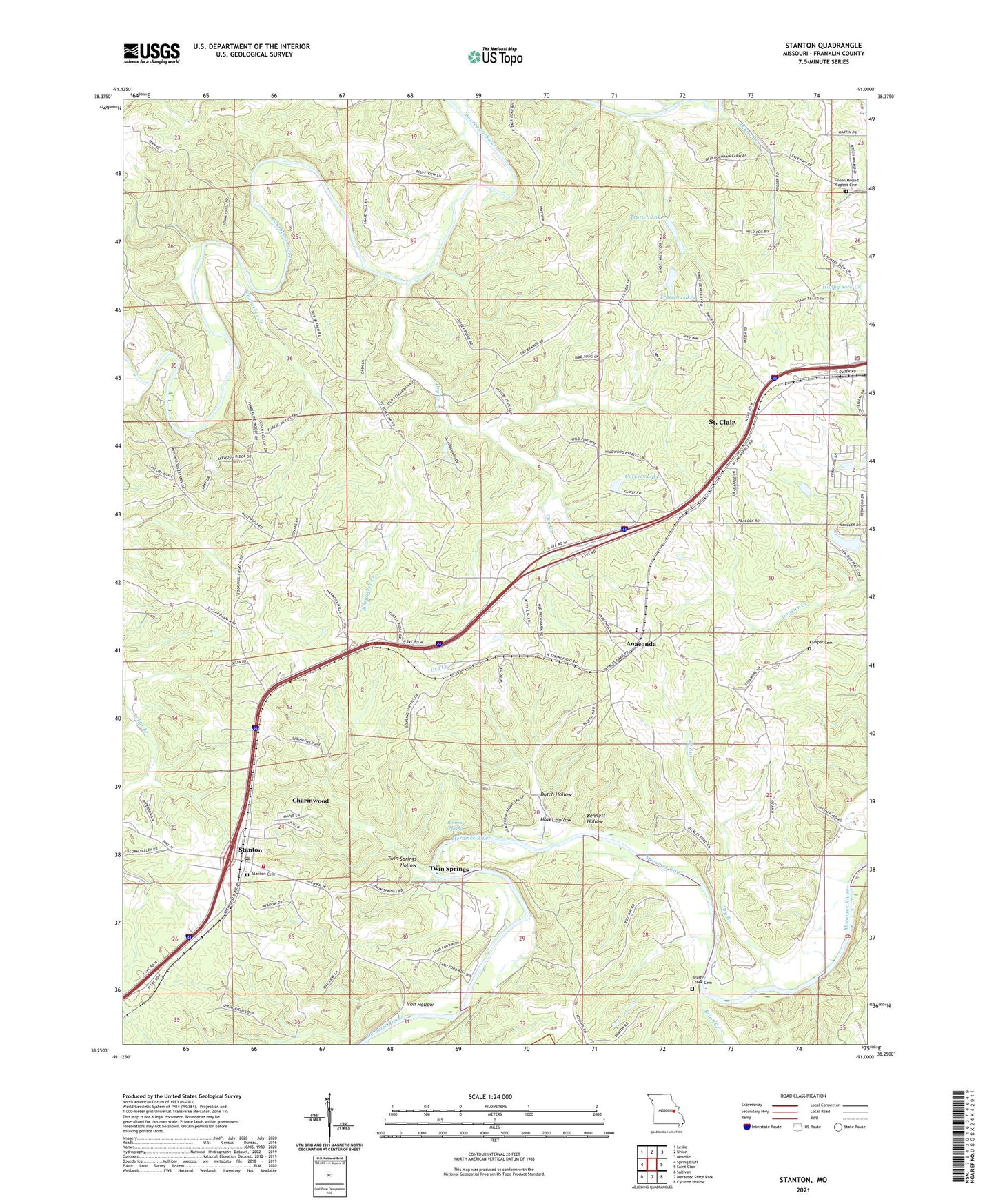
2021 topographic map quadrangle Stanton in the state of Missouri. Scale: 1:24000. Based on the newly updated USGS 7.5' US Topo map series, this map is in the following counties: Franklin. The map contains contour data, water features, and other items you are used to seeing on USGS maps, but also has updated roads and other features. This is the next generation of topographic maps. Printed on high-quality waterproof paper with UV fade-resistant inks.
Quads adjacent to this one:
West: Spring Bluff
Northwest: Leslie
North: Union
Northeast: Moselle
East: Saint Clair
Southeast: Cyclone Hollow
South: Meramec State Park
Southwest: Sullivan
Contains the following named places: Anaconda, Anaconda Church, Ankar Lake Dam, Bennett Hollow, Benson Tourist City, Binsbacker Creek, Brush Creek, Brush Creek Cemetery, Carvers Lake, Carvers Lake Dam, Charmwood, Doer School, Dry Branch, Dry Creek, Duly School, Dutch Hollow, Green Mound Baptist Cemetery, Green Mound Church, Hazel Hollow, Huff Ford, International Friendship Park, Iron Hollow, Kamper Cemetery, Lake Saint Clair Number Three Dam, Massey Ford, Morrelton School, Oak Grove School, O'Donnell Ford, Payne Branch, Roaring Spring, Roaring Springs Dam, Rock Hill Church, Salem School, Sand Ford, Stanton, Stanton Cemetery, Stanton Census Designated Place, Stanton Post Office, Stanton School, Sullivan Fire Protection District Station 2, Town of Charmwood, Township of Meramec, Trutsch Lake, Trutsch Lakes, Trutsch Lakes Lower Dam, Trutsch Lakes Upper Dam, Twin Springs, Twin Springs Hollow, ZIP Code: 63079