MyTopo
Sullivan Missouri US Topo Map
Couldn't load pickup availability
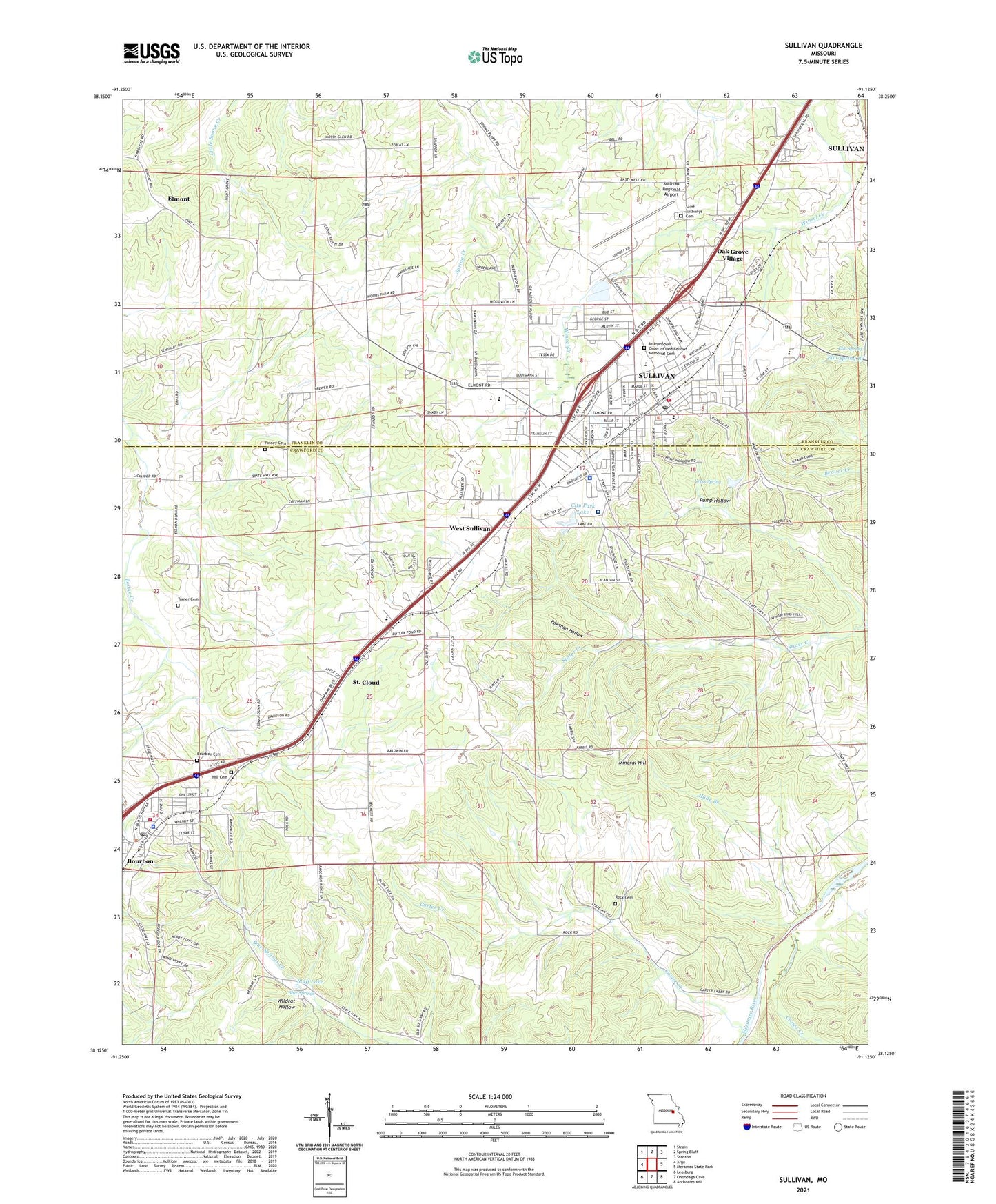
2021 topographic map quadrangle Sullivan in the state of Missouri. Scale: 1:24000. Based on the newly updated USGS 7.5' US Topo map series, this map is in the following counties: Crawford, Franklin. The map contains contour data, water features, and other items you are used to seeing on USGS maps, but also has updated roads and other features. This is the next generation of topographic maps. Printed on high-quality waterproof paper with UV fade-resistant inks.
Quads adjacent to this one:
West: Argo
Northwest: Strain
North: Spring Bluff
Northeast: Stanton
East: Meramec State Park
Southeast: Anthonies Mill
South: Onondaga Cave
Southwest: Leasburg
This map covers the same area as the classic USGS quad with code o38091b2.
Contains the following named places: Blue Springs, Bluff Lake, Bourbon, Bourbon Cemetery, Bourbon Fire Protection District, Bourbon Police Department, Bourbon Post Office, Bowman Hollow, Camp Mihaska, Carter Creek, Carter Lead Mine, City of Bourbon, City of Sullivan, City Park Lake, City Park Lake Dam, Cress Spring, Crows Creek, Dowler Gristmill, Dowler Mill School, Elm Spring, Elmont, Finney Cemetery, Hibler Lead Diggings, Hill Cemetery, Hyde Branch, Independent Order of Odd Fellows Memorial Cemetery, Isgrigs Lead Diggings, KTUI-AM (Sullivan), KTUI-FM (Sullivan), Luke Bluff Lead Mine, Mineral Hill, Mineral Hill Lead Mines, Missouri Baptist Sullivan Hospital, Missouri Department of Conservation Forestry Saint Louis Regional Field Fire Office Sullivan, Negro Wool Hollow, New Rock School, Oak Grove School, Oak Grove Village, Pilot Grove Church, Pump Hollow, Ramstein Lake, Ramstein Lake Dam, Reeds Defeat School, Rock Cemetery, Romine Lead Mine, Saint Anthonys Cemetery, Saint Cloud, Smith School, Soulard Lead Mine, Sullivan, Sullivan Country Club, Sullivan Elementary School, Sullivan Fire Protection District Station 1, Sullivan Police Department, Sullivan Post Office, Sullivan Regional Airport, Town of West Sullivan, Township of Boone, Turner Cemetery, Village of Oak Grove Village, Village of Saint Cloud, Von Hoffman Lake, Wesleyan Church, West Sullivan, Wildcat Hollow, Williams Lead Mine