MyTopo
Thornfield Missouri US Topo Map
Couldn't load pickup availability
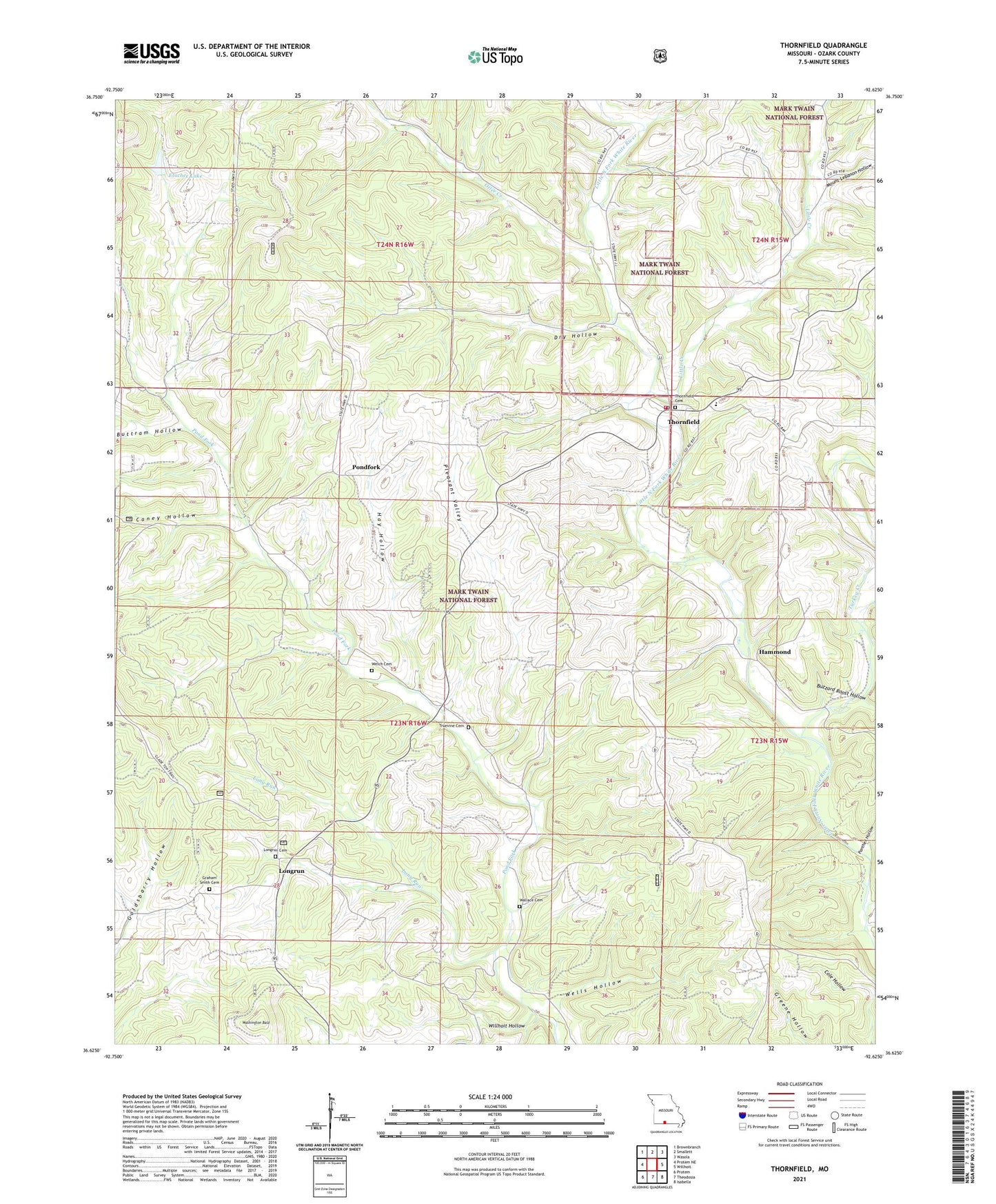
2021 topographic map quadrangle Thornfield in the state of Missouri. Scale: 1:24000. Based on the newly updated USGS 7.5' US Topo map series, this map is in the following counties: Ozark. The map contains contour data, water features, and other items you are used to seeing on USGS maps, but also has updated roads and other features. This is the next generation of topographic maps. Printed on high-quality waterproof paper with UV fade-resistant inks.
Quads adjacent to this one:
West: Protem NE
Northwest: Brownbranch
North: Smallett
Northeast: Wasola
East: Willhoit
Southeast: Isabella
South: Theodosia
Southwest: Protem
Contains the following named places: Bear Branch, Buttram Hollow, Buzzard Roost Hollow, Caney Hollow, Dry Hollow, Etuchee Dam, Etuchee Lake, Graham Smith Cemetery, Hammond, Hammond School, Hay Hollow, Igo School, Little Creek, Long Run, Longrun, Mount Lebanon Church, Mount Lebanon Hollow, Mount Lebanon School, Mount Pleasant School, Northview School, Otter Creek, Panther Hollow, Pleasant Valley, Pondfork, Thornfield, Thornfield Post Office, Thornfield Volunteer Fire Department, Township of Longrun, Township of Thornfield, True Vine School, Truevine Cemetery, Turkey Creek, Turkey Creek School, United States Forest Service Fire Tower, Wallace Cemetery, Washington Bald, Welch Cemetery, Wells Hollow, White Star School, Willhoit Hollow, ZIP Code: 65762