MyTopo
Westphalia West Missouri US Topo Map
Couldn't load pickup availability
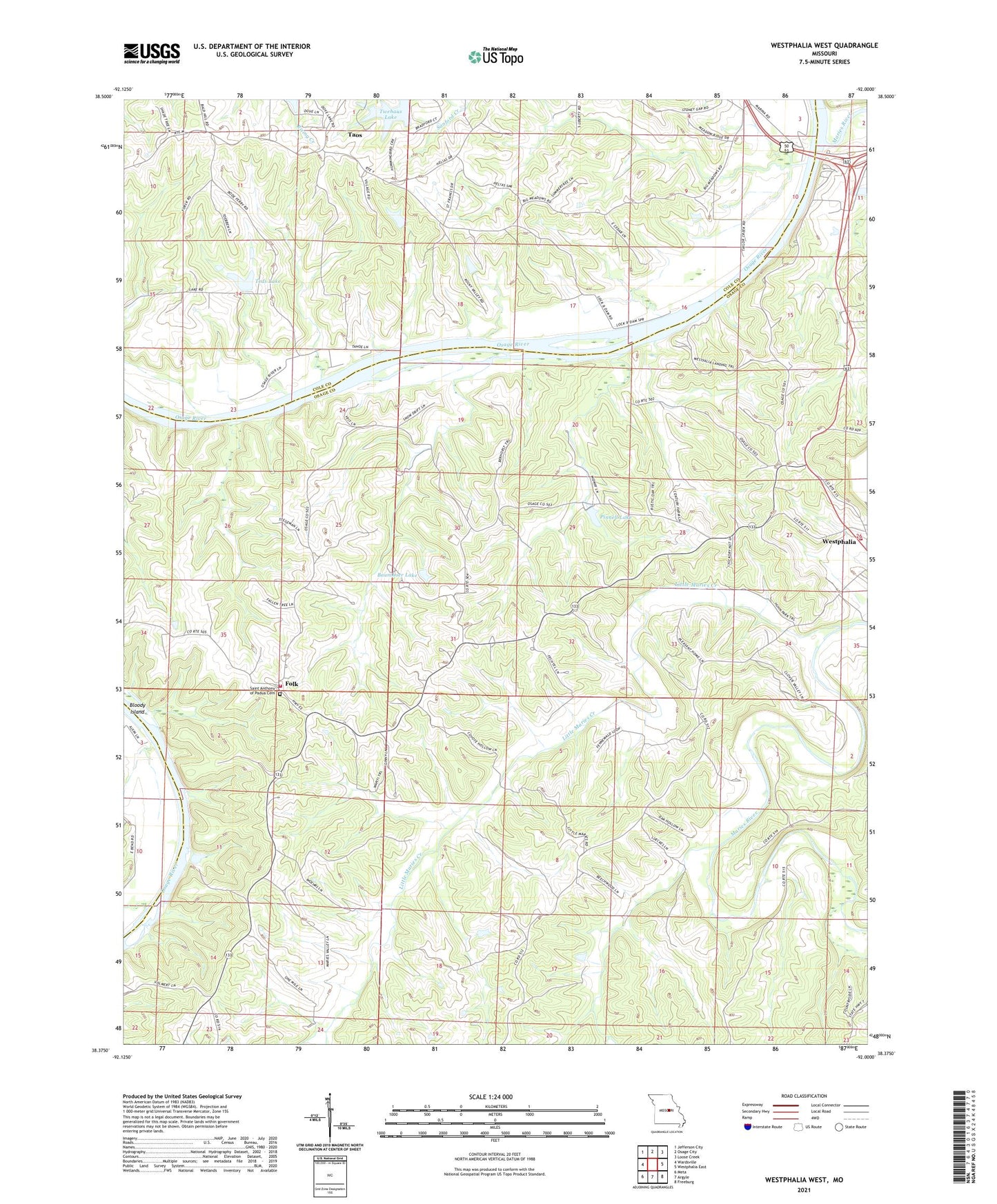
2021 topographic map quadrangle Westphalia West in the state of Missouri. Scale: 1:24000. Based on the newly updated USGS 7.5' US Topo map series, this map is in the following counties: Osage, Cole. The map contains contour data, water features, and other items you are used to seeing on USGS maps, but also has updated roads and other features. This is the next generation of topographic maps. Printed on high-quality waterproof paper with UV fade-resistant inks.
Quads adjacent to this one:
West: Wardsville
Northwest: Jefferson City
North: Osage City
Northeast: Loose Creek
East: Westphalia East
Southeast: Freeburg
South: Argyle
Southwest: Meta
Contains the following named places: Baumhoer Lake, Baumhoer Lake Dam, Bloody Island, City of Taos, City of Westphalia, Deer Valley Lake Dam, Folk, Folk Fire Department, Liberty School, Lisletown, Little Maries Creek, Maries River, Mari-Osa State Wildlife Area, Old Lock and Dam, Painted Rock Lodge, Painted Rock State Forest, Pinnell Lake, Pinnell Lake Dam, Saint Josephs Catholic Church, Teds Lake, Teds Lake Dam, Twehaus Lake, Twehaus Lake Dam, Verhoff School, Westphalia Fire Protection District House 1, ZIP Code: 65085