MyTopo
Freeburg Missouri US Topo Map
Couldn't load pickup availability
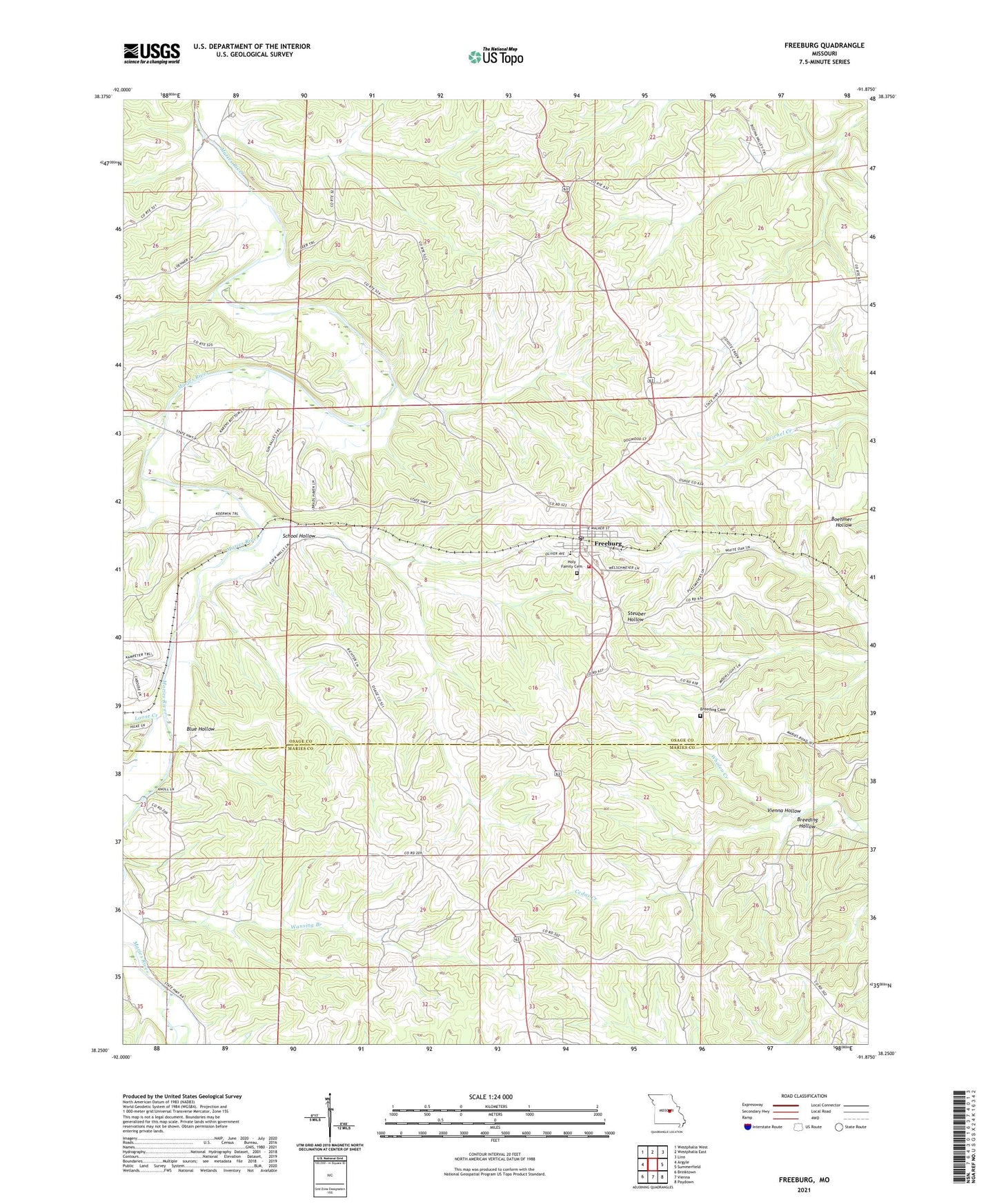
2021 topographic map quadrangle Freeburg in the state of Missouri. Scale: 1:24000. Based on the newly updated USGS 7.5' US Topo map series, this map is in the following counties: Osage, Maries. The map contains contour data, water features, and other items you are used to seeing on USGS maps, but also has updated roads and other features. This is the next generation of topographic maps. Printed on high-quality waterproof paper with UV fade-resistant inks.
Quads adjacent to this one:
West: Argyle
Northwest: Westphalia West
North: Westphalia East
Northeast: Linn
East: Summerfield
Southeast: Paydown
South: Vienna
Southwest: Brinktown
This map covers the same area as the classic USGS quad with code o38091c8.
Contains the following named places: Blue Hollow, Breeding Cemetery, Breeding Hollow, Cedar Creek, Church of the Holy Family, Excelsior School, Freeburg, Freeburg Lookout Tower, Freeburg Post Office, Freeburg Volunteer Fire Department Station 1, Holy Family Cemetery, Loehner School, Loose Creek, Renneke School, School Hollow, Vienna Hollow, Village of Freeburg, Wansing Branch, Welschmeyers Dam, Welschmeyers Lake, ZIP Code: 65035