MyTopo
Amphitheatre Mountain Montana US Topo Map
Couldn't load pickup availability
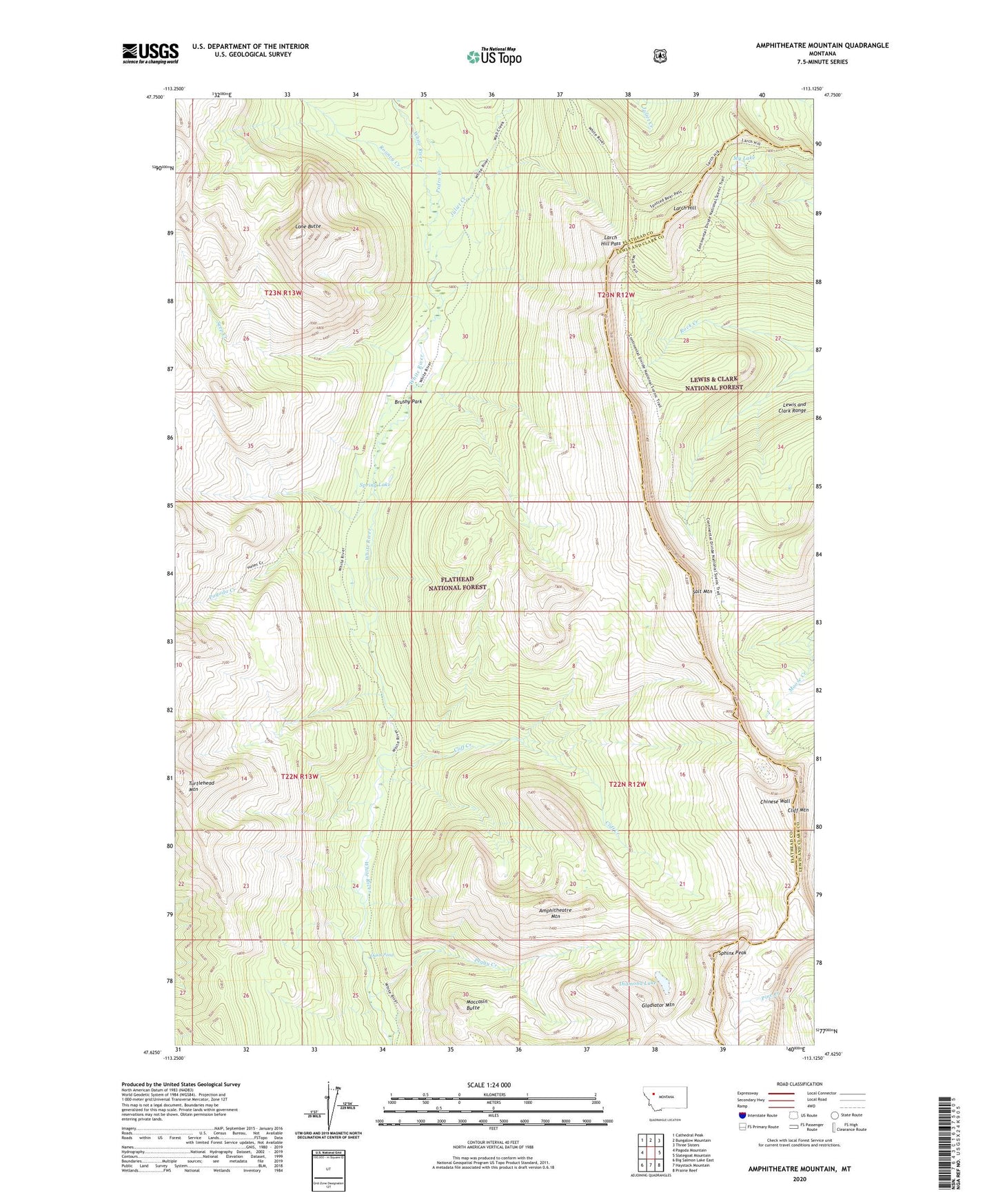
2020 topographic map quadrangle Amphitheatre Mountain in the state of Montana. Scale: 1:24000. Based on the newly updated USGS 7.5' US Topo map series, this map is in the following counties: Flathead, Lewis and Clark. The map contains contour data, water features, and other items you are used to seeing on USGS maps, but also has updated roads and other features. This is the next generation of topographic maps. Printed on high-quality waterproof paper with UV fade-resistant inks.
Quads adjacent to this one:
West: Pagoda Mountain
Northwest: Cathedral Peak
North: Bungalow Mountain
Northeast: Three Sisters
East: Slategoat Mountain
Southeast: Prairie Reef
South: Haystack Mountain
Southwest: Big Salmon Lake East
Contains the following named places: Amphitheatre Mountain, Bob Marshall Wilderness, Brushy Park, Chinese Wall, Cliff Creek, Cliff Mountain, Diamond Lake, Gladiator Mountain, Helen Creek Trail, Juliet Creek, Larch Hill, Larch Hill Pass, Larch Hill Trail, Lone Butte, Moccasin Butte, My Lake, Oasis Pond, Pagoda Creek, Pedro Creek, Peggy Creek, Rooney Creek, Salt Mountain, Seep Creek, Sphinx Peak, Spring Lake, White River Trail