MyTopo
Three Sisters Montana US Topo Map
Couldn't load pickup availability
Also explore the Three Sisters Forest Service Topo of this same quad for updated USFS data
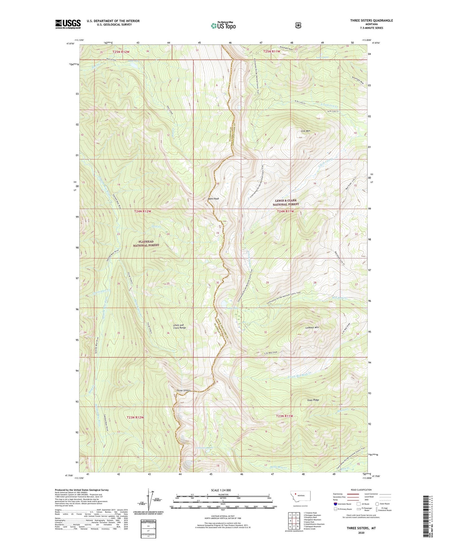
2024 topographic map quadrangle Three Sisters in the state of Montana. Scale: 1:24000. Based on the newly updated USGS 7.5' US Topo map series, this map is in the following counties: Lewis and Clark, Flathead. The map contains contour data, water features, and other items you are used to seeing on USGS maps, but also has updated roads and other features. This is the next generation of topographic maps. Printed on high-quality waterproof paper with UV fade-resistant inks.
Quads adjacent to this one:
West: Bungalow Mountain
Northwest: Trilobite Peak
North: Pentagon Mountain
Northeast: Porphyry Reef
East: Gates Park
Southeast: Glenn Creek
South: Slategoat Mountain
Southwest: Amphitheatre Mountain
This map covers the same area as the classic USGS quad with code o47113g1.
Contains the following named places: Christopher Creek, Goat Creek, Goat Ridge, Hahn Peak, Hart Lake, Hoop Creek, Lake Quiet, Lick Mountain, Lookout Mountain, North Fork Lick Creek, Sock Lake, South Fork Lick Creek, Three Sisters, Three Sisters Creek, Unnamed Lake