MyTopo
Ashley Mountain Montana US Topo Map
Couldn't load pickup availability
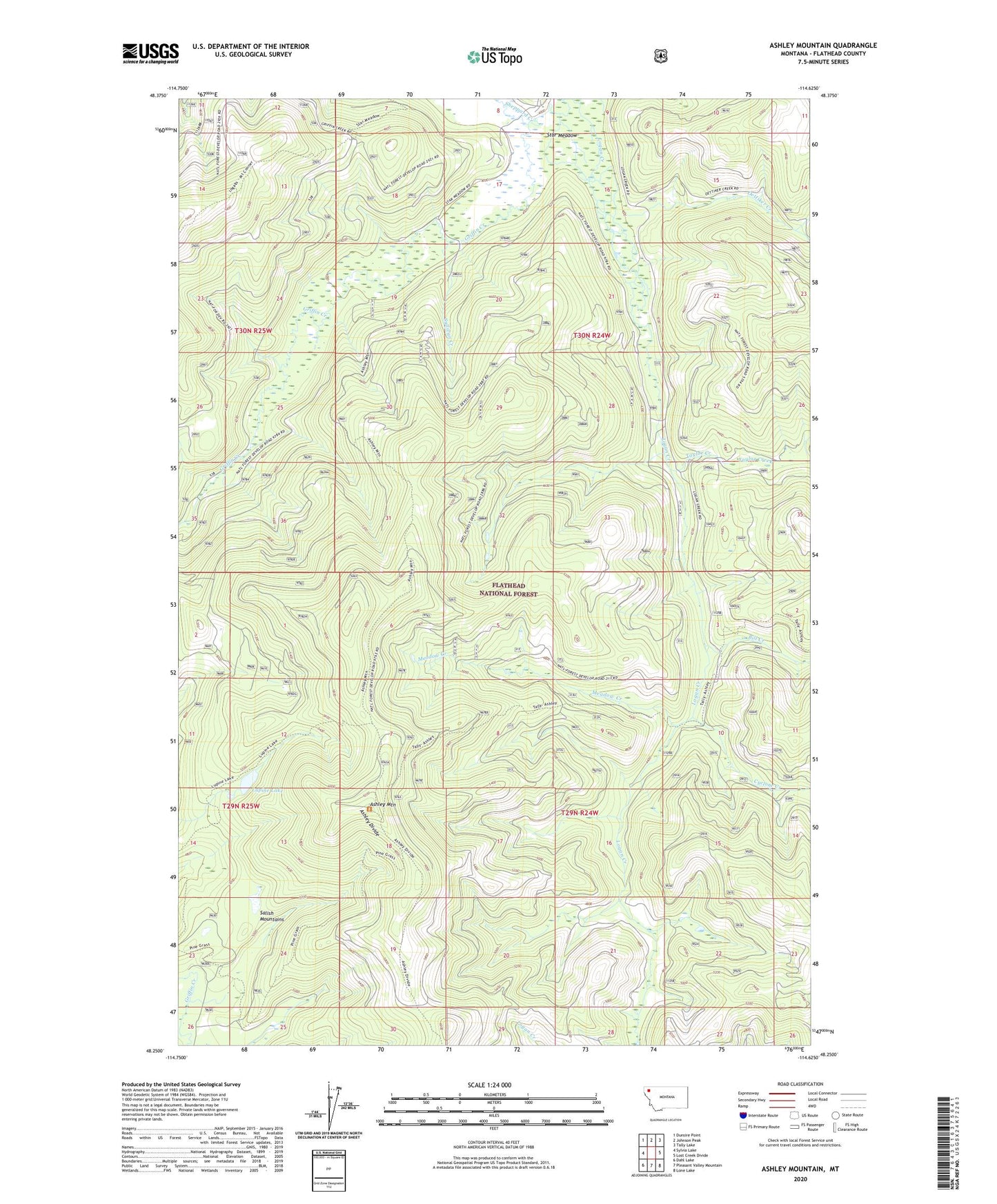
2020 topographic map quadrangle Ashley Mountain in the state of Montana. Scale: 1:24000. Based on the newly updated USGS 7.5' US Topo map series, this map is in the following counties: Flathead. The map contains contour data, water features, and other items you are used to seeing on USGS maps, but also has updated roads and other features. This is the next generation of topographic maps. Printed on high-quality waterproof paper with UV fade-resistant inks.
Quads adjacent to this one:
West: Sylvia Lake
Northwest: Dunsire Point
North: Johnson Peak
Northeast: Tally Lake
East: Lost Creek Divide
Southeast: Lone Lake
South: Pleasant Valley Mountain
Southwest: Dahl Lake
Contains the following named places: Ashley Divide, Ashley Divide Trail, Ashley Mountain, Ashley Mountain Lookout Tower, Bill Creek, Copper King Mine, Cyclone Creek, Griffin Creek, Griffin Creek Trail, Kalispell Northwest Division, Logan Creek Trail, Lupine Lake, Lupine Lake Trail, Meadow Creek, Meadow Creek Trail, Oettiker Creek, Salish Mountains, Sheppard Creek, Star Meadow, Star Meadow Ranch, Sullivan Creek, Taylor Creek