MyTopo
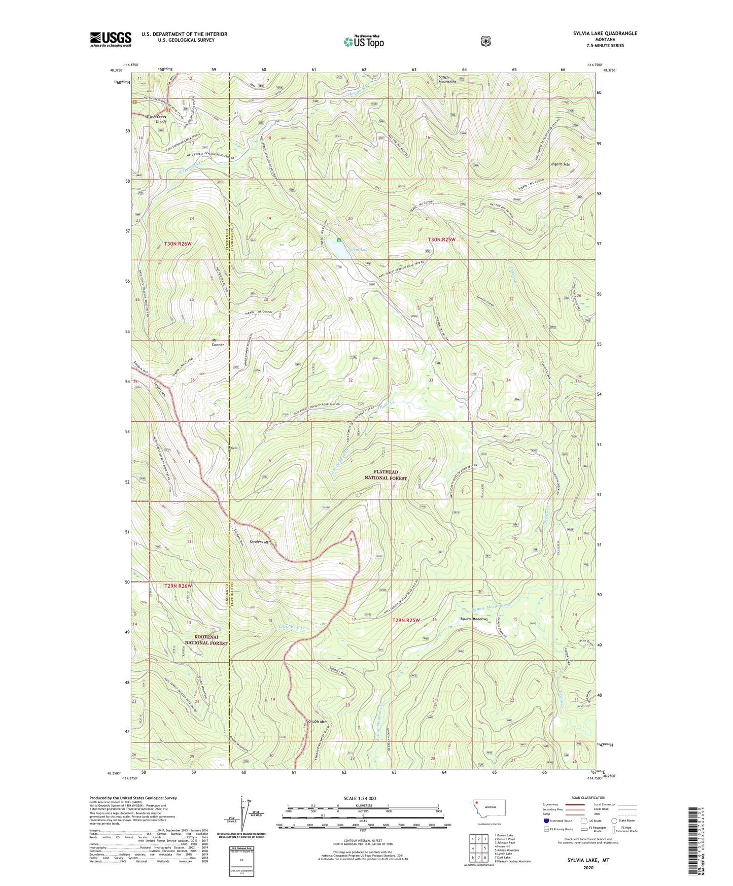
Sylvia Lake Montana US Topo Map
Couldn't load pickup availability
Also explore the Sylvia Lake Forest Service Topo of this same quad for updated USFS data
2024 topographic map quadrangle Sylvia Lake in the state of Montana. Scale: 1:24000. Based on the newly updated USGS 7.5' US Topo map series, this map is in the following counties: Flathead, Lincoln. The map contains contour data, water features, and other items you are used to seeing on USGS maps, but also has updated roads and other features. This is the next generation of topographic maps. Printed on high-quality waterproof paper with UV fade-resistant inks.
Quads adjacent to this one:
West: Horse Hill
Northwest: Bowen Lake
North: Dunsire Point
Northeast: Johnson Peak
East: Ashley Mountain
Southeast: Pleasant Valley Mountain
South: Dahl Lake
Southwest: Lynch Lake
This map covers the same area as the classic USGS quad with code o48114c7.
Contains the following named places: Dunsire Creek, Griffin Creek Trail, Grubb Mountain, Hand Creek, Ingalls Creek, Ingalls Mountain, Mount Conner, Sanders Mountain, South Fork Hand Creek, Squaw Meadows, Squaw Meadows Creek, Sylvia Lake