
MyTopo
Benton Lake East Montana US Topo Map
Couldn't load pickup availability
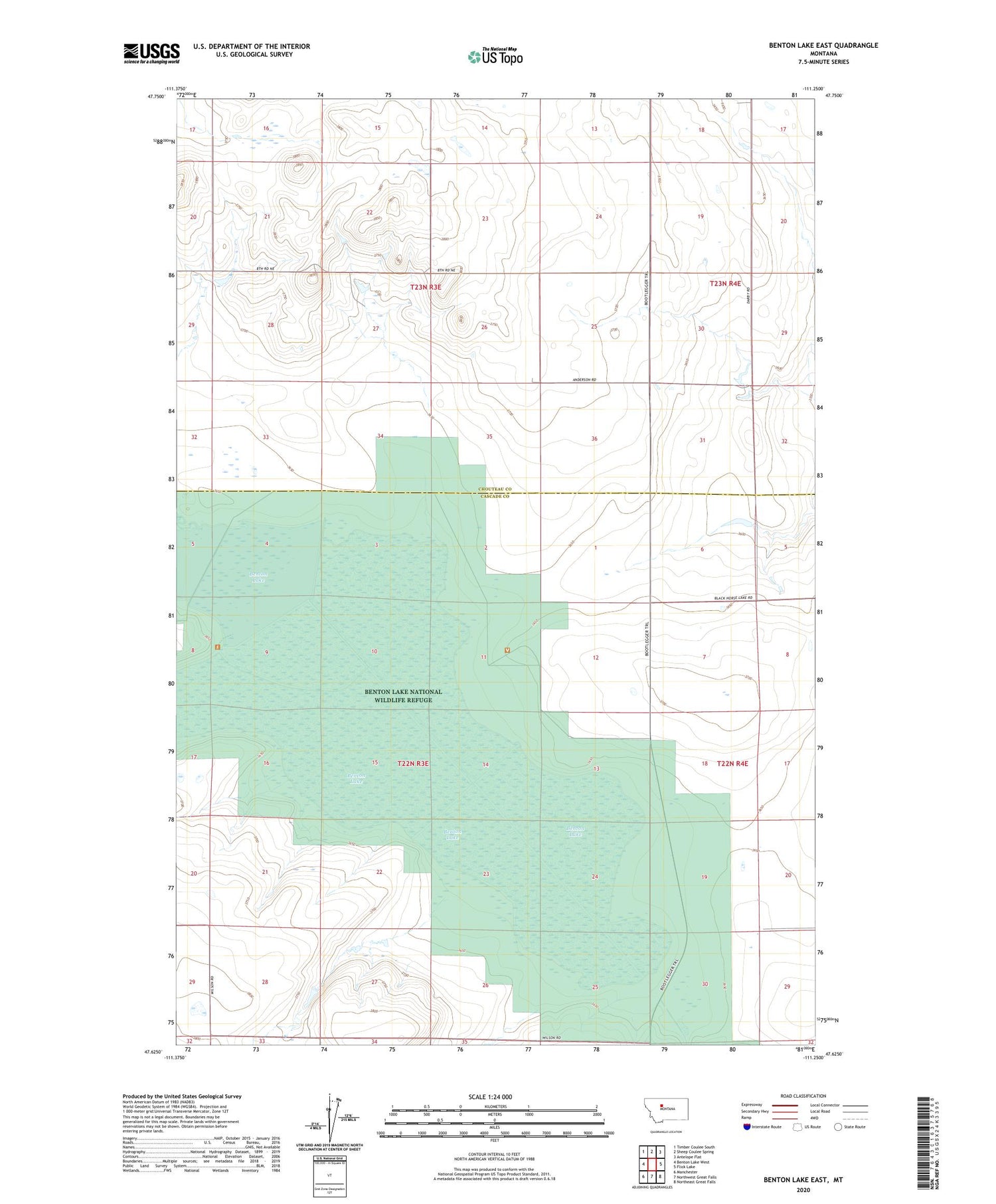
2020 topographic map quadrangle Benton Lake East in the state of Montana. Scale: 1:24000. Based on the newly updated USGS 7.5' US Topo map series, this map is in the following counties: Cascade, Chouteau. The map contains contour data, water features, and other items you are used to seeing on USGS maps, but also has updated roads and other features. This is the next generation of topographic maps. Printed on high-quality waterproof paper with UV fade-resistant inks.
Quads adjacent to this one:
West: Benton Lake West
Northwest: Timber Coulee South
North: Sheep Coulee Spring
Northeast: Antelope Flat
East: Flick Lake
Southeast: Northeast Great Falls
South: Northwest Great Falls
Southwest: Manchester
Contains the following named places: 22N03E22AACB02 Well, 22N03E22AACC07 Well, 22N03E22ABCC12 Well, 22N03E22ABDB08 Well, 22N03E22ACAC13 Well, 22N03E22ACCD14 Well, 22N03E22ADAB03 Well, 22N03E22ADBB11 Well, 22N03E22ADCB04 Well, 22N03E22CAAA15 Well, 22N03E22CAAB18 Well, 22N03E22CACD17 Well, 22N03E22CDAA16 Well, 22N03E22DBAA09 Well, 22N03E22DBCA19 Well, 22N03E26CDCB01 Well, 59404, Benton Lake, Benton Lake National Wildlife Refuge, Kodak Dam, Lake Creek, Swall School, Toy Box Dam


