MyTopo
Manchester Montana US Topo Map
Couldn't load pickup availability
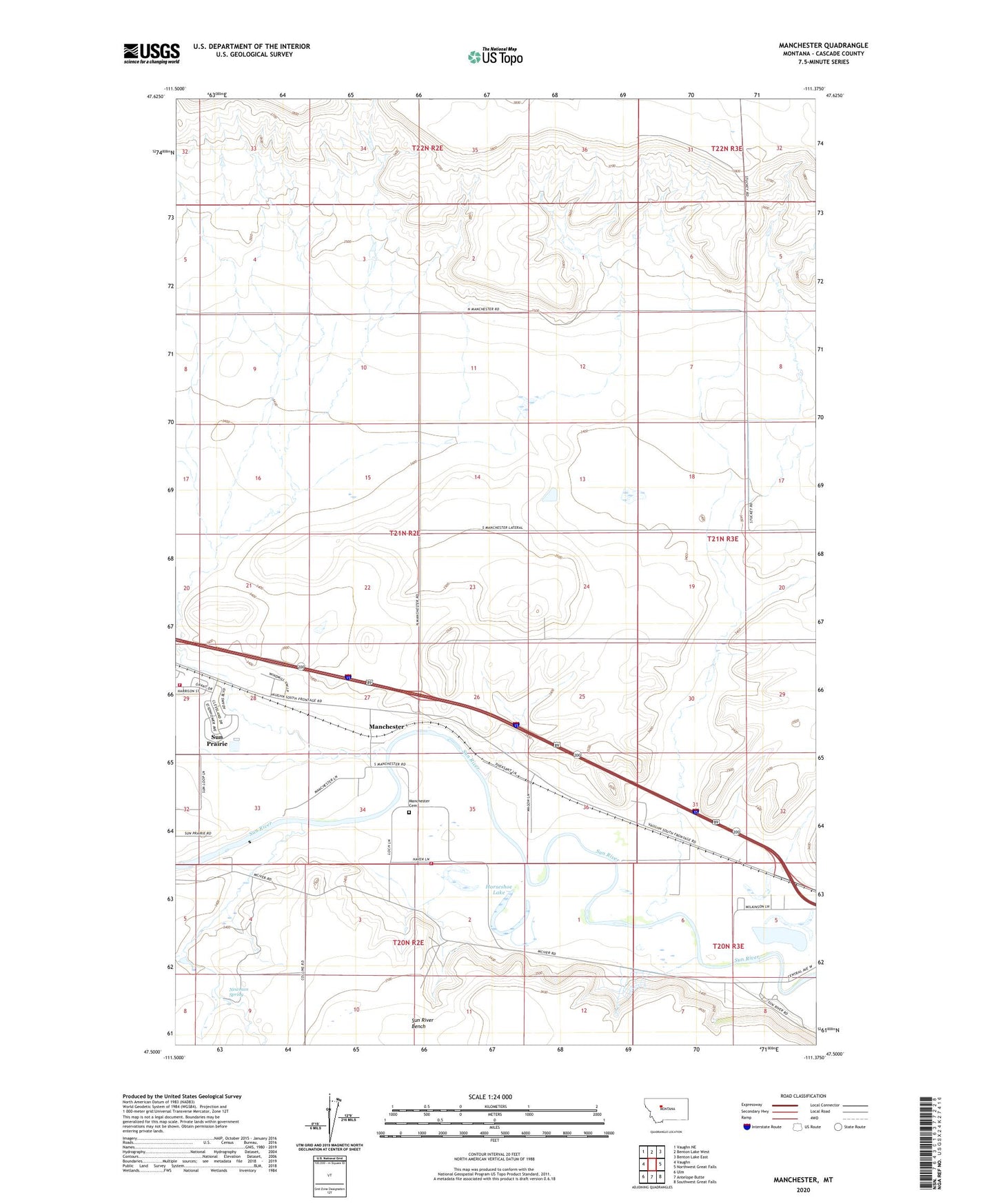
2024 topographic map quadrangle Manchester in the state of Montana. Scale: 1:24000. Based on the newly updated USGS 7.5' US Topo map series, this map is in the following counties: Cascade. The map contains contour data, water features, and other items you are used to seeing on USGS maps, but also has updated roads and other features. This is the next generation of topographic maps. Printed on high-quality waterproof paper with UV fade-resistant inks.
Quads adjacent to this one:
West: Vaughn
Northwest: Vaughn NE
North: Benton Lake West
Northeast: Benton Lake East
East: Northwest Great Falls
Southeast: Southwest Great Falls
South: Antelope Butte
Southwest: Ulm
This map covers the same area as the classic USGS quad with code o47111e4.
Contains the following named places: 20N02E01AABA01 Well, 20N02E01CCCB01 Well, 20N02E01CCCC01 Spring, 20N02E02C___01 Well, 20N02E03BAAD01 Well, 20N02E09____01 Well, 20N03E06DCDC01 Well, 21N02E13BDCD01 Well, 21N02E34ABCC01 Well, Horseshoe Lake, KEIN-AM (Great Falls), Manchester, Manchester Cemetery, Manchester Post Office, Manchester School, Manchester Volunteer Fire Department, Newman Spring, Payton Place Dam, Sun Prairie, Sun Prairie Census Designated Place, Sun Prairie Volunteer Fire Department, Wadsworth Park