MyTopo
Bobcat Coulee NE Montana US Topo Map
Couldn't load pickup availability
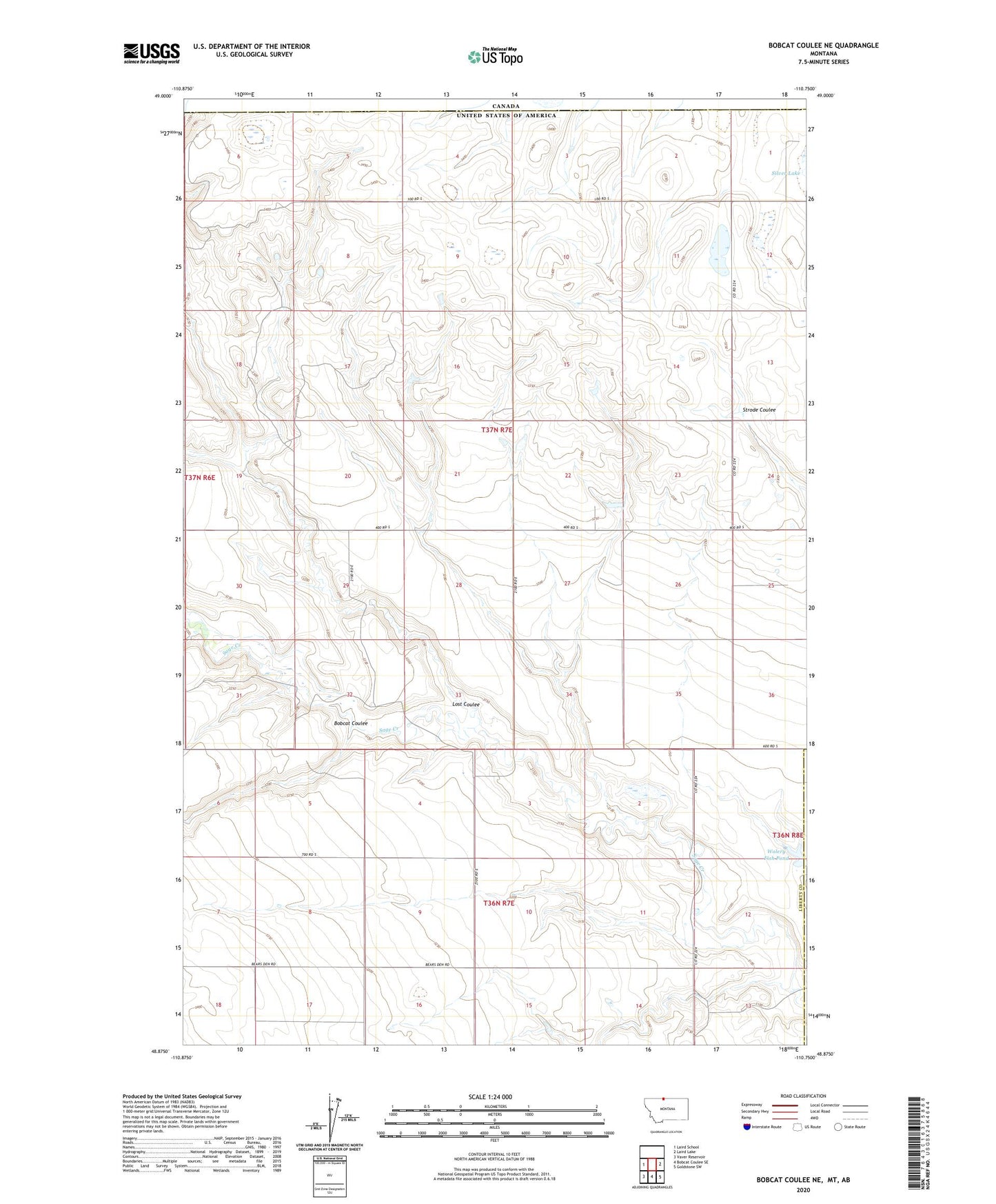
2020 topographic map quadrangle Bobcat Coulee NE in the state of Montana. Scale: 1:24000. Based on the newly updated USGS 7.5' US Topo map series, this map is in the following counties: Liberty, Hill. The map contains contour data, water features, and other items you are used to seeing on USGS maps, but also has updated roads and other features. This is the next generation of topographic maps. Printed on high-quality waterproof paper with UV fade-resistant inks.
Quads adjacent to this one:
West: Laird School
East: Laird Lake
Southeast: Goldstone SW
South: Bobcat Coulee SE
Southwest: Vaver Reservoir
Contains the following named places: 36N07E03BCDD01 Well, 36N07E03BDAB01 Well, 36N07E03BDAD01 Well, Bobcat Coulee, Immanuel Church, King Post Office, King School, Laird Creek, Lost Coulee, Wolery Fish Pond, Wolery Fish Pond Dam