MyTopo
Cilly Creek Montana US Topo Map
Couldn't load pickup availability
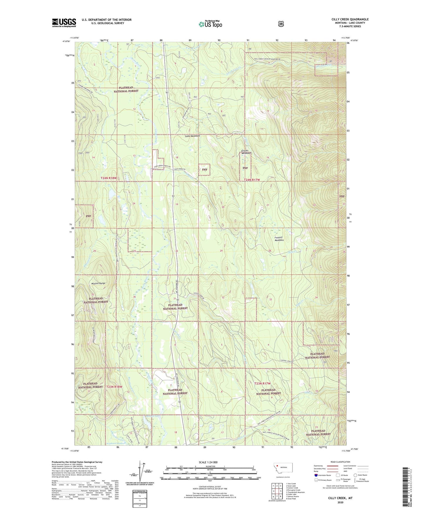
2020 topographic map quadrangle Cilly Creek in the state of Montana. Scale: 1:24000. Based on the newly updated USGS 7.5' US Topo map series, this map is in the following counties: Lake. The map contains contour data, water features, and other items you are used to seeing on USGS maps, but also has updated roads and other features. This is the next generation of topographic maps. Printed on high-quality waterproof paper with UV fade-resistant inks.
Quads adjacent to this one:
West: Porcupine Creek
Northwest: Yew Creek
North: Swan Lake
Northeast: Connor Creek
East: Thunderbolt Mountain
Southeast: Swan Peak
South: Salmon Prairie
Southwest: Cedar Lake
Contains the following named places: 24N17W07BCAA01 Well, Cilly Creek, Foothill Meadows, Graves Meadows, In-pa-ah Creek, Lost Creek, Metcalf Lake, Napa Creek, North Fork Lost Creek, Perry Creek, Point Pleasant Campground, Porcupine Creek, Soup Creek, Soup Creek Campground, South Fork Lost Creek, South Woodward Creek, State Meadows, Swan River Correctional Training Center, Swan River State Forest Headquarters, Whitetail Creek, Woodward Creek