MyTopo
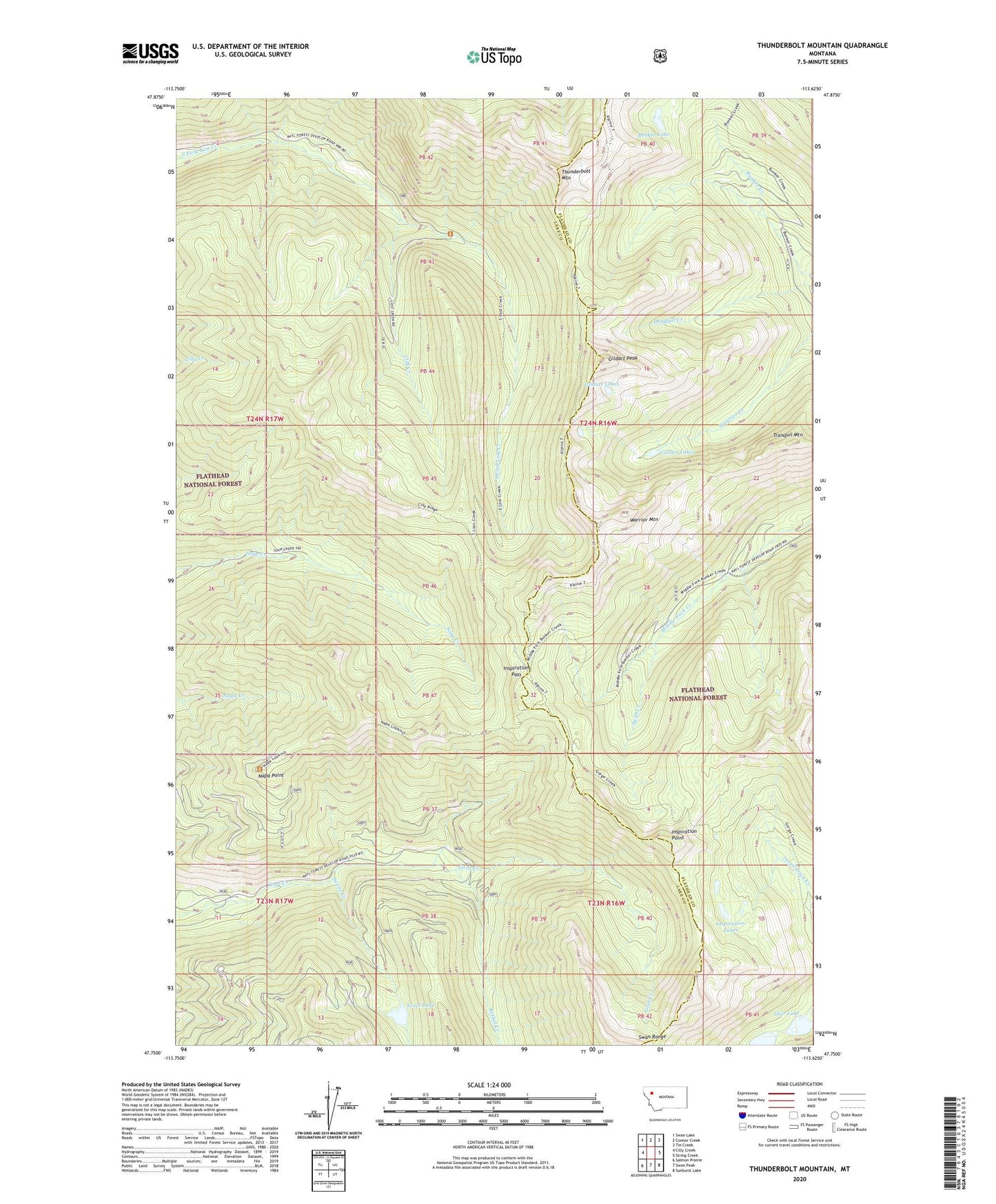
Thunderbolt Mountain Montana US Topo Map
Couldn't load pickup availability
Also explore the Thunderbolt Mountain Forest Service Topo of this same quad for updated USFS data
2024 topographic map quadrangle Thunderbolt Mountain in the state of Montana. Scale: 1:24000. Based on the newly updated USGS 7.5' US Topo map series, this map is in the following counties: Lake, Flathead. The map contains contour data, water features, and other items you are used to seeing on USGS maps, but also has updated roads and other features. This is the next generation of topographic maps. Printed on high-quality waterproof paper with UV fade-resistant inks.
Quads adjacent to this one:
West: Cilly Creek
Northwest: Swan Lake
North: Connor Creek
Northeast: Tin Creek
East: String Creek
Southeast: Sunburst Lake
South: Swan Peak
Southwest: Salmon Prairie
This map covers the same area as the classic USGS quad with code o47113g6.
Contains the following named places: Bethal Creek, Bunker Lake, Cliff Creek, Gildart Lakes, Gildart Peak, Inspiration Lakes, Inspiration Pass, Inspiration Point, Little Napa Lookout, Napa Point, Olor Lake, Scout Creek, Scout Lake, Swift Creek, Thunderbolt Mountain, Tranquil Mountain, Warrior Mountain