MyTopo
Coal Mine Creek East Montana US Topo Map
Couldn't load pickup availability
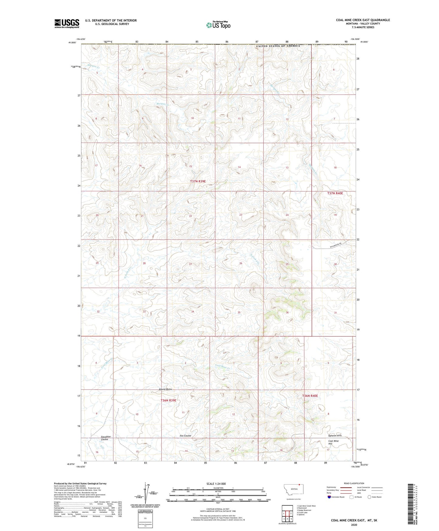
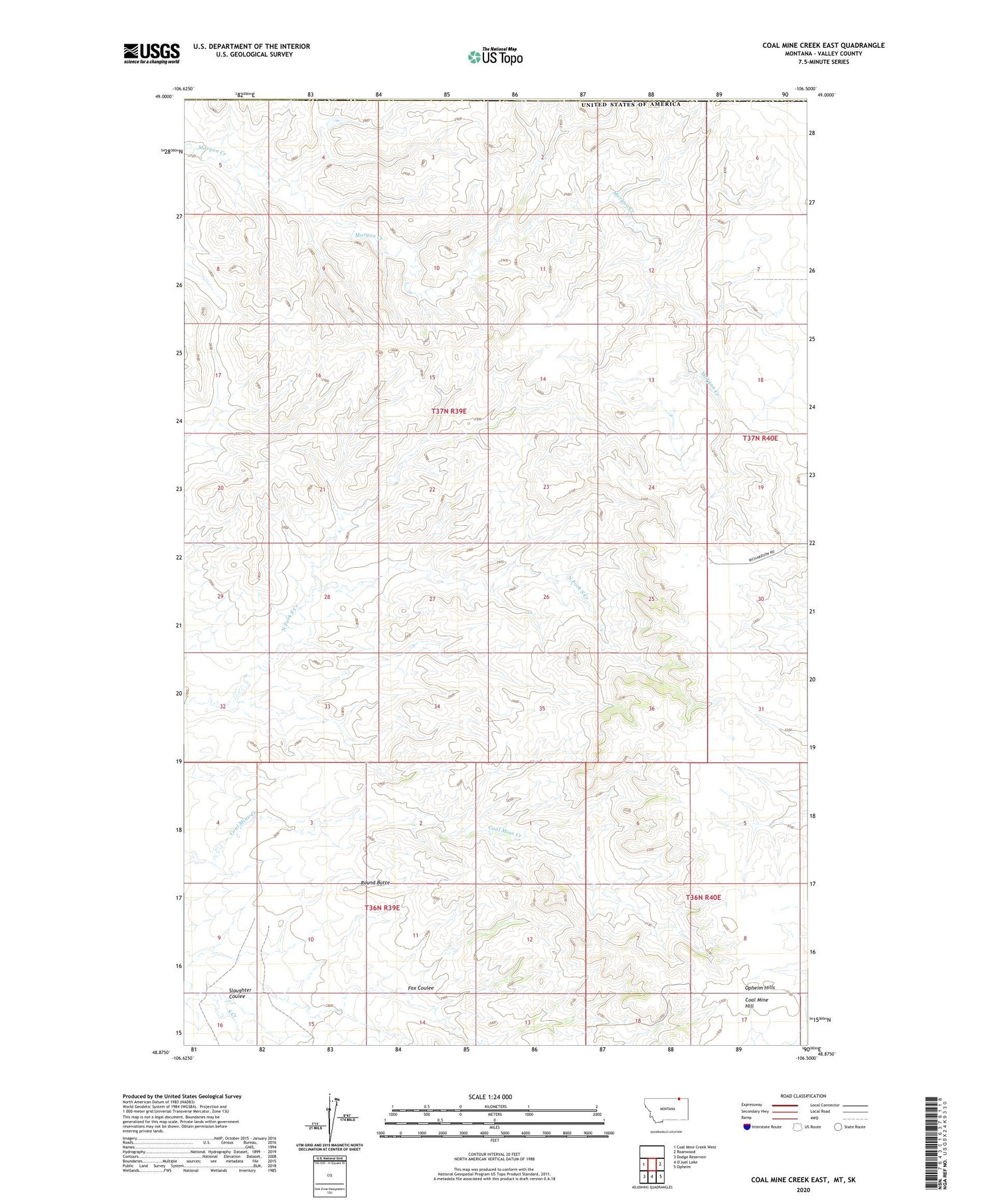
2020 topographic map quadrangle Coal Mine Creek East in the state of Montana. Scale: 1:24000. Based on the newly updated USGS 7.5' US Topo map series, this map is in the following counties: Valley. The map contains contour data, water features, and other items you are used to seeing on USGS maps, but also has updated roads and other features. This is the next generation of topographic maps. Printed on high-quality waterproof paper with UV fade-resistant inks.
Quads adjacent to this one:
West: Coal Mine Creek West
East: Roanwood
Southeast: Opheim
Southwest: Dodge Reservoir
Contains the following named places: Badger School, Black Eagle School, Coal Mine Hill, Fox Coulee, Opheim Hills, Roanwood School, Round Butte, Slaughter Coulee, Sweo Dam, ZIP Code: 59250