MyTopo
Discovery Butte Montana US Topo Map
Couldn't load pickup availability
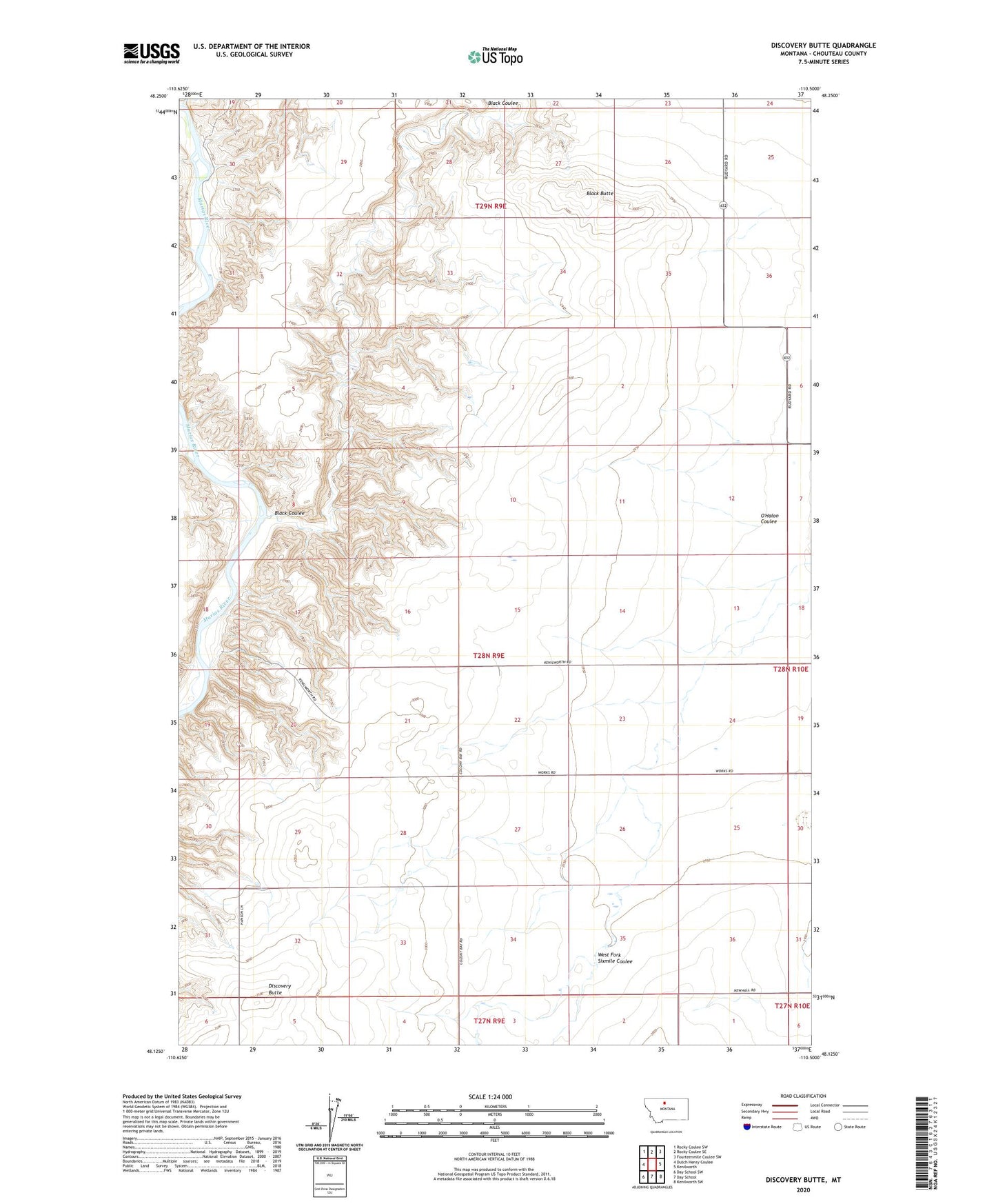
2020 topographic map quadrangle Discovery Butte in the state of Montana. Scale: 1:24000. Based on the newly updated USGS 7.5' US Topo map series, this map is in the following counties: Chouteau. The map contains contour data, water features, and other items you are used to seeing on USGS maps, but also has updated roads and other features. This is the next generation of topographic maps. Printed on high-quality waterproof paper with UV fade-resistant inks.
Quads adjacent to this one:
West: Dutch Henry Coulee
Northwest: Rocky Coulee SW
North: Rocky Coulee SE
Northeast: Fourteenmile Coulee SW
East: Kenilworth
Southeast: Kenilworth SW
South: Day School
Southwest: Day School SW
Contains the following named places: 28N02E31BCCC01 Well, 28N09E22BBBB01 Well, 28N10E07BB__01 Well, Bessette Ranch, Black Butte, Black Coulee, Discovery Butte, O'Halon Coulee, Peters Post Office, West Fork Sixmile Coulee