MyTopo
Fig Mountain Montana US Topo Map
Couldn't load pickup availability
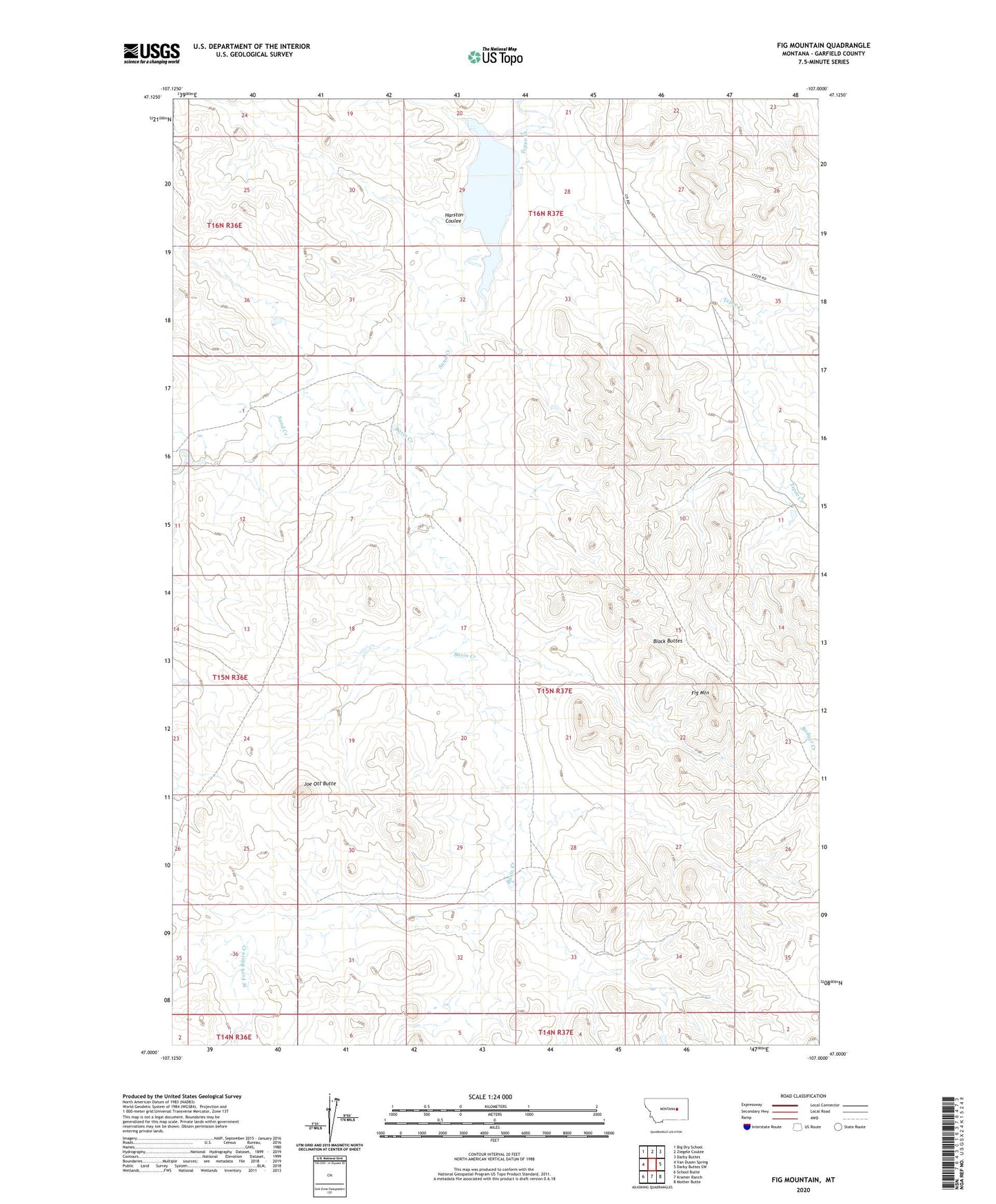
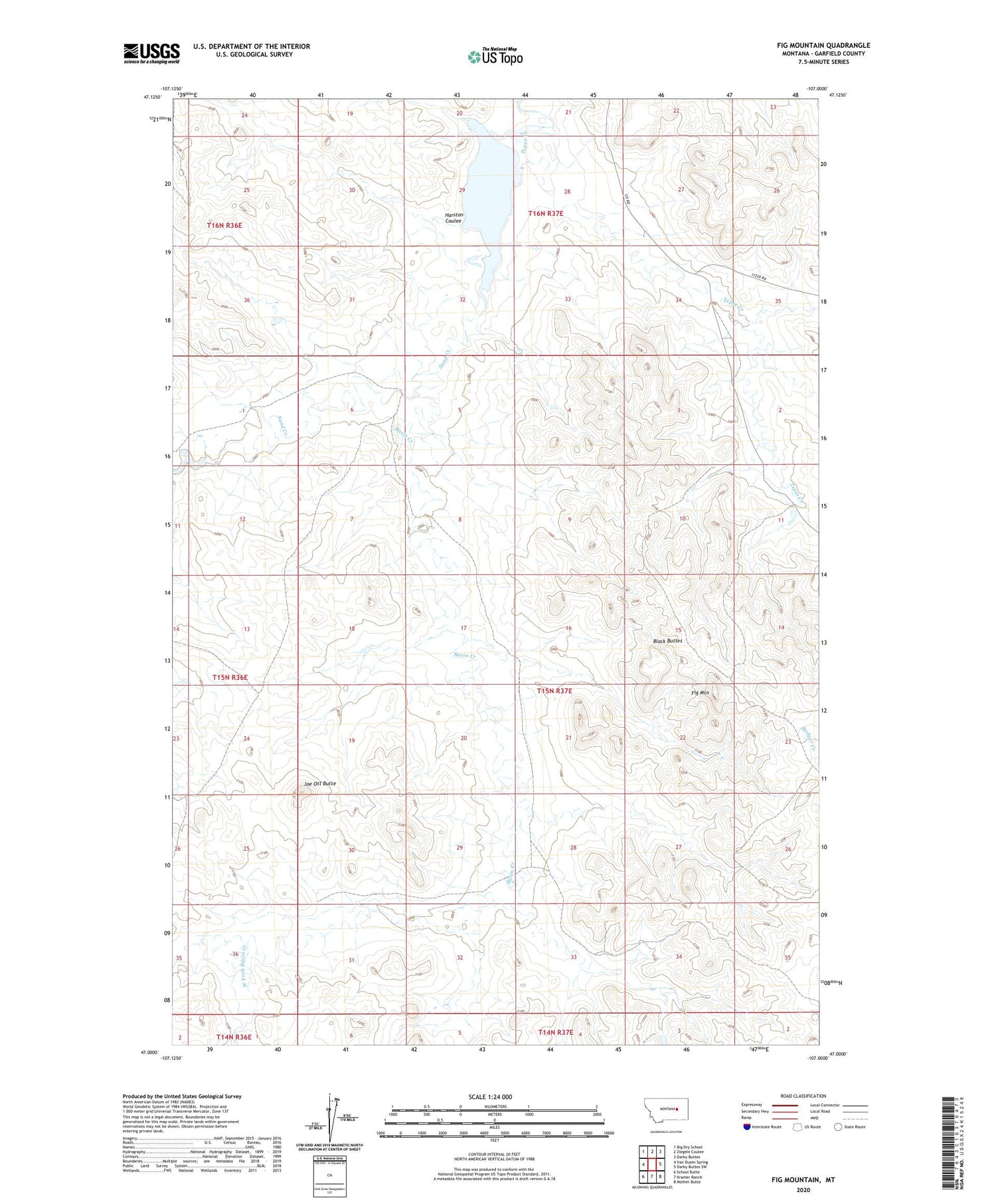
2020 topographic map quadrangle Fig Mountain in the state of Montana. Scale: 1:24000. Based on the newly updated USGS 7.5' US Topo map series, this map is in the following counties: Garfield. The map contains contour data, water features, and other items you are used to seeing on USGS maps, but also has updated roads and other features. This is the next generation of topographic maps. Printed on high-quality waterproof paper with UV fade-resistant inks.
Quads adjacent to this one:
West: Van Dusen Spring
Northwest: Big Dry School
North: Ziegele Coulee
Northeast: Darby Buttes
East: Darby Buttes SW
Southeast: Mother Butte
South: Kramer Ranch
Southwest: School Butte
Contains the following named places: Basin Creek, Black Buttes, Fig Mountain, Harston Coulee, Joe Ott Butte, Lacosta Dam, Tepee Creek, West Fork Basin Creek