
MyTopo
Flatwillow Montana US Topo Map
Couldn't load pickup availability
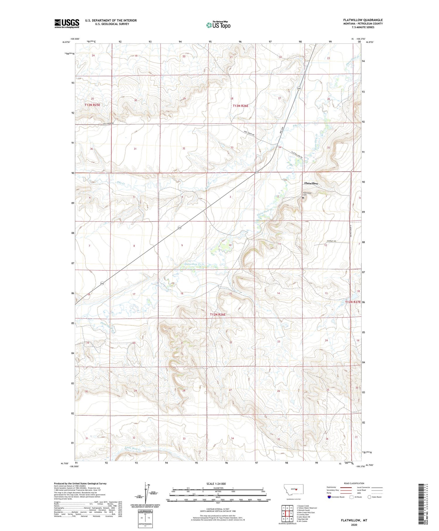
2020 topographic map quadrangle Flatwillow in the state of Montana. Scale: 1:24000. Based on the newly updated USGS 7.5' US Topo map series, this map is in the following counties: Petroleum. The map contains contour data, water features, and other items you are used to seeing on USGS maps, but also has updated roads and other features. This is the next generation of topographic maps. Printed on high-quality waterproof paper with UV fade-resistant inks.
Quads adjacent to this one:
West: Pike Creek Hills East
Northwest: Snoose Creek
North: Yellow Water Reservoir
Northeast: Winnett South
East: Crowley Dam
Southeast: Jim Coulee
South: Big Wall NW
Southwest: Lake Mason NE
Contains the following named places: 12N26E11AA__01 Well, Eliasson Dam, Flatwillow, Flatwillow Cemetery, Flatwillow Post Office, Lower Flatwillow School, Lucky Fort, Orient School, Pike Creek, Root School, Sharkey Number 1 Dam, Wallview, Wallview School, Yellow Water Basin School


