MyTopo
Yellow Water Reservoir Montana US Topo Map
Couldn't load pickup availability
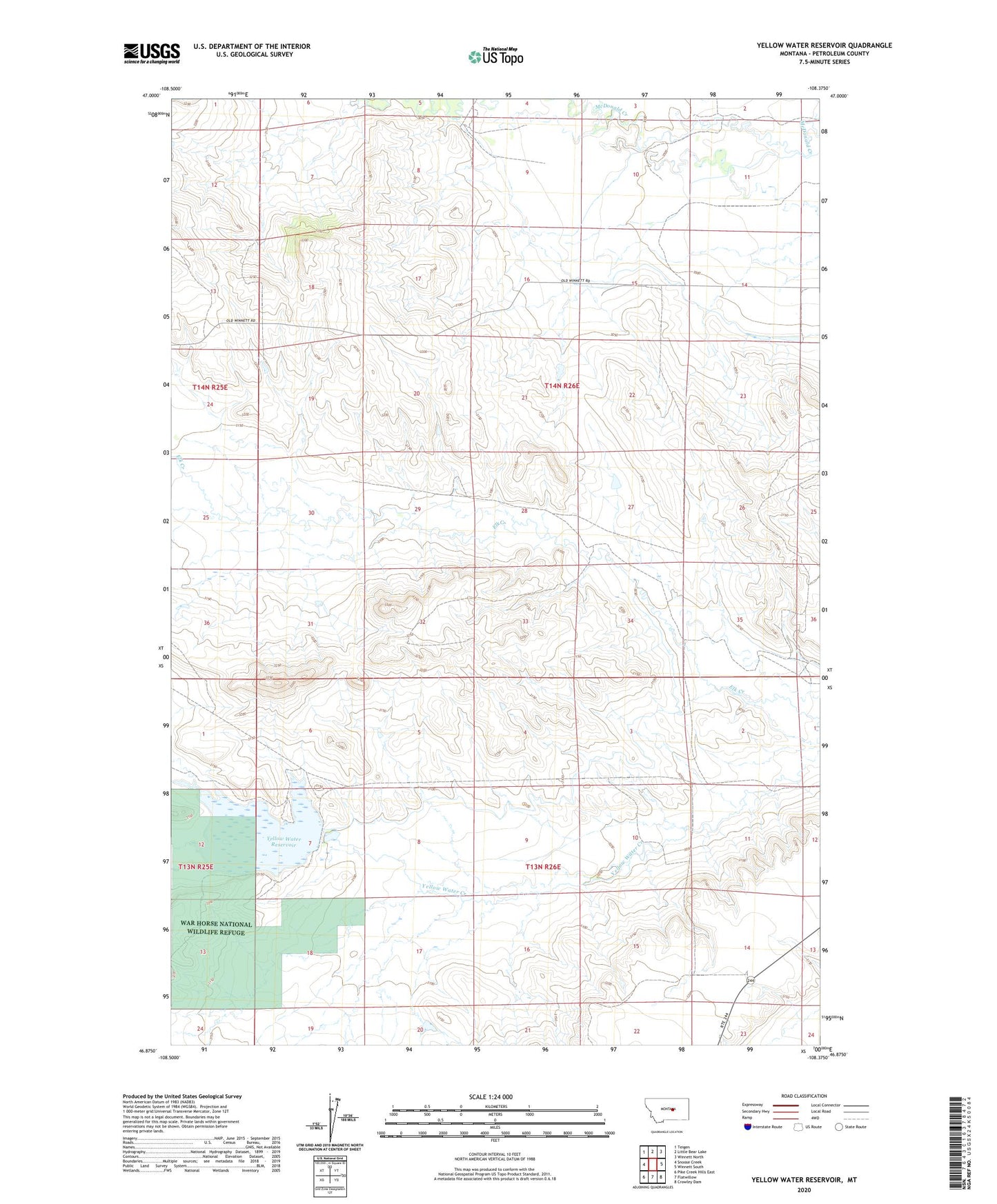
2024 topographic map quadrangle Yellow Water Reservoir in the state of Montana. Scale: 1:24000. Based on the newly updated USGS 7.5' US Topo map series, this map is in the following counties: Petroleum. The map contains contour data, water features, and other items you are used to seeing on USGS maps, but also has updated roads and other features. This is the next generation of topographic maps. Printed on high-quality waterproof paper with UV fade-resistant inks.
Quads adjacent to this one:
West: Snoose Creek
Northwest: Teigen
North: Little Bear Lake
Northeast: Winnett North
East: Winnett South
Southeast: Crowley Dam
South: Flatwillow
Southwest: Pike Creek Hills East
This map covers the same area as the classic USGS quad with code o46108h4.
Contains the following named places: 14N26E35ACC_01 Well, 14N26E35AD__01 Well, Elk Creek School, J King Number 1 Dam, J King Number 2 Dam, Snoose Creek, Walker School, War Horse National Wildlife Refuge, Yellow Water Dike, Yellow Water Main Dam, Yellow Water Reservoir