
MyTopo
Haskill Mountain Montana US Topo Map
Couldn't load pickup availability
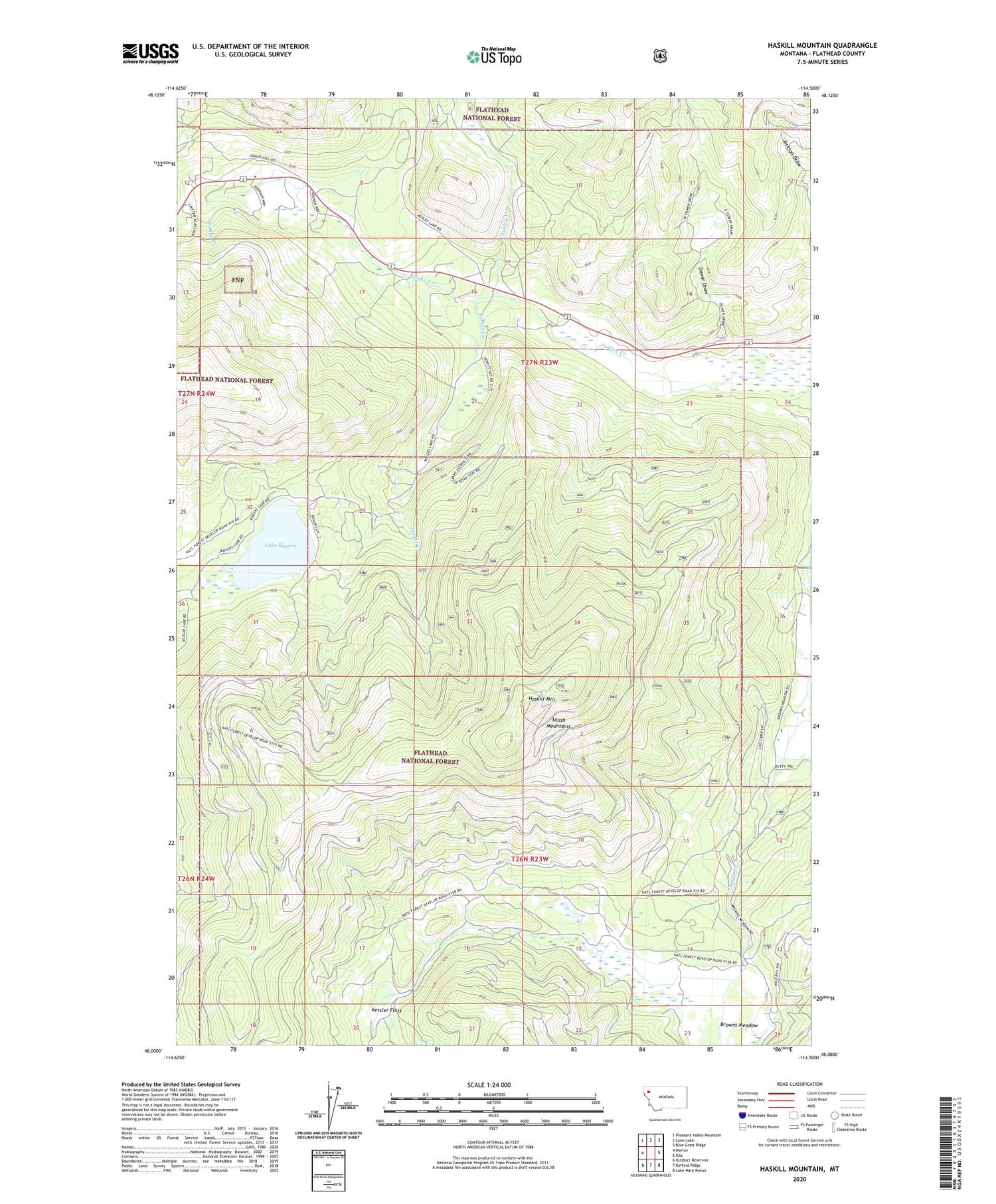
2020 topographic map quadrangle Haskill Mountain in the state of Montana. Scale: 1:24000. Based on the newly updated USGS 7.5' US Topo map series, this map is in the following counties: Flathead. The map contains contour data, water features, and other items you are used to seeing on USGS maps, but also has updated roads and other features. This is the next generation of topographic maps. Printed on high-quality waterproof paper with UV fade-resistant inks.
Quads adjacent to this one:
West: Marion
Northwest: Pleasant Valley Mountain
North: Lone Lake
Northeast: Blue Grass Ridge
East: Kila
Southeast: Lake Mary Ronan
South: Kofford Ridge
Southwest: Hubbart Reservoir
Contains the following named places: Ashley Creek Fishing Access Site, Ashley Creek School, Athens, Browns Meadow, Dower Draw, Dowers, Haskill Mountain, Idaho Creek, Kessler Flats, Lake Rogers, Porter Creek, ZIP Code: 59920


