MyTopo
Haymaker Ranch Montana US Topo Map
Couldn't load pickup availability
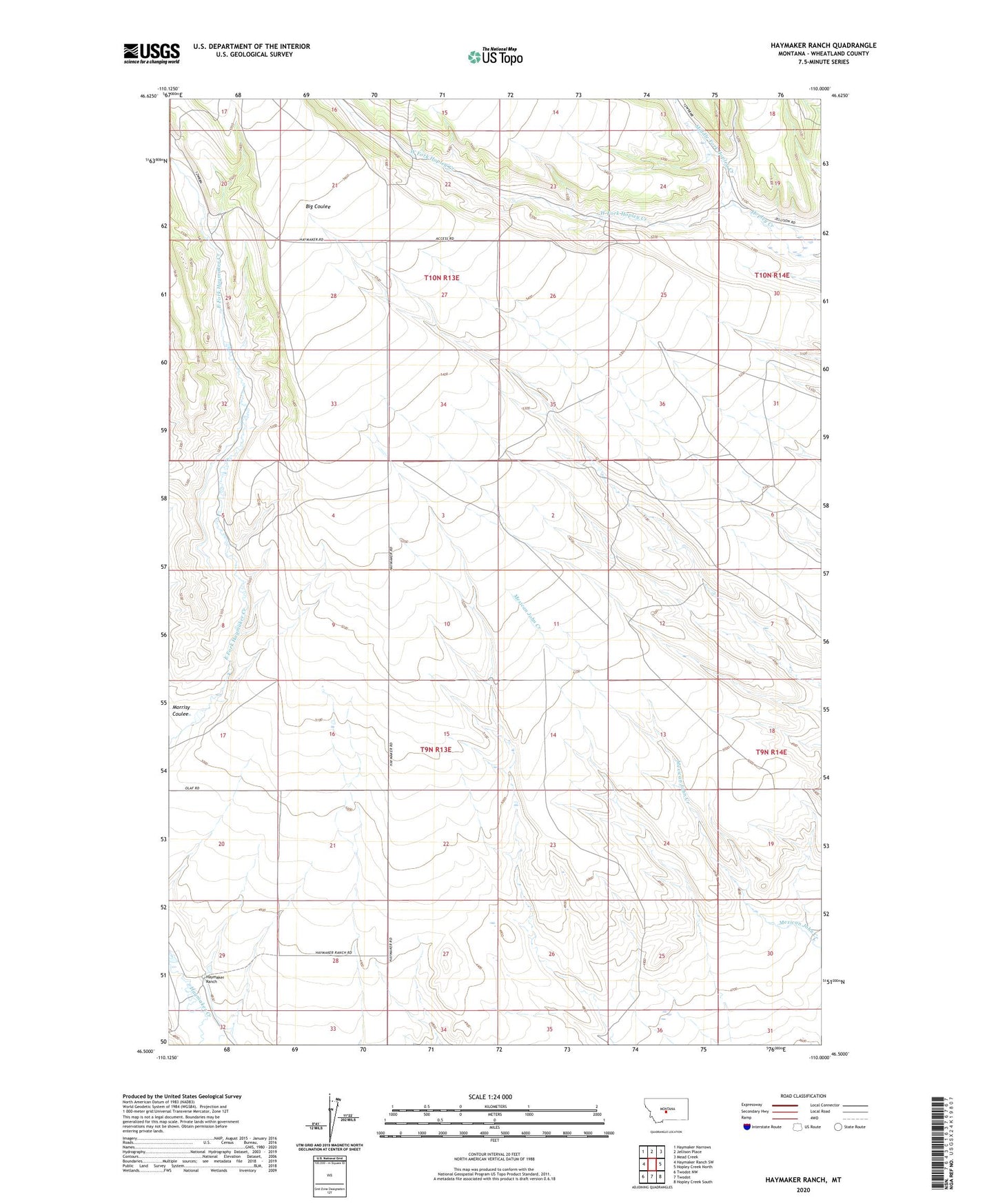
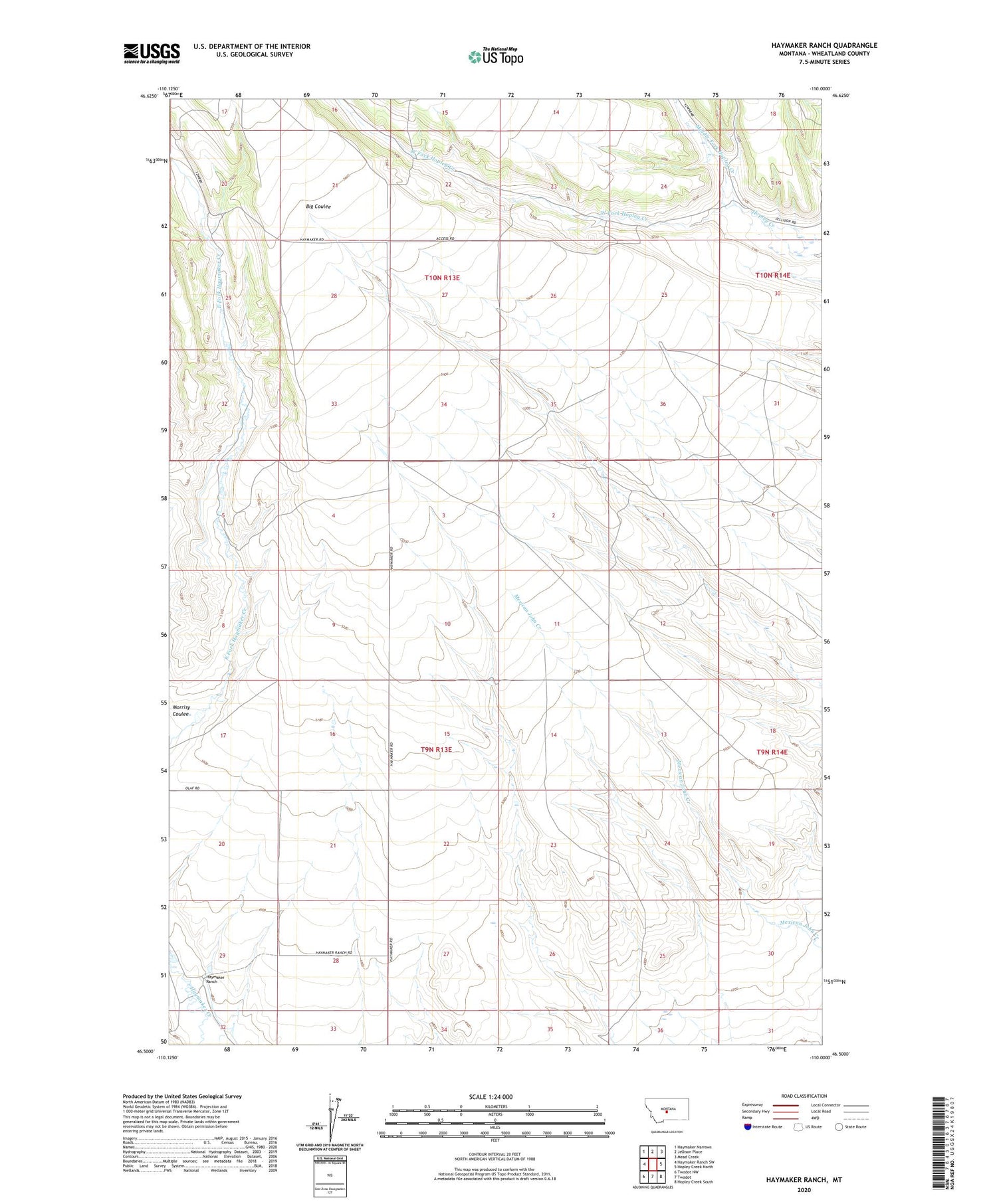
2020 topographic map quadrangle Haymaker Ranch in the state of Montana. Scale: 1:24000. Based on the newly updated USGS 7.5' US Topo map series, this map is in the following counties: Wheatland. The map contains contour data, water features, and other items you are used to seeing on USGS maps, but also has updated roads and other features. This is the next generation of topographic maps. Printed on high-quality waterproof paper with UV fade-resistant inks.
Quads adjacent to this one:
West: Haymaker Ranch SW
Northwest: Haymaker Narrows
North: Jellison Place
Northeast: Mead Creek
East: Hopley Creek North
Southeast: Hopley Creek South
South: Twodot
Southwest: Twodot NW
Contains the following named places: 09N13E09____01 Well, 09N13E11CADC01 Well, 09N14E30A___01 Well, 10N13E21____01 Well, 10N13E29C___01 Well, Godfrey, Haymaker Post Office, Haymaker Ranch, Middle Fork Hopley Creek, West Fork Hopley Creek