MyTopo
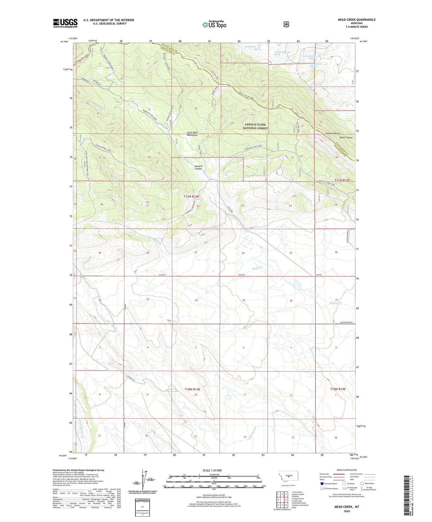
Mead Creek Montana US Topo Map
Couldn't load pickup availability
Also explore the Mead Creek Forest Service Topo of this same quad for updated USFS data
2024 topographic map quadrangle Mead Creek in the state of Montana. Scale: 1:24000. Based on the newly updated USGS 7.5' US Topo map series, this map is in the following counties: Wheatland, Judith Basin. The map contains contour data, water features, and other items you are used to seeing on USGS maps, but also has updated roads and other features. This is the next generation of topographic maps. Printed on high-quality waterproof paper with UV fade-resistant inks.
Quads adjacent to this one:
West: Jellison Place
Northwest: Twin Sisters
North: Martin Coulee
Northeast: Buffalo
East: Judith Gap
Southeast: Oka
South: Hopley Creek North
Southwest: Haymaker Ranch
This map covers the same area as the classic USGS quad with code o46109f8.
Contains the following named places: 10N15E06B___01 Well, 11N14E01AD__01 Spring, 11N14E01AD__02 Spring, 11N14E01BB__01 Spring, 11N14E02AA__01 Spring, 11N14E34DCA_01 Well, 11N15E31C___01 Well, Lode Ranch, Mead Creek, Sawmill Canyon, Stevens Butte, Stone Ranch