MyTopo
Hill Ranch Montana US Topo Map
Couldn't load pickup availability
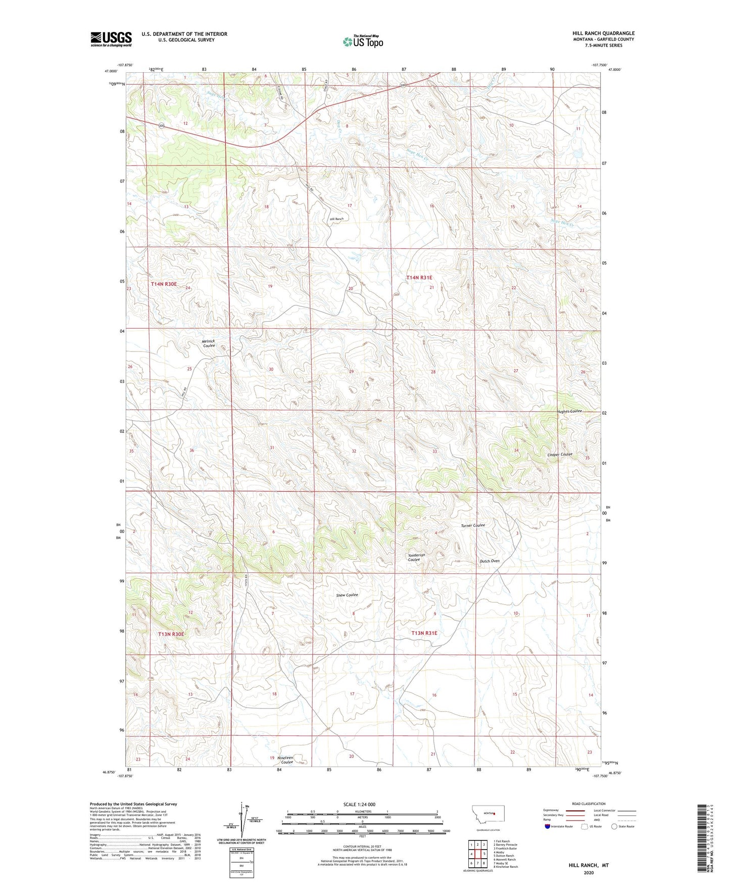
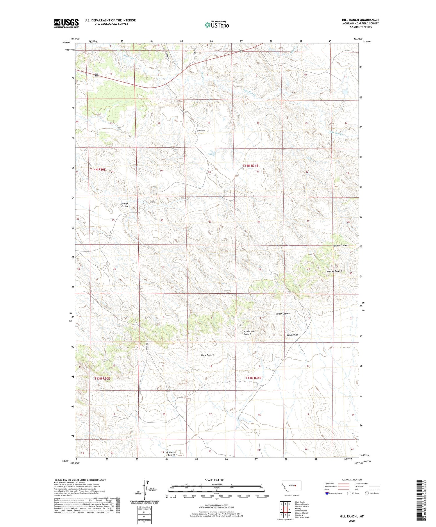
2020 topographic map quadrangle Hill Ranch in the state of Montana. Scale: 1:24000. Based on the newly updated USGS 7.5' US Topo map series, this map is in the following counties: Garfield. The map contains contour data, water features, and other items you are used to seeing on USGS maps, but also has updated roads and other features. This is the next generation of topographic maps. Printed on high-quality waterproof paper with UV fade-resistant inks.
Quads adjacent to this one:
West: Mosby
Northwest: Fail Ranch
North: Barney Pinnacle
Northeast: Froehlich Butte
East: Dutton Ranch
Southeast: Kincheloe Ranch
South: Mosby SE
Southwest: Maxwell Ranch
Contains the following named places: Dog Creek, Dutch Oven, Fort Musselshell Historical Marker, Hill Ranch, Melnick Coulee, Montana Number 26 Dam, North Fork Sage Hen Creek, Shaw Dam, Shaw Number 1 Dam